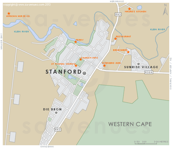
Map of Stanford, Western Cape
Stanford detail and street level map showing popular landmarks and attractions in Stanford. Peaceful and largely unaffected by change, Stanford is an eclectic mix of shops, galleries, restaurants and coffee shops, and the list of activities for a largely rural village exceeds ones expectations. To find out more please see Stanford Information.
If you are interested in overnighting in the area, we can recommend some great accommodation options including hotels, guest houses and self-catering properties. If you're only planning on driving through Stanford, en-route to another destination, you may want to peruse our Stanford Restaurants before you leave to see if you should plan a stop here for lunch or maybe just a coffee. Also check out Stanford Things To Do to see if there are any activities for which you would consider stopping.
Maps of the Western Cape
Provincial Maps
Street Level Maps
Western Cape Regions
Special Interests by Map
In the vicinity
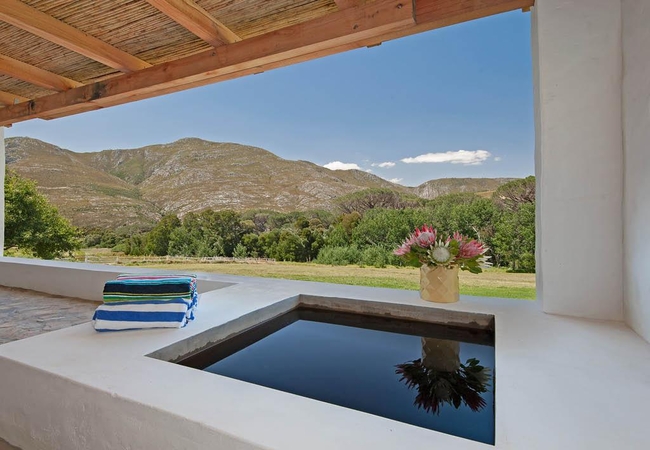
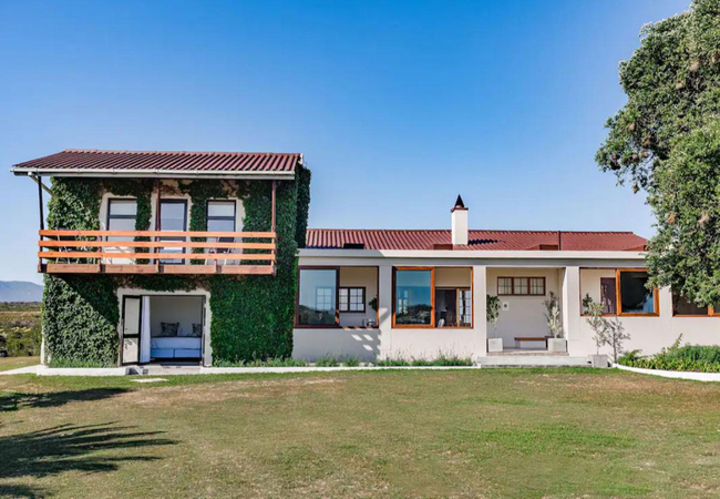
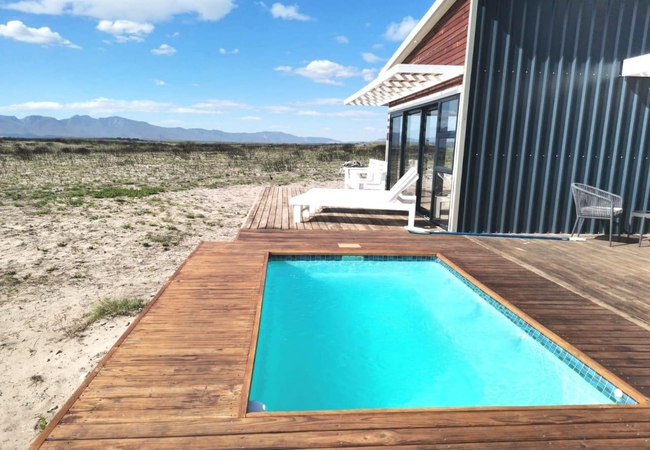
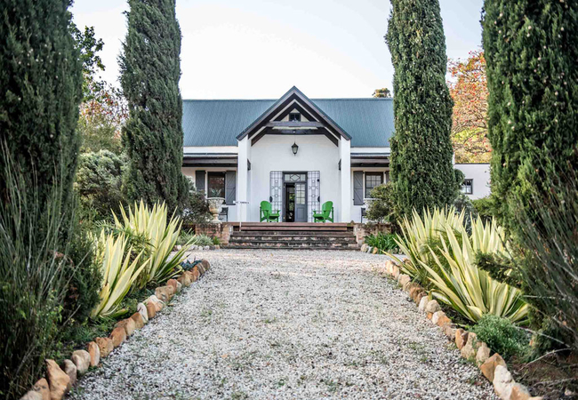
Hotels & other accommodation options
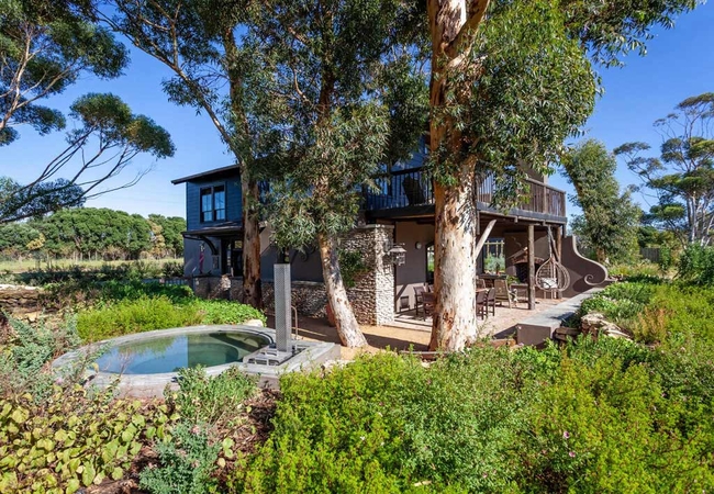
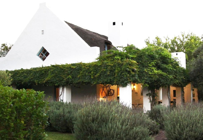
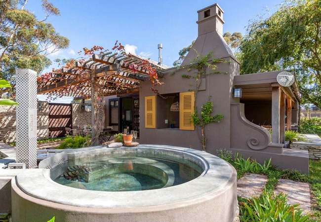
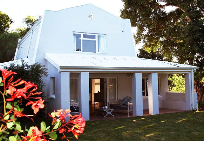
Milk and Honey
Beloftebos Milk and Honey offers Stanford accommodation amongst fruit trees and huge old oaks. The last permanent resident, Old George, was the s...
Rivergate Potters Shed Cottage
Potters Shed Cottage is located on Rivergate Guest Farm, a working farm on the banks of the Klein River, just 2,3km from Stanford. The farm offer...

Oxalis Cottage @ Phillipskop
Oxalis Cottage @ Phillipskop offers Stanford accommodation in the Phillipskop Mountain Reserve. The cottage is surrounded by beautiful natural ve...
Port Boathouses at Coot Club
Port Boathouse has three bedrooms. An open plan lounge, dining and kitchen with vaulted ceiling adds to the airy and spacious charm that flows se...
Rivergate Gatehouse Cottage
Gatehouse Cottage is located on Rivergate Guest Farm, a working farm on the banks of the Klein River, just 2,3km from Stanford. The farm offers S...
Laughing Waters Farm
Laughing Waters Farm is a tranquil working farm in the Sondagskloof, inviting visitors to enjoy characterful accommodation and to experience uniq...
The Manor at Stanford Hills
The Manor is a 4-bedroom holiday home in Stanford, an original old farmhouse, steeped in history. It has a wonderful outside area with barbeque f...
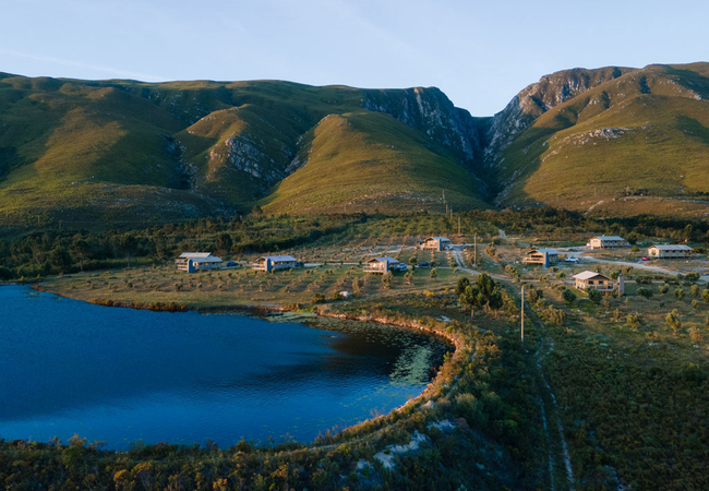
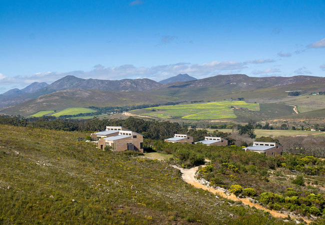
AfriCamps at Stanford Hills
AfriCamps at Stanford Hills boasts boutique tents, all situated overlooking the dam on the foothill of the Klein River Mountain range. From here ...
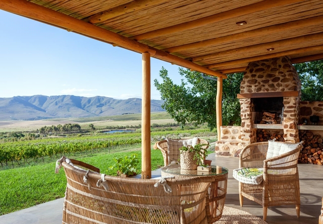
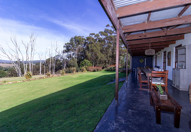
Stanford Valley Country Lodge
Stanford Valley Country Lodge is nestled in the valley of the Klein Rivier, 10km outside of Stanford village. We offer comfortable accommodation ...
Casa d'Italo House
At Casa d'Italo guests can enjoy the glorious night skies, with more stars that you've seen in a long time, ideal to escape, relax and unwind. Th...

Bambi Cottage
Offering self-catering accommodation in Stanford, Bambi Cottage is a charming self-catering home with two bedrooms; idea for a group or small fam...
Walkerbay Dunes Lodge
Situated in the heart of the famous Walkerbay Nature Reserve, with views stretching over Stanford hills, Hermanus and Gansbaai mountains, Walkerb...
White Water Farmhouse
White Water Farmhouse dates back to 1846 and offers accommodation in Stanford on a working farm. We offer guests a welcoming rural haven with mag...

Sixpence Cottage
Combining the convenience and security of an hotel with the privacy of a self-catering holiday home, Sixpence Cottage is a stand-alone cottage lo...
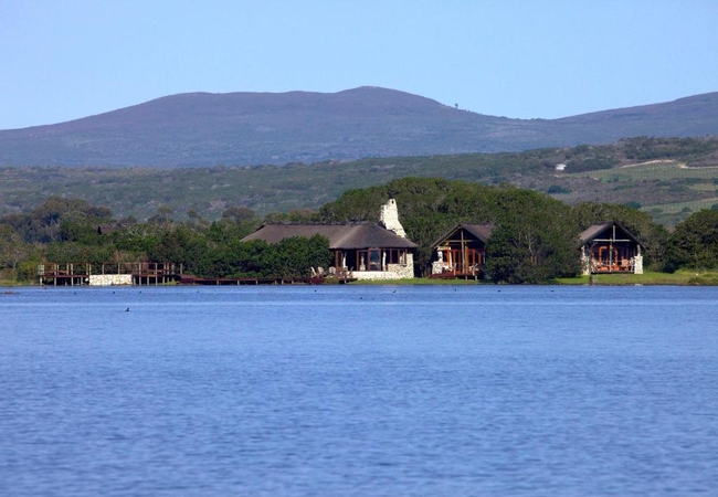
Mosaic Lagoon Lodge
A popular guest retreat and 1000 HA conservation reserve on the Hermanus Lagoon, bordering the pristine Whale Coast Walker Bay Beach. Our seclude...
Blue Gum Villa
The Villa @ Blue Gum offers accommodation in Stanford on a working wine estate. The delightful Country Estate, nestled among ancient Blue Gum tre...
40 On Longmarket
40 On Longmarket is a cottage in Stanford that has had interior walls removed and the ceiling opened to create a double volume, airy, light space...
Vineyard Cottage
Vineyard Cottage at Goodluck Homestead is a stunning, off-grid eco cottage situated on a working regenerative farm. Perfect for a couple's getawa...
Rivergate Dairy Shed
Dairy Shed is an open plan cottage located on Rivergate Guest Farm, a working farm on the banks of the Klein River, just 2,3km from Stanford. The...

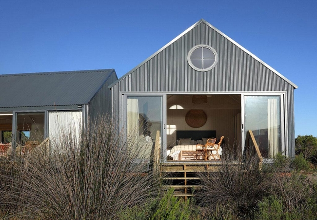
Milkwood Trail Cottage
Milkwood Trail Cottage is set along one-and-a-half kilometres of unspoilt shoreline and 1 000 acres of indigenous fynbos. Milkwood Trail Cottage ...
Blue Gum Country Estate
Blue Gum Country Estate is hidden in a valley that ascends towards the small town of Stanford, just outside Hermanus. The estate is a working win...
Rivergate Woodrose Cottage
Woodrose Cottage is a unique round cottage located on Rivergate Guest Farm, a working farm on the banks of the Klein River, just 2,3km from Stanf...
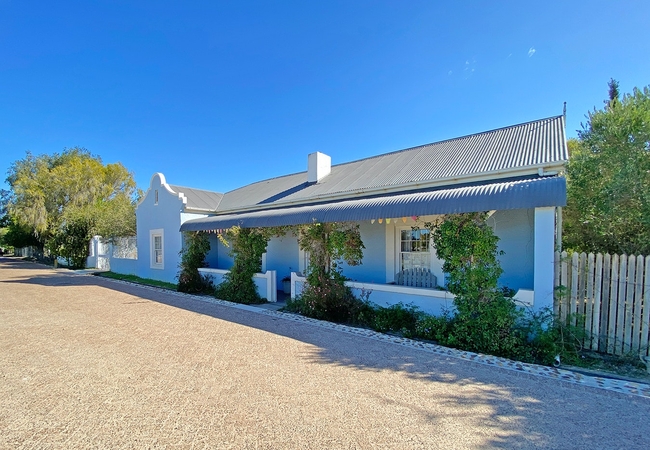
Blue House
The Blue House is a spacious Victorian cottage perfectly positioned in the historic core of Stanford. The stylish cottage exudes country chic wit...
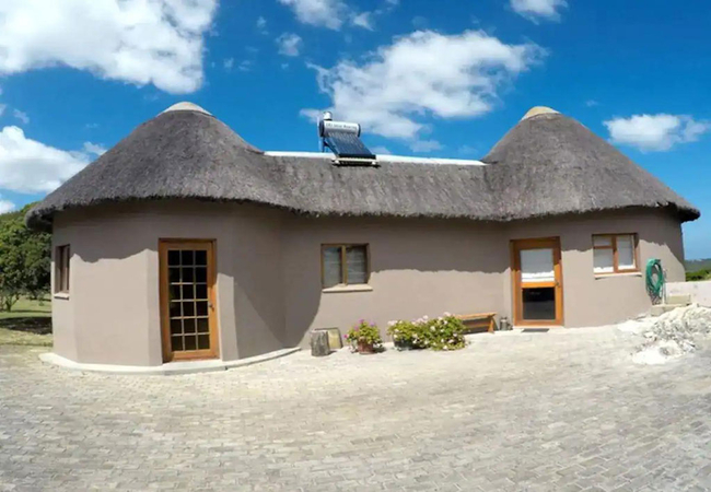
Phillipskop Mountain Reserve
Choose from five separate, spacious self catering cottages. Each fully equipped cottage can sleep six people in three bedrooms. The main bedroom ...

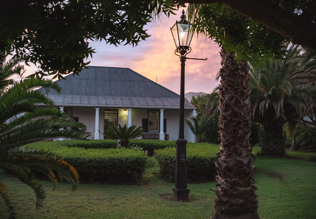
The Stanford Hotel
The perfect weekend destination, Stanford is a delightful historic village a mere 90 minutes from Cape Town. The Klein River is one of Stanford's...
Casa d'Italo Bungalow
Casa d'Italo Bungalow has two bedrooms furnished with a King-size bed or twin beds. The en-suite bathrooms are fitted with a shower, toilet and b...
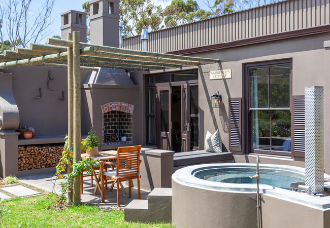
Rivergate Gardeners Cottage
Gardeners Cottage is an open plan cottage located on Rivergate Guest Farm, a working farm on the banks of the Klein River, just 2,3km from Stanfo...
Rivergate Carpenters Cottage
Carpenters Cottage is an open plan cottage located on Rivergate Guest Farm, a working farm on the banks of the Klein River, just 2,3km from Stanf...
Lavenders Blue
Lavenders Blue is a romantic thatched cottage nestled in an established garden amongst mature mango, avocado, lemon and guava trees. The secluded...
Fairhill Nature Reserve
Fairhill is a self catering guest house that sleeps 10 people and is rented out as a unit. Treat yourself to a unique fynbos experience in the he...

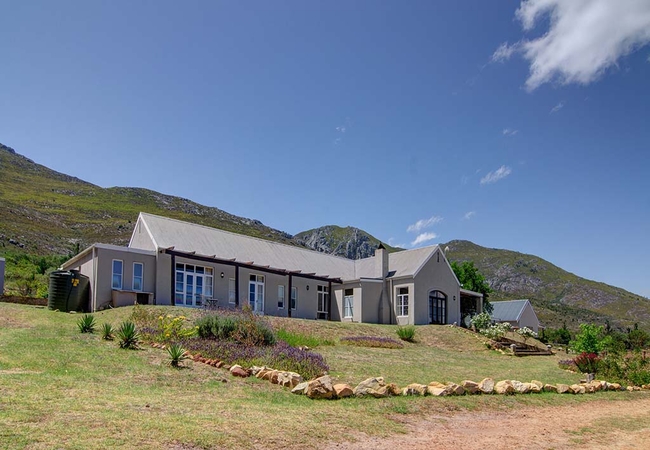
Bellavista Country Place
Bellavista Country Place offers luxury bed & breakfast accommodation just, 8km from the quaint Stanford village. We offer five beautifully decora...
Lobelia Cottage @ Phillipskop
Lobelia Cottage @ Phillipskop offers Stanford accommodation in the Phillipskop Mountain Reserve. The cottage is surrounded by beautiful natural v...
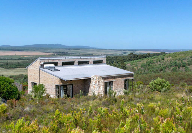
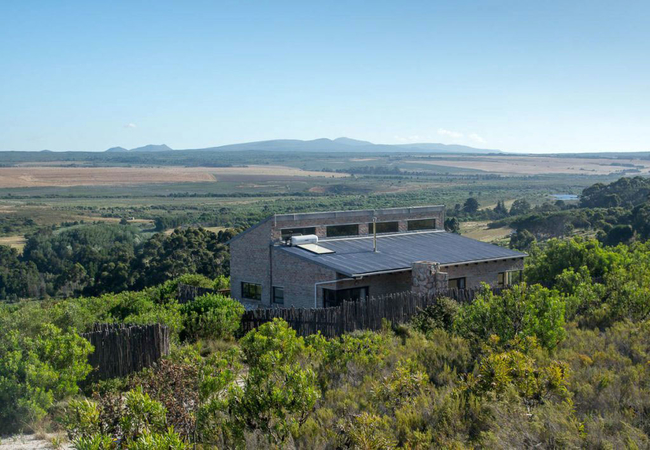
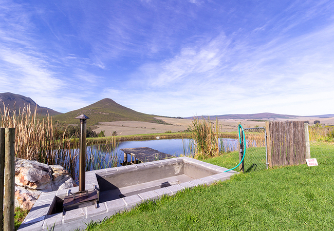
Rivers End Farm
Rivers End Farm is a lovely cabin located on a farm in Stanford. The uniqueness of the farm is the wetlands in front of the cabin and the 160 hec...
The Little Farmhouse
Located on a farm in Stanford and oozing plenty of country character, the Little Farmhouse is a quaint hidden gem. Sleeping six and ideal for a s...

Fynbos Trail Studio
Fynbos Trail Studio offers Stanford accommodation less than 2 hours from Cape Town where you can soak up this dazzling site. The cottage is set a...
Issey118 Heritage Cottage
Issey118 is one of the treasured heritage cottages offering accommodation in Stanford. There is a sunny open plan living area with comfortable se...
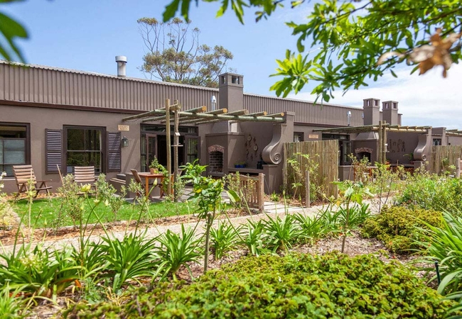
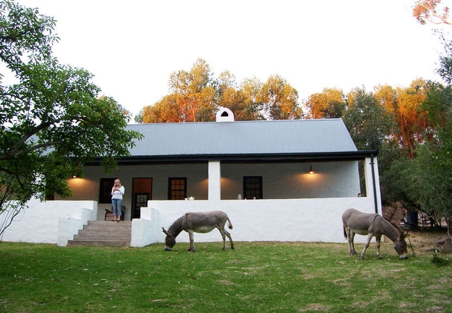
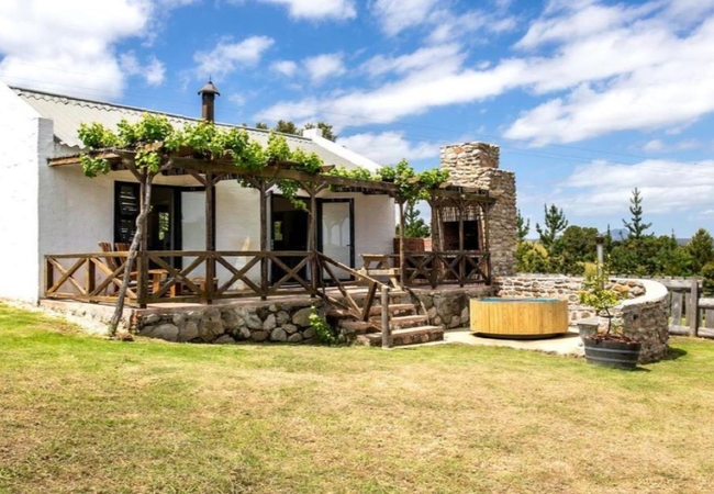
Beloftebos Farm Cottages
Beloftebos Farm Cottages offers self catering accommodation on Paardenberg Farm just outside the quaint village of Stanford. e offer four separat...
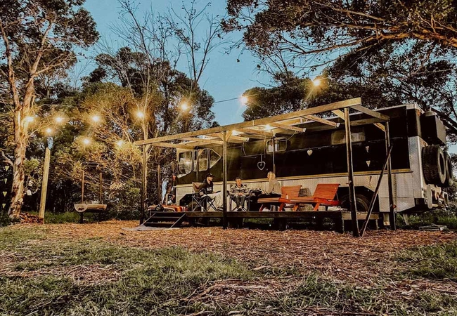
The Black Eagle Bus
The uniqueness of the farm is the wetlands in front of the cabin and the 160 hectares of uninterrupted fynbos with views for days at the back, a ...
Restio Cottage @ Phillipskop
Restio Cottage @ Phillipskop offers Stanford accommodation in the Phillipskop Mountain Reserve. The cottage is surrounded by beautiful natural ve...

Lawns & Little Lawns
Lawns Cottage offers Stanford accommodation set along one-and-a-half kilometres of unspoilt shoreline and 1000 acres of indigenous fynbos and str...
Protea Cottage @ Phillipskop
Protea Cottage @ Phillipskop offers Stanford accommodation in the Phillipskop Mountain Reserve. The nature reserve is 10 minutes past Stanford an...
Melkstal Cottage
Melkstal is a family farm lifestyle experience for the discerning traveller. It has a beautiful view overlooking natural fynbos mountains and a s...

Populierbos Cottage
Populierbos Holiday Cottage offers self catering accommodation in Stanford for four guests in two bedrooms. The open plan cottage which is made u...

Erica Cottage
Erica Cottage @ Phillipskop offers Stanford accommodation in the Phillipskop Mountain Reserve. The nature reserve is 10 minutes past Stanford on ...
Sylvia Cottage
Sylvia Cottage offers comfort and self-contained convenience for 4-5 guests. There is a comfortable lounge with a fireplace. The kitchenette is e...
Vineyard Villa Two
Vineyard Villa 2 offers self-catering accommodation in Stanford at the Stanford Hills Estate on the banks of the Klein River. The village is only...
Willowdale Farm Cottages
Willowdale Farm Cottages is a working sheep farm with a small indigenous tree nursery. There is Standford self catering in the form of restored a...

Garden Trail Cottage
Garden Trail Cottage offers Stanford accommodation overlooking fynbos gardens. The cottage is set along one-and-a-half kilometres of unspoilt sho...
White Water Farm
Escape to historic White Water Farm where guests will find a welcoming rural haven with magnificent mountain scenery in the Kleinriver Valley nea...

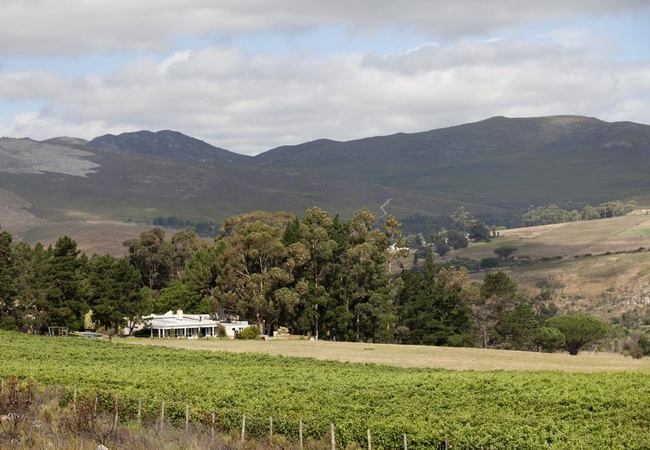
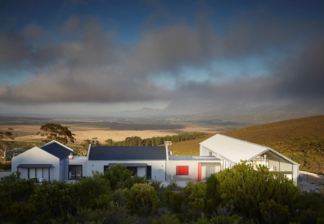
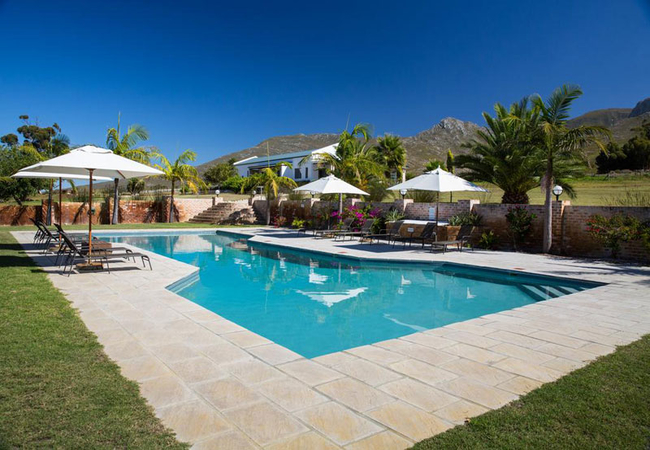
Stanford Hills Estate
Stanford Hills Estate is found near the quaint village of Stanford, which is situated on the banks of the Klein River. This village is almost two...
Rivergate Stable Cottage
Stable Cottage is located on Rivergate Guest Farm, a working farm on the banks of the Klein River, just 2,3km from Stanford. The farm offers acco...
Starboard Boathouse at Coot Club
Starboard Boathouse has two bedrooms. An open plan lounge, dining and kitchen with vaulted ceiling adds to the airy and spacious charm that flows...
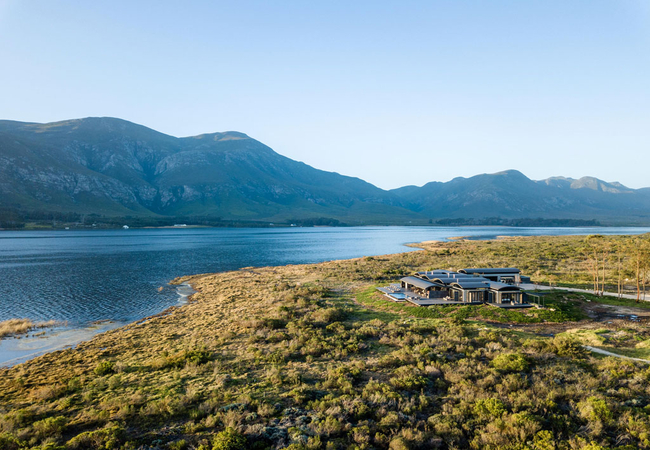
Perivoli Lagoon House
Perivoli Lagoon House is set in a stunning, isolated, 140ha wilderness of colourful Fynbos biome, a stone's throw from the Klein River lagoon wit...
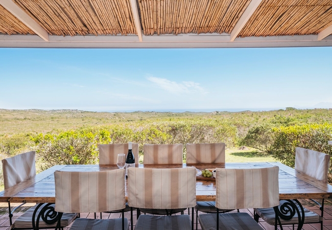
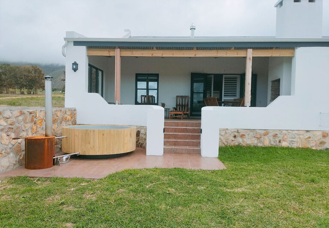
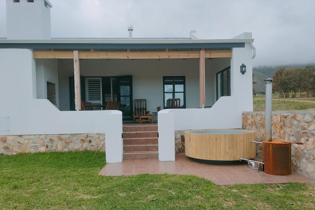
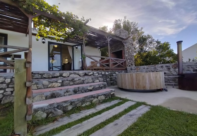
Light Cottage
For rest and renewal come and stay in Stanford at our cottage on the hill, Beloftebos Light Cottage. Overlooking a dam, Light Cottage offers pano...
The Ark Holiday Home
The Ark is an intriguing house, aptly named, reminds one of Noah's Ark. It nestles amongst giant trees in a wooded garden a few steps away from t...
Vineyard Villa One
Vineyard Villa 1 offers self-catering accommodation in Stanford at the Stanford Hills Estate on the banks of the Klein River. The village is only...

Brunia Cottage
Brunia Cottage is an old labourers cottage in Stanford that has been restored to offer comfort and self-contained convenience. The first bedroom ...
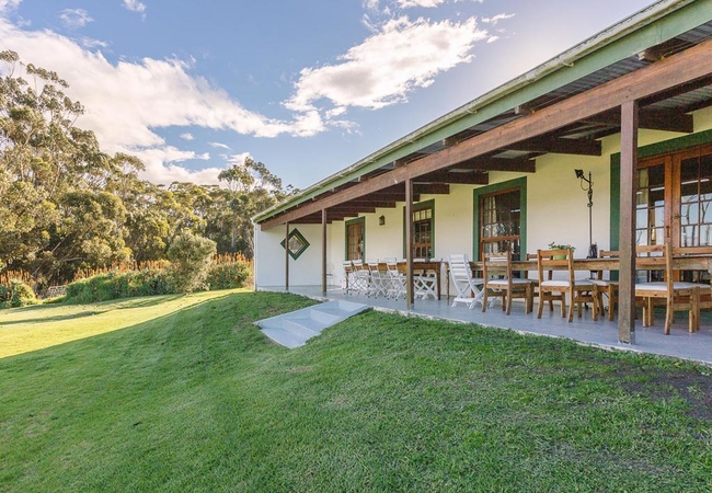
Groenvy Farmhouse
Beloftebos Groenvy Farmhouse offers Stanford accommodation in a country style and is the ideal place for a family gathering. Whether your sense o...
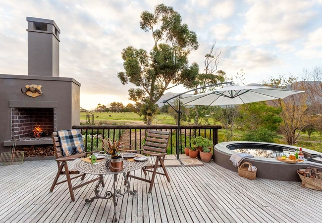
Waterblom @ Stanford Valley
Waterblom can be found on the Guest Farm nestled in the valley of the Klein Rivier, 10km outside Stanford village. Outside there is a deck with s...
Things to do in the area - see all in Cape Overberg
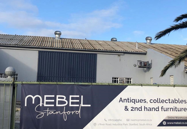
Mebel Stanford
Located in the beautiful country town of Stanford not far from Gansbaai and Hermanus and 145km from Cape Town, Mebel Warehouse is situated in the...
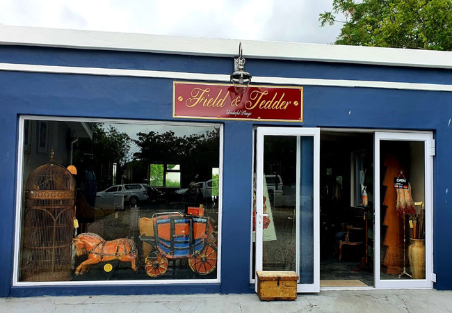
Field & Tedder Wonderful Things
There is just no missing the blue house on Stanfords main Queen Victoria Street with an original 1930s petrol pump parked outside (fully restor...
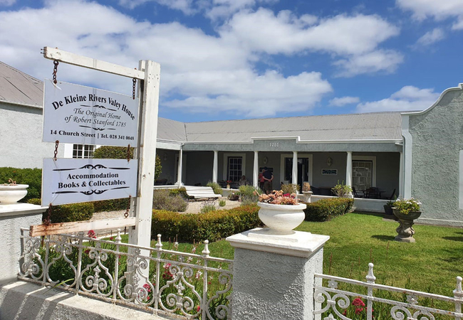
Robert Stanford Antiques
The oldest existing antique store is Robert Stanford Antiques, located at no.14 Church Street.The building itself is one of the oldest known buil...
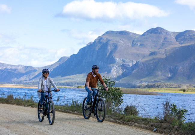
e-Rides @ Stanford Hills
e-Rides is all about being outdoors in nature and exploring unforgettable South African scenery on one of our premium electric mountain bikes. St...

Stanford Saturday Morning Market
On Saturday mornings, the courtyard alongside Stanford Art Café on Stanford's main road, Queen Victoria Street, fills up with locals selling fres...
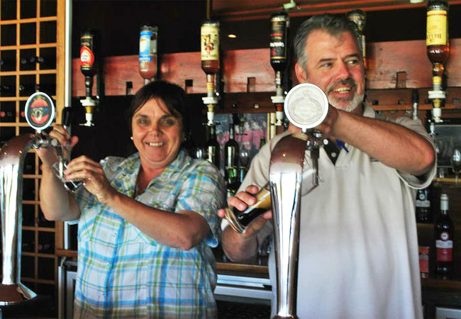
Birkenhead Brewery
As the first brewing estate in the Southern Hemisphere, we run a small but growing micro brewery situated in the Western Cape of South Africa. We...
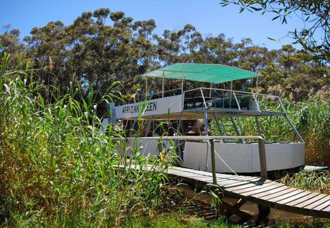
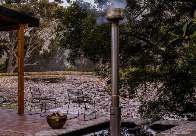
Cruise up the Klein River in Stanford
Come and enjoy yourself and relax on a wonderful cruise up the Klein River. Come enjoy the birds, the tranquility and be mesmerized as our beauti...

Guided Horse Trails in Stanford
We offer are rides ranging from 1 hour to three days. Being based in Stanford, gives access to the Kleinrivier mountains, the river, the coastlin...
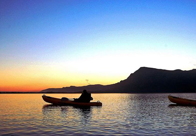
Kayaking at Mosaic Sanctuary
From the shores of Mosaic, launch yourself among a myriad of water birds on the lagoon. Explore the mouth of the lagoon where it meets the ocean ...
Noteworthy attractions - see all in Cape Overberg
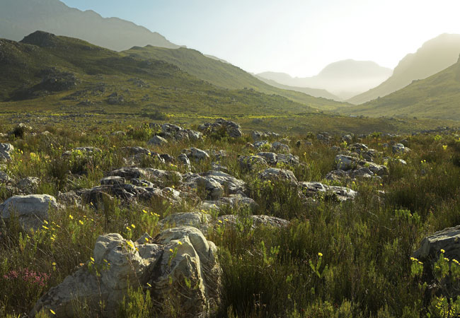
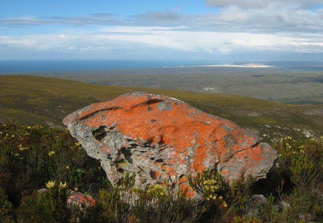
Kogelberg Nature Reserve
Lying within the southern extension of the Hottentots Holland Mountain range about 90 kilometres south-east of Cape Town and 8 kilometres from Kl...
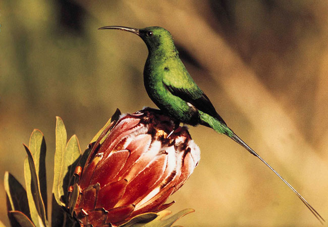
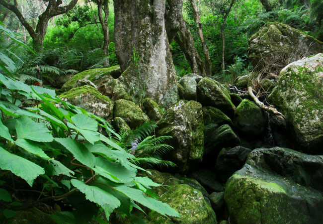
Harold Porter Botanical Gardens
The Harold Porter National Botanical Garden lies in the epicentre (heart) of the Cape fynbos region - a dedication to this natural shrubland vege...
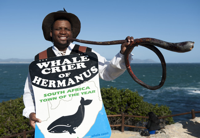
Hermanus Whale Crier
Hermanus on the Cape Whale Coast has its very own whale crier, and, whats more, Hermanus lays claim to the only whale crier in the world. The po...
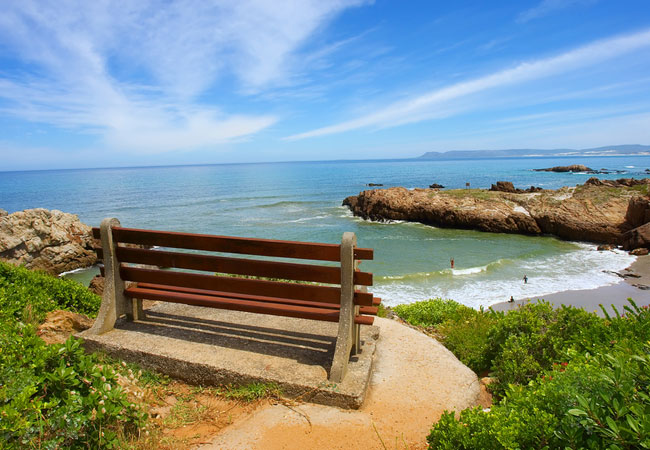
Hermanus Beaches
Where? +/-2 hours drive from Cape Town on the south coast of the Cape. Includes: Onrus Beach, Grotto Beach, Kammabaai and Langbaai Beach. Go ther...
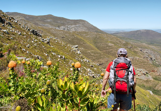
Hermanus Hiking Trails
While most visitors to Hermanus have many things to do on their itinerary, most involving the whales that have made this town famous, there are m...

Hermanus Golf Club
The course doesnt only challenge however, you are rewarded, hole after hole, with panoramic views that overlook the sparkling ocean and adding t...
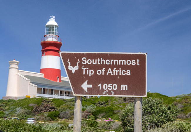
Agulhas National Park
Lying in what is known as the Agulhas Plain at the southernmost tip of Africa is the Agulhas National Park, just 45 kilometres from the popular v...
Marloth Nature Reserve
Lying just three kilometres from the pretty little town of Swellendam, the Marloth Nature Reserve conserves the central Langeberg Mountains that ...
De Hoop Nature Reserve
The De Hoop Nature Reserve is approximately 34 000 ha in size and one of the largest natural areas managed by Cape Nature Conservation. It is a f...
Find accommodation in Stanford
FIND / South Africa Accommodation / Western Cape Accommodation / Cape Town Accommodation / Cape Overberg Accommodation / Stanford Accommodation
Stanford as a destination
Why book with SA-Venues.com
- Your card is safe with us; strictest card verification in the industry and we don't store card numbers.
- No airy fairy service fees; you save!
- We care. Service with integrity.
- Multiple payment methods:
credit card, SID instant EFT, bank transfer. - All Stanford property owners / managers are verified (our experience protects you from online fraud).
- Secure your booking
Maps
Destination Stanford
- By type in Stanford
- Stanford Accommodation
- Stanford Hotels
- Stanford Guest Houses
- Stanford Bed & Breakfast
- Stanford Self Catering
- & Holiday Apartments & Suites
- & Holiday Cottages & Chalets
- & Holiday Homes & Villas
- Stanford Honeymoons
- Destinations near Stanford
- Baardskeerdersbos, Barrydale, Bettys Bay, Botrivier, Buffeljagsrivier, Caledon, Cape Agulhas, De Hoop, De Kelders, Elgin, Fisherhaven, Franskraal, Gansbaai, Grabouw, Greyton, Hawston, Heidelberg, Hermanus, Kleinbaai, Kleinmond, Malgas, Onrus, Pearly Beach, Pringle Bay, Riviersonderend, Rooi Els, Sandbaai, Suiderstrand, Suurbraak, Swellendam, Tesselaarsdal, Vermont, Villiersdorp, Witsand
- Resources for tourists
- About Stanford
- Things To Do
- Attractions
- Reviews