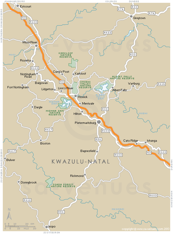
Map of Natal Midlands, KwaZulu Natal
Map showing the towns and attractions of the Natal Midlands in KwaZulu Natal. Between Pietermaritzburg and the Drakensberg Mountains, is a beautiful region filled with stretches of farmland, charming little towns, a wonderful arts and crafts route and picturesque scenery known as the Natal Midlands. For additional info visit Natal Midlands Information.
Maps of KwaZulu Natal
Provincial Maps
Street Level Maps
KwaZulu Natal Regions
Special Interests by Map
In the vicinity
Hotels & other accommodation options
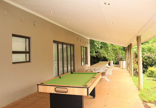
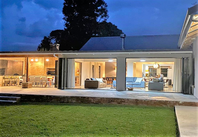
The Farmhouse at Shekinah
The Farmhouse is a holiday house offering five beautifully decorated rooms for up to ten guests. Wide stacking doors open onto a large patio with...
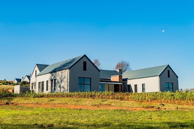
Gowrie Farm House 222
Located on the secure Gowrie Farm Golf Estate in Nottingham Road, Gowrie Farm House 222 offers accommodation in a beautifully appointed house. Th...
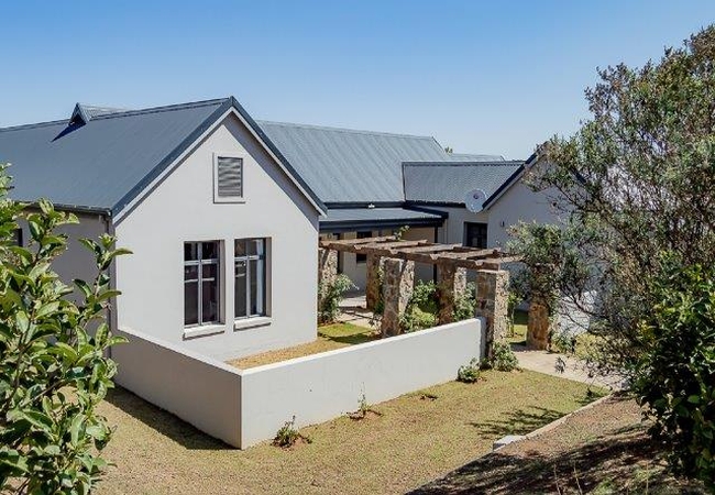
Gowrie Farm House 217
Gowrie Farm House 217 offers accommodation in a modern house situated on the secure Gowrie Farm Golf Estate in Nottingham Road. The estate boasts...
Fairfax Farmhouse
Fairfax Farmhouse is a modern holiday home located on a secure farm, just 4.2 km away from Nottingham Road central. Nottingham Road is the hub of...
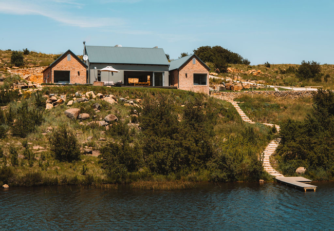
Stoneford Lodge
Stoneford Lodge is a style sensation that will leave you wanting for nothing. Located on the Star Dam estate, this holiday home offers a comforta...
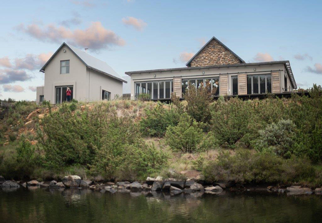
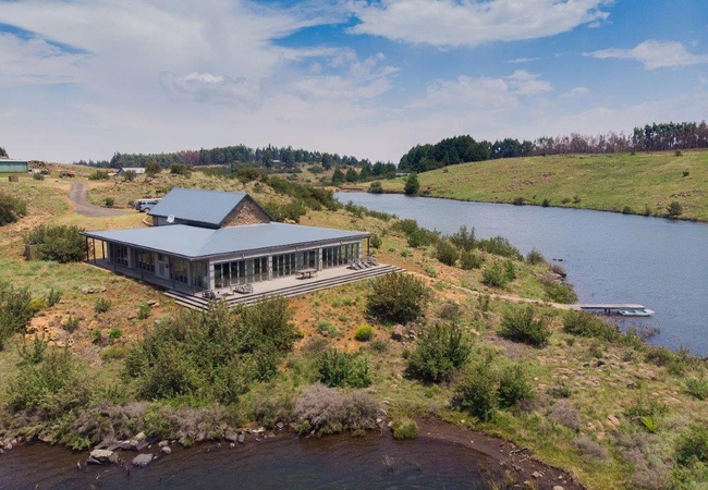
Waterford Lodge
Waterford Lodge is a comfortable Dargle holiday home offering accommodation on the star Dam estate. The lodge boasts a private jetty facilitating...
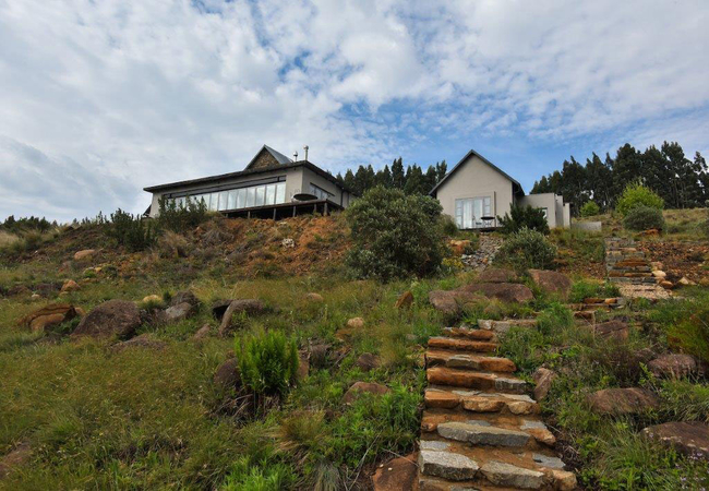
Rockwood Farm House
Rockwood Farm House is a four bedroom luxurious, contemporary and spacious home. The private Karkloof Nature Reserve is a short drive away. Explo...
Safire Lodge
Safire Lodge is a holiday home offering Natal Midlands self catering in the Star Dam Estate. Safire Lodge boasts generous proportions and seamles...
Inkanyezi Lodge
The lodge offers access to a large wooden deck with an umbrella and an outdoor lounge set. A small fishing boat is also available for rental. Ink...
Noteworthy attractions
Albert Falls Dam Nature Reserve
The source of the uMngeni River lies in the uMngeni Vlei area, an ancient wetland bounded by hills. From here it meanders eastward through undula...
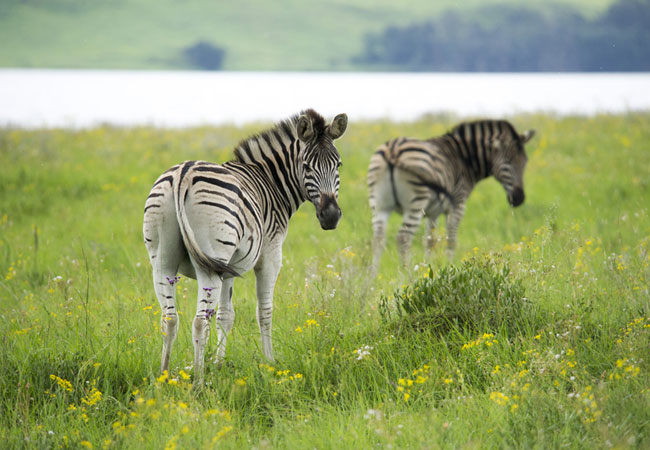
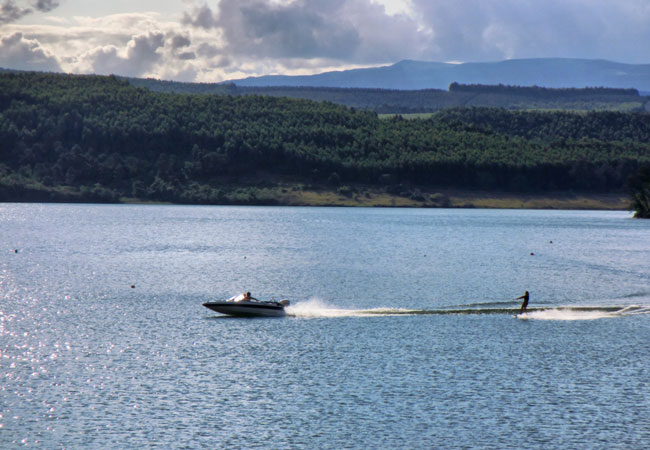
Midmar Dam Nature Reserve
The large stretch of fresh water from the uMngeni, coupled with 1000 hectares of game park that contains red hartebeest, blesbok, reedbuck, black...

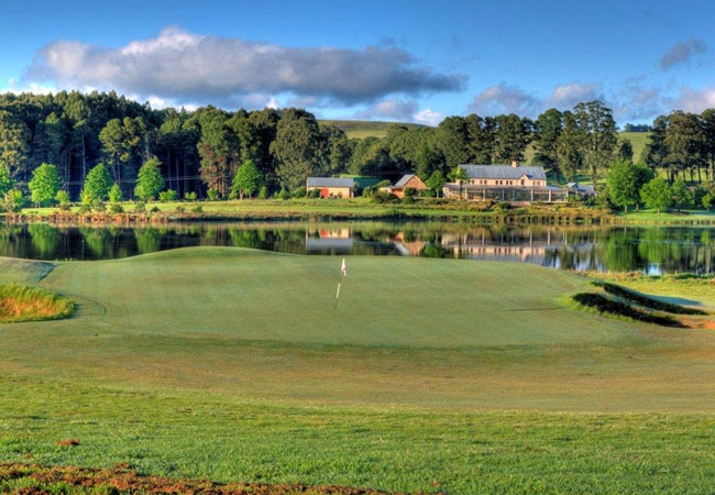
Bosch Hoek Golf Club
Bosch Hoek Golf Course in the KwaZulu Natal Midlands must qualify as one of the most picturesque layouts in the country. The estate is convenient...
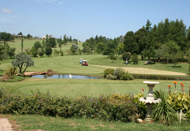
Gowrie Farm Golf Course
Gowrie Farm Golf Course, one of KwaZulu Natals finest golf courses, was built in the traditional way with push up greens and rugged bunkers. The...

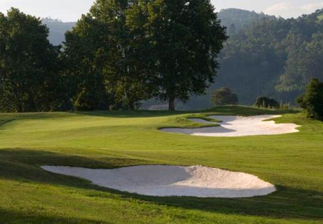
Maritzburg Golf Club
The Maritzburg Golf Club in Pietermaritzburg is one of the oldest golf clubs in South Africa, dating back to 1886. It has lush, smooth cynodon gr...
Sakabula Golf Club
Sakabula Golf Club is a unique combination of agricultural smallholdings around a delightful 18-hole, par 73, golf course in a scenic rural envir...
Victoria Country Club
Less than five minutes from the CBD of Pietermaritzburg, the Victoria Country Club is superbly located in the scenic parklands adjoining the Quee...
Battlefields Route
The KwaZulu Natal hinterland has witnessed some of the most brutal and significant battles to be fought in South Africa. These historical sites f...
Midlands Meander
The enchantment of the Midlands has long inspired many a visitor and resident to creativity and as a result, local artists, potters and weavers c...
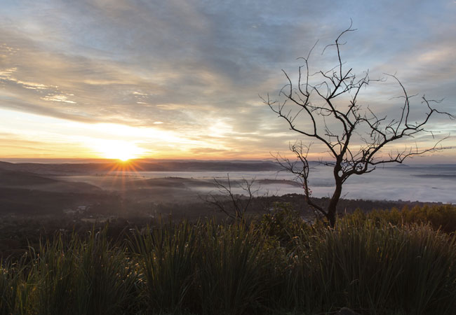
Natal Midlands as a destination
Why book with SA-Venues.com
- Your card is safe with us; strictest card verification in the industry and we don't store card numbers.
- No airy fairy service fees; you save!
- We care. Service with integrity.
- Multiple payment methods:
credit card, SID instant EFT, bank transfer. - All Natal Midlands property owners / managers are verified (our experience protects you from online fraud).
- Secure your booking
Maps
Destination Natal Midlands
- By type in the Natal Midlands
- Natal Midlands Accommodation
- Natal Midlands Hotels
- Natal Midlands Guest Houses
- Natal Midlands Bed & Breakfast
- Natal Midlands Self Catering
- & Holiday Apartments & Suites
- & Holiday Cottages & Chalets
- & Holiday Homes & Villas
- Natal Midlands Conferences
- Natal Midlands Weddings
- Natal Midlands Honeymoons
- Destinations in the Natal Midlands
- Balgowan, Boston, Currys Post, Dargle, Estcourt, Eston, Fort Nottingham, Greytown, Hidcote, Hilton, Hlutankungu, Howick, Ixopo, Karkloof, Lidgetton, Lions River, Merrivale, Mid Illovo, Mooi River, Nottingham Road, Pietermaritzburg, Richmond, Rosetta
- Resources for tourists
- About Natal Midlands
- Things To Do
- Attractions