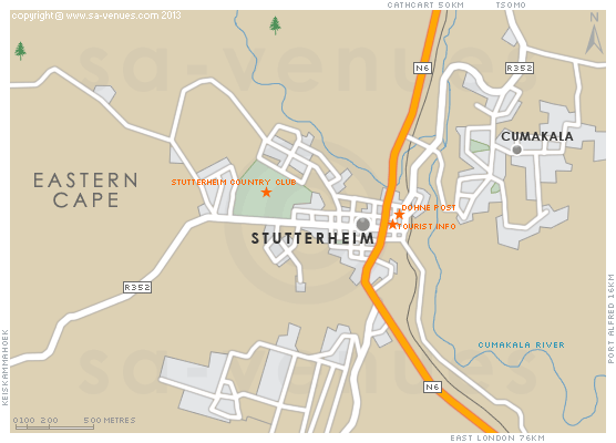
Map of Stutterheim, Eastern Cape
Stutterheim detail and street level map showing the suburbs, some attractions and landmarks of Stutterheim. Other than the peace and quiet of the town, the incredible trout and bass fishing and the hikes and walks, you can also visit the Mgwali Village or call in at the Stutterheim Engine Museum, which houses a wide collection of steam engines from days gone by. To find out more please visit Stutterheim Information.
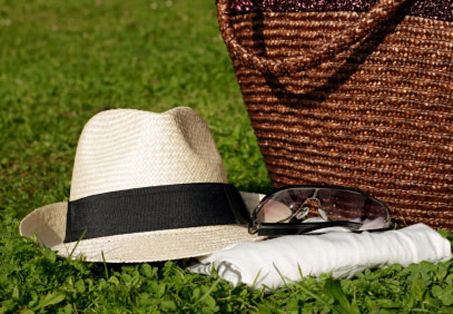
If you are interested in overnighting in the area, we can recommend some great accommodation options including hotels, guest houses and self-catering properties. If you're only planning on driving through Stutterheim, en-route to another destination, you may want to peruse our Stutterheim Restaurants before you leave to see if you should plan a stop here for lunch or maybe just a coffee. Also check out Stutterheim Things To Do to see if there are any activities for which you would consider stopping.
Maps of the Eastern Cape
Provincial Maps
Street Level Maps
Eastern Cape Regions
Special Interests by Map
In the vicinity
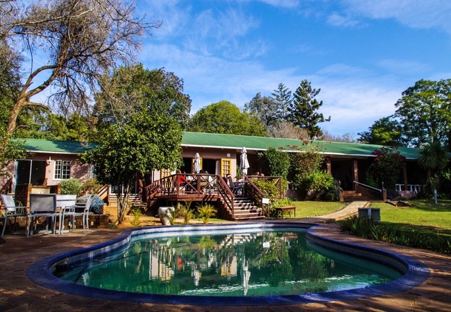
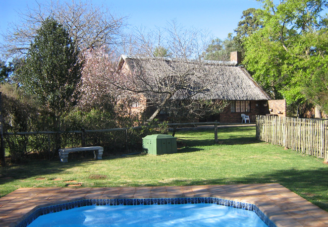
Hotels & other accommodation options
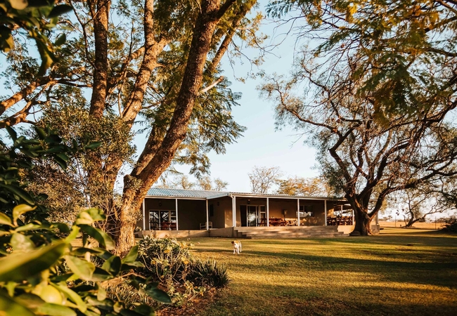
Rockdell Lodge
Step into farm style comfort and luxury Rockdell Lodge is situated 35km from the Eastern Cape town of Stutterheim. Intimate and cosy Rockdell o...
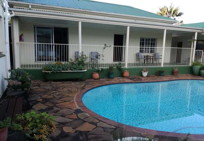
The Manderson Hotel
A warm welcome awaits you at The Manderson, three star Hotel and Conference Centre, situated at the base of the forested Amatola Mountains, 7km f...
The Croft Cottages
The Croft Cottages offer accommodation conveniently situated when traveling to or from East London, Bhisho, King Williams Town and Queenstown. It...
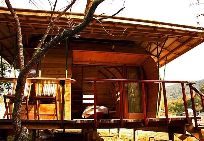
The Shire Eco Lodge
As refreshing as it is unique; an extraordinary and truly unique space, captivating with its innovative design and magnificent forest setting. Th...
Things to do in the area - see all in Amatola
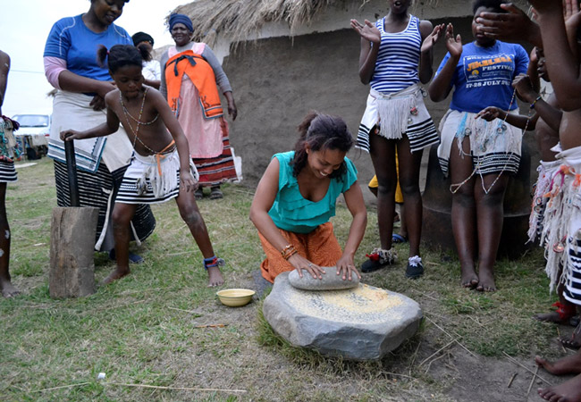
Day Visit to Mgwali Village
Experience true Xhosa hospitality on the delightful day trip of Mgwali Village, the oldest village in Eastern Cape. Taste traditional food and en...
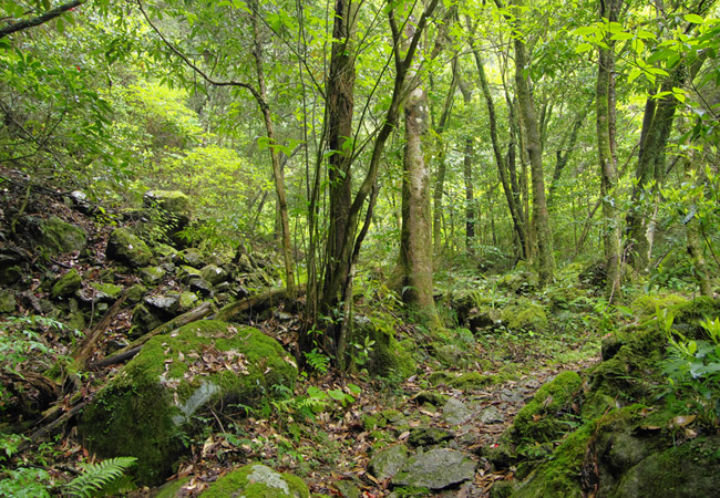
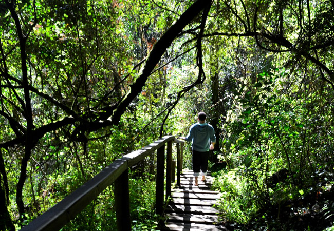
Hike the Kologha Forest Trails
The Kologha Forest Trails are located in the eastern end of the Amatola Mountains which are near Stutterheim in the Eastern Cape. These mountain...
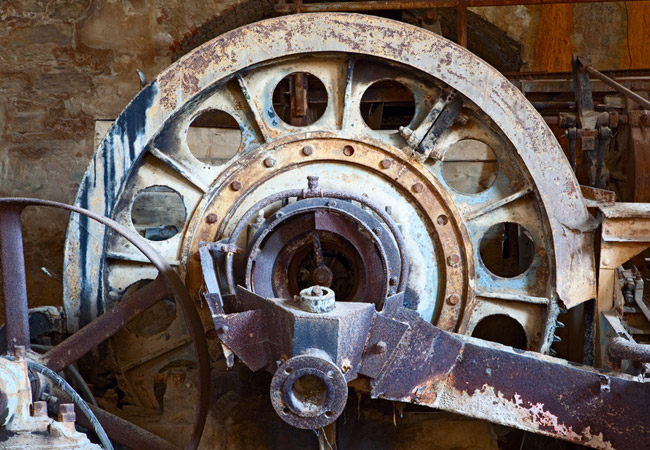
Stutterheim Stationary Engine Museum
The Stutterheim Stationary Engine Museum is believed to have one of the largest and most comprehensive collections of restored stationary engine...
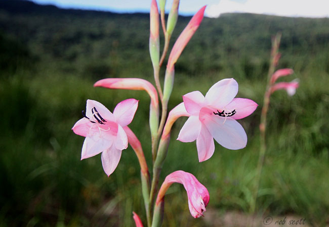
Shire Wild Bulb Nursery
The Shire Wild Bulb Nursery is an indigenous nursery with a large range of indigenous trees and an extensive collection of Eastern Cape bulbs, so...
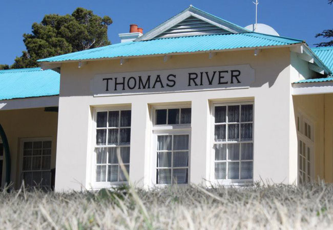
Thomas River Historical Village
Nestled between Stutterheim and Cathcart is the Thomas River Historical Village. The village is named after a British deserter, Thomas Bently who...
Kologha Forest Blue Day Walk
Indulge in this easy three kilometre walk through the beauty of the Eastern Cape Province for a retreat from city life. The Kologha Forest Blue D...
Andersons Dam Trail
For a fun filled family day out, grab a picnic basket, rustle up the kids and head to the Andersons Dam Trail. The 8 kilometer walk is easy and s...
Pirie Forest Hike
Start: southern end of the Maden DamFinish: back where you started, as it's circularDuration: 9kmFitness: it's an easy walkOur tip: look out for ...
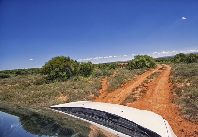
Ferndale 4x4 Trail
The Ferndale 4x4 Trails create a veritable playground for the adventurous. They are situated in the mountain ranges of South Africa, just outside...
Noteworthy attractions - see all in Amatola
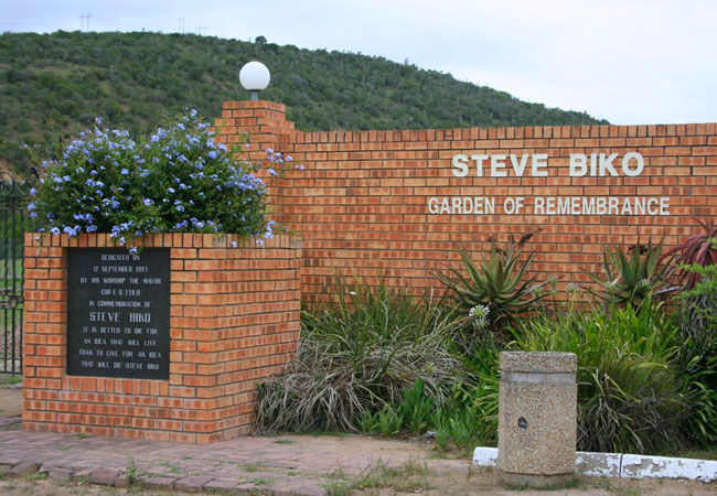
Steve Biko Garden of Remembrance
Bantu Steven Biko, one of the most recognised leaders of the Black Consciousness Movement, is regarded as one of the greatest martyrs of the anti...
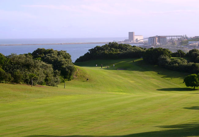
East London Golf Club
The East London Golf Club, skilfully fashioned out of dense coastal bush, hills and dunes, just a few metres away from the warm water of the Indi...
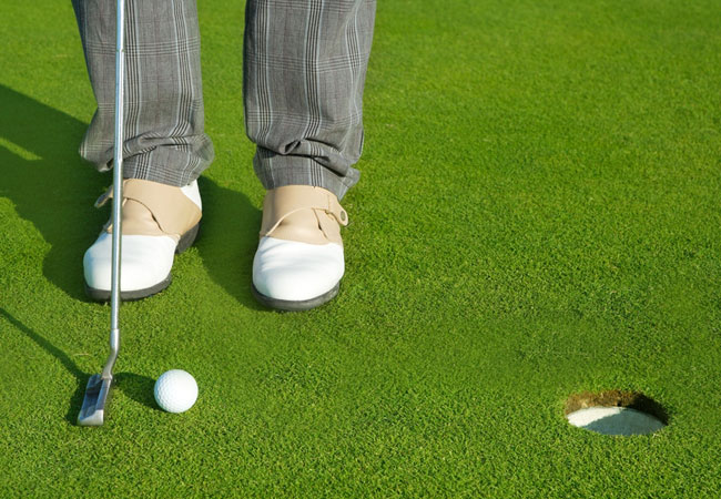
West Bank Golf Club
The West Bank Golf Club, which celebrated its centenary in October 2007, has an 18 hole golf course rated as Number 93 in South Africa. Enjoy lov...
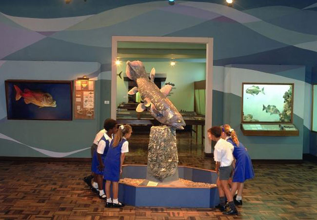
East London Museum
The East London Museum has the world's only dodo egg, a large natural science collection, collections ranging from the prehistoric times of South...
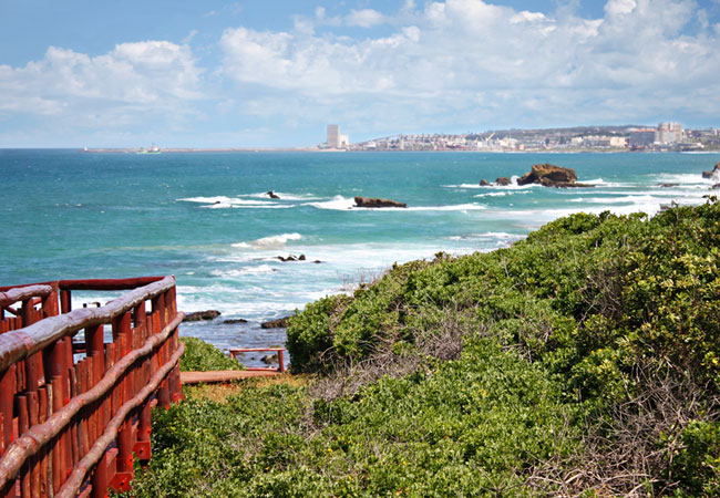
East London Beaches
Think warm Indian Ocean waters and sub-tropical weather that allow visitors to enjoy the climate all year round - East London basks gloriously be...
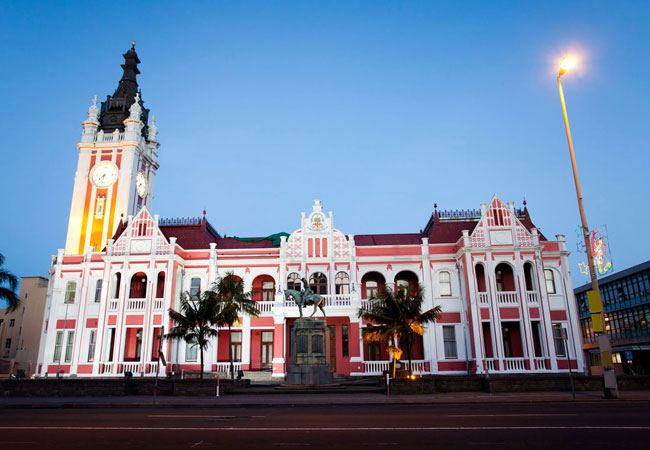
East London City Hall
The foundation stone of the stately East London City Halll was laid in 1897. The clock tower commemorates the diamond jubilee of Queen Victoria. ...

East London Coast Nature Reserve
The East London Coast Nature Reserve is a gorgeous stretch of coast that extends from the Great Kei River in the north east all the way to the Ty...

Amalinda Nature Reserve
The Amalinda Nature Reserve is situated less than 10 kilometres from the ever-growing city hub of East London in the Eastern Cape. Established in...
Fort Fordyce Nature Reserve
Set close to the little community of Blinkwater, Fort Fordyce Nature Reserve lies on the Post Retief road, almost equidistant between Adelaide an...
Find accommodation in Stutterheim
FIND / South Africa Accommodation / Eastern Cape Accommodation / Amatola Accommodation / Stutterheim Accommodation
Stutterheim as a destination
Why book with SA-Venues.com
- Your card is safe with us; strictest card verification in the industry and we don't store card numbers.
- No airy fairy service fees; you save!
- We care. Service with integrity.
- Multiple payment methods:
credit card, SID instant EFT, bank transfer. - All Stutterheim property owners / managers are verified (our experience protects you from online fraud).
- Secure your booking
Maps
Destination Stutterheim
- By type in Stutterheim
- Stutterheim Accommodation
- Stutterheim Hotels
- Stutterheim Guest Houses
- Stutterheim Bed & Breakfast
- Stutterheim Self Catering
- & Holiday Apartments & Suites
- & Holiday Cottages & Chalets
- & Holiday Homes & Villas
- Stutterheim Conferences
- Stutterheim Honeymoons
- Destinations near Stutterheim
- Adelaide, Bedford, Cintsa, Cove Rock, East London, Fort Beaufort, Gonubie, Hogsback, Katberg, Kidds Beach, King Williams Town, Steynsburg, Tarkastad, Winterberg
- Resources for tourists
- About Stutterheim
- Things To Do
- Attractions
- Reviews