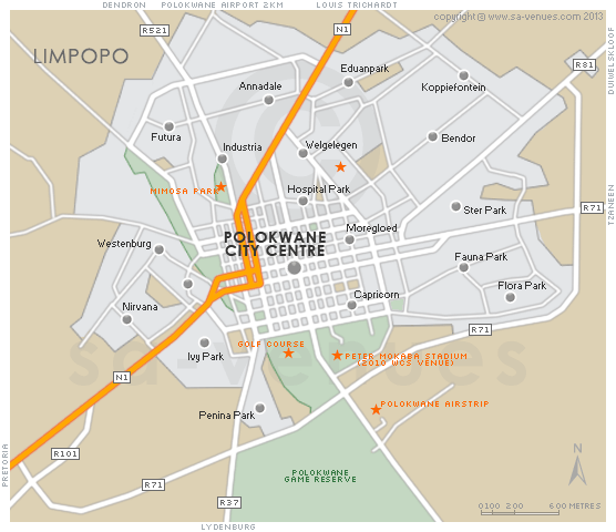
Map of Polokwane, Limpopo
Polokwane detail and street level map showing the suburbs and landmarks of Polokwane including the location of the the Peter Mokoba Stadium and Polokwane Game Reserve. Few travellers to this part of the world can avoid Polokwane - Passing through is mandatory, before continuing to destinations like the Kruger National Park and the Magoebaskloof. For additional information please visit Polokwane Information.
If you are interested in overnighting in the area, we can recommend some great accommodation options including hotels, guest houses and self-catering properties. If you're only planning on driving through Polokwane, en-route to another destination, you may want to peruse our Polokwane Restaurants before you leave to see if you should plan a stop here for lunch or maybe just a coffee. Also check out Polokwane Things To Do to see if there are any activities for which you would consider stopping.
Maps of the Limpopo Province
Provincial Maps
Street Level Maps
Special Interests by Map
In the vicinity
Hotels & other accommodation options
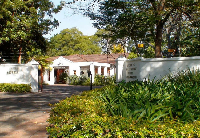
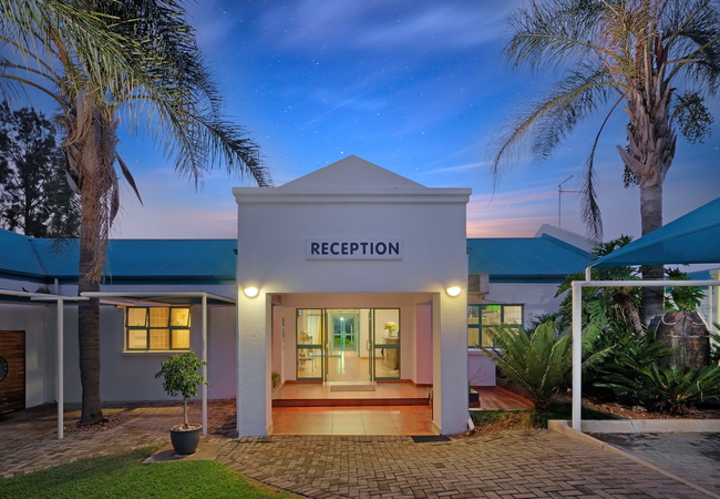
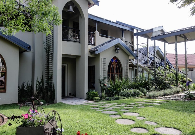
Pietersburg Club
Pietersburg Club is located in Polokwane and is one of the jewels in the crown of the Limpopo Province. The gracious style of the main building c...
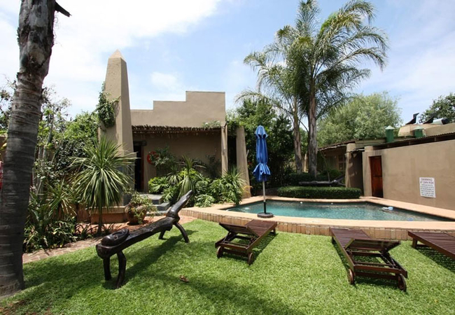
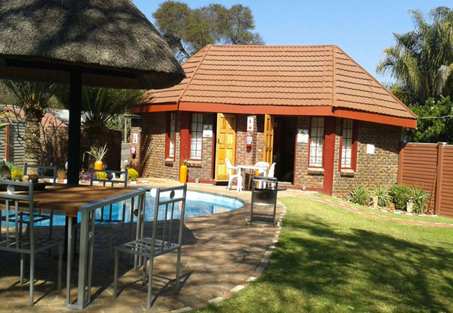
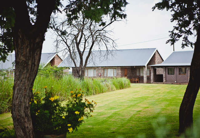
61 on Ireland
61 On Ireland is a paradise rock village with intimate architecture, inspired by rock, Koi ponds, indigenous plants and contemporary living. Our ...

Pietersburg Lodge
Pietersburg Lodge is located in the suburb of Ivy Park in Polokwane and has 48 rooms. The guest house offers a restaurant and a pub and is 3km aw...
Limpopo Lodge
Limpopo Lodge is located on a smallholding just 7km outside Polokwane and offers B&B, self catering and camping accommodation. The en-suite rooms...
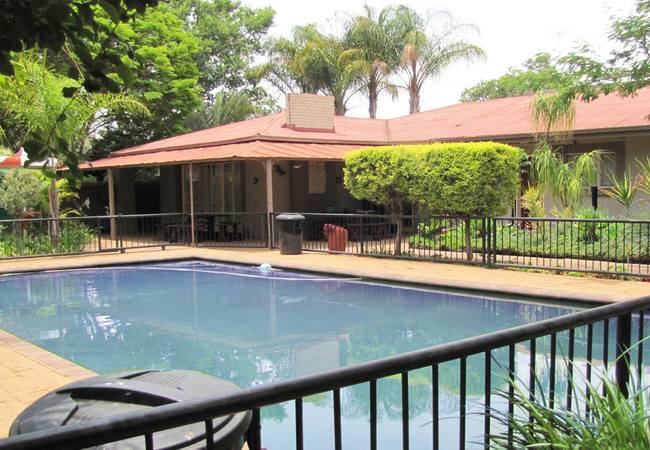
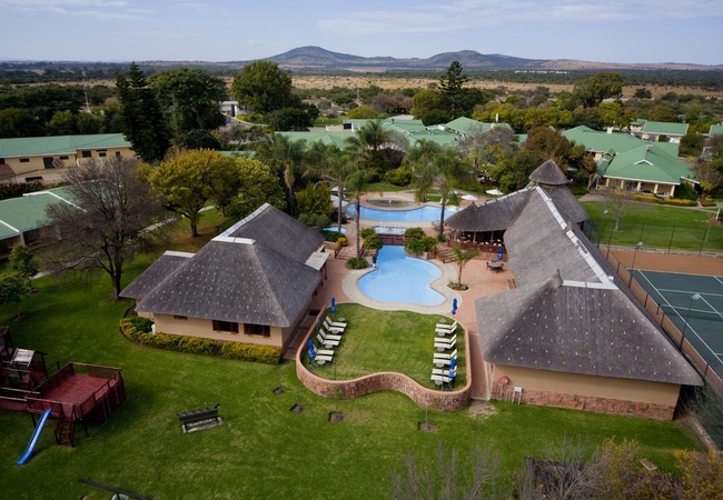
Polokwane Place
This luxury lodge with its two swimming pools, floodlit tennis court, lapa with braai facilities, conference venue and superb restaurant will exc...
African Roots Guest House
African Roots Guest House offers accommodation in the Polokwane. All rooms have direct access to the garden and are equipped with a TV with SABC ...
Tawni Safari Lodge
Hidden away on almost 1000 hectares of unspoiled bushveld, Tawni Safari Lodge offers bed and breakfast accommodation in a choice of rooms and cha...
Polo Guest House
Polo Guest House offers bed & breakfast accommodation in central Polokwane. Accommodation in iffered in eight comfortable rooms each equipped wit...
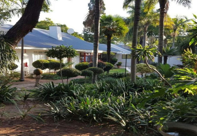
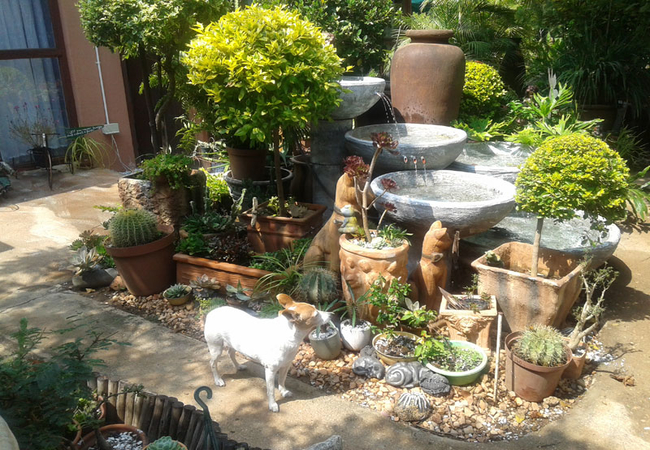
Country Blue Guest House
Country Blue Guest House is located in Polokwane and offers bed and breakfast accommodation in a home away from home environment. From the moment...
Bolivia Lodge
Bolivia Lodge offers a range of accommodation options, all conveniently located on one site. Situated on a smallholding, on the eastern side of P...
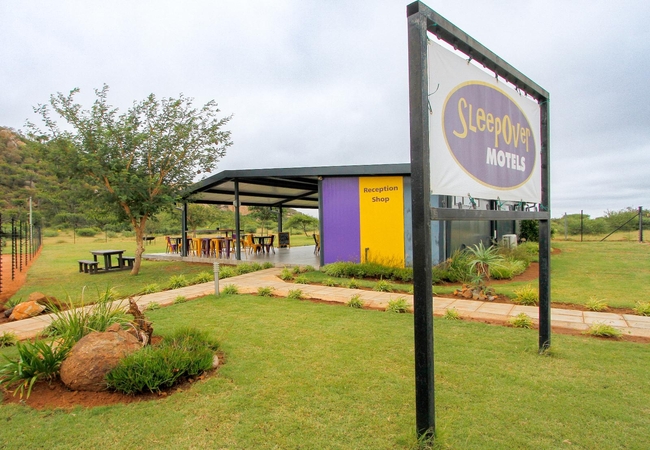
SleepOver Matoks
SleepOver Matoks offers accommodation in Polokwane, just 50km north of the main town and located next to the N1 highway. This is an ideal stop fo...
Lempitse Lodge
Lempitse Lodge offers top-class, affordable accommodation, well known for their warm hospitality and excellent service. The lodge is located appr...
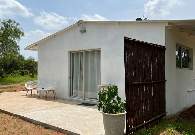
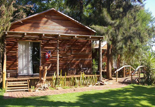
The Barn @ Tembele
Experience the tranquillity of a farm stay at The Barn at Tembele, offering self-catering accommodation in Polokwane, ideal for those who love fi...
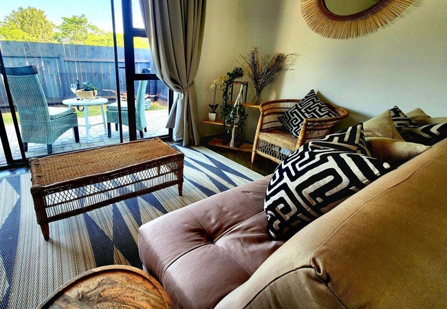
Pan's Breeze
Pan's Breeze is a cosy semi-detached self-catering cottage situated on a small-holding outside the city of Polokwane. Pan's Breeze is open plan a...
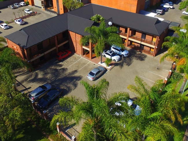
Protea Hotel Polokwane Landmark
Protea Hotel Polokwane Landmark offers affordable, comfortable and spacious accommodation to suit your business or leisure needs. Ideally located...
Lindekroon Guest House
Lindekroon Guest House is situated in a quiet neighbourhood close to the CBD in Polokwane. Accommodation is offered with garden views and friendl...
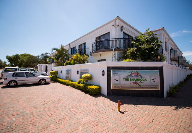
The Shamrock Lodge
The Shamrock Lodge offers 4 star accommodation in Polokwane The Lodge has a total of 30 rooms as well as conference facilities, board rooms and a...
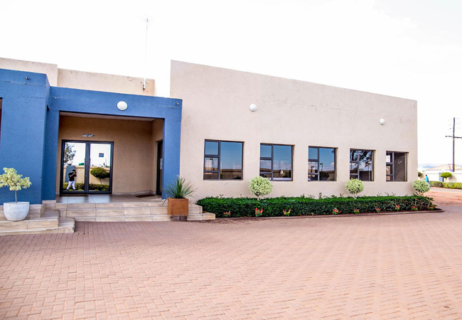
SleepOver Moria
SleepOver Moria offers comfortable, safe and affordable accommodation in Polokwane. The motel features 30 rooms with air-conditioning, catering t...
Marlot Guest House
Marlot Guest House believes in hospitality of the highest standard and a visit to our friendly guest house will exceed all your expectations and ...
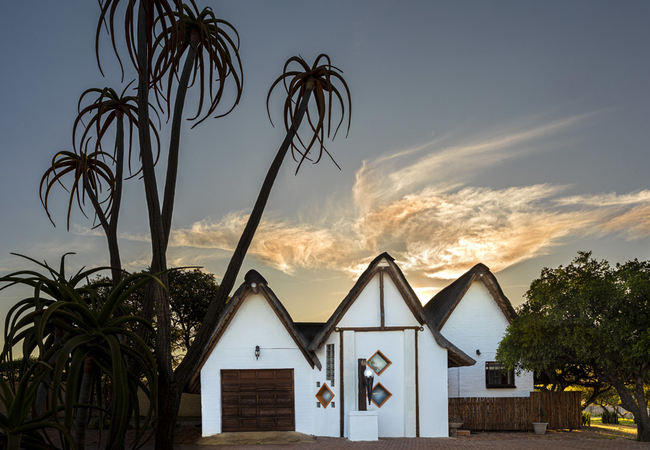
Lodge Aloe-Hymn
At Lodge Aloe-Hymn you immediately become aware of the tranquility and peaceful surroundings of the thorn trees and aloes. Lodge Aloe-Hymn is a b...
Bendor Bayete
Bendor Bayete offers accommodation in the tranquil suburb of Bendor in Polokwane. The en-suite self catering rooms are tastefully decorated with...
Far North Accommodation
Far North is a privately owned luxury overnight accommodation, situated outside Polokwane / Pietersburg 8km from town on the Louis Trichardt road...
Eskulaap Hotel
Eskulaap Hotel offers bed & breakfast accommodation in the heart of Polokwane nestled in a hectare of landscaped gardens. This ideal location is ...
Avonlea Guesthouse
Avonlea Guesthouse offers luxurious yet affordable guesthouse accommodation in Polokwane. The accommodation is suitable for leisure and business ...
Cycad Guest House
Cycad Guest House proudly offers luxury accommodation in Pietersburg / Polokwane. The comfort and quality of service, as well as the beauty and i...
Reggies Guest Rooms
Located in Polokwane, Reggies Guest Rooms offers two stylish and comfortable guest rooms and a self-catering unit, all of which are part of a lov...
Patong Lodge
Patong Guest Lodge is located Polokwane. Guests can expect a soothing and tropical atmosphere and can choose to enjoy a drink at the welcoming fa...
Destiny Inn Lodge
Destiny Inn Lodge is a peaceful, eco-friendly, private resort, close to Polokwane. We provide comfortable luxury and budget Limpopo accommodation...
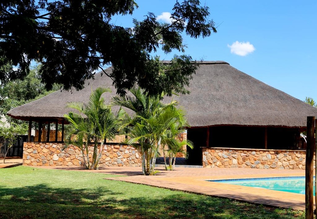
Protea Hotel The Ranch
The Ranch hotel is the leading conference venue and leisure resort within Limpopo and offers more than 110 spacious deluxe rooms featuring all th...
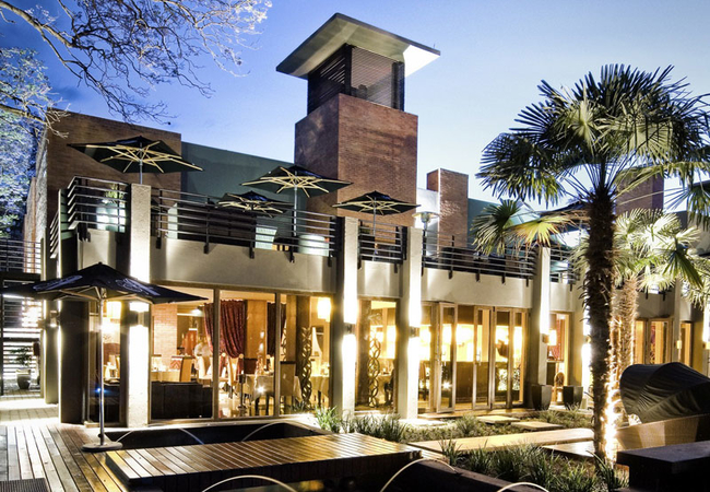
Fusion Boutique Hotel
Be prepared to embark on an unexpected soul journey when crossing the threshold of Fusion Boutique Hotel in the heart of Polokwane, the buzzing c...
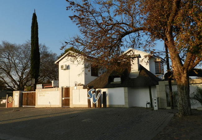
Sleepers Villa Guesthouse
Sleepers Villa offers 8 rooms: air-conditioned, en-suite bathroom or shower, single beds with electric blanket s, DStv and a tea / coffee station...
Danlee Overnight Accommodation
Danlee Overnight Accommodation offers accommodation in Polokwane. Each room is equipped with a heater, tea and coffee making facilities, a TV wit...
Grincourt Nature Reserve
Situated 10kms outside Polokwane, Grincourt Nature Reserve boasts a unique and tranquil Bushveld setting. The Guest House has an on site restaura...
Things to do in the area - see all in Capricorn

Magoebaskloof Canopy Tour
The Limpopo Province in South Africa is one that is abundant in natural splendour, history (even relics and fossils dating back to prehistoric ti...

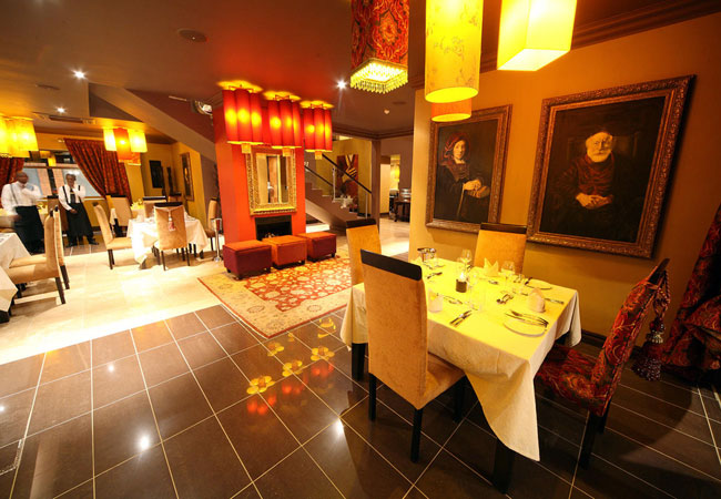
Cubaña Restaurant
Cubaña Restaurant is a very trendy, up-market eatery with a fantastic atmosphere. The décor could be described as traditional, rustic, natural, y...

Harvest Charcoal Grill
Sumptuous, sizzling steaks are the way to go at Harvest Charcoal Grill. There is also an outstanding selection of mouth watering South African di...
Saskia Restaurant
Saskia Restaurant named after renowned artist Rembrandt Van Rijn's wife and muse is a modern tribute to life and art. The opulent ornamentation, ...
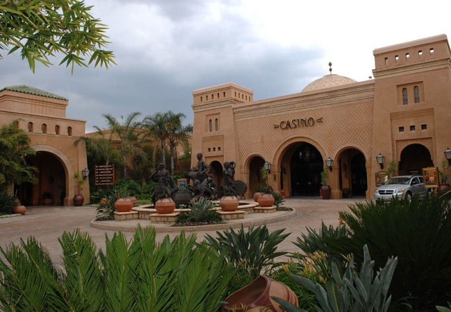
Meropa Casino
Meropa Casino and Entertainment World is situated in Limpopo, 5km from the capital Polokwane. The Meropa Casino offers an upmarket casino experie...

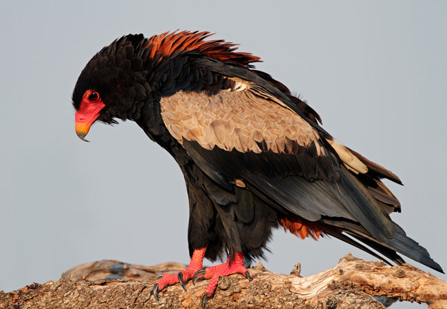
Polokwane Bird and Reptile Park
A great attraction in the city is the Polokwane Bird and Reptile Park. It is one of the largest municipal reserves in the country and is a show p...
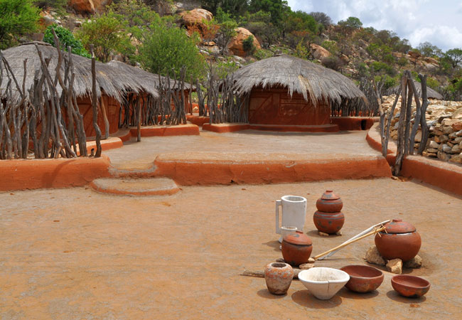
Visit the Bakone Malapa Museum
Experience the warm hospitality and rich culture of the BaSotho people in the Bakone Malapa Museum. The Bakone, a sub-group of the Northern Sotho...

Visit the Polokwane Game Reserve
One of the biggest municipal-owned game reserves in the country, the Polokwane Game Reserve's main attraction must be the amount of ground one ca...
WildThingZ Complex
Situated next to the craft market at Meropa Entertainment Complex is WildThingZ. This enclosure, which forms part of the Wild World Outdoor area ...
Noteworthy attractions - see all in Capricorn

Polokwane Golf Club
The Polokwane Golf Course has bent grass greens, Kikuyu fairways and 14 water hazards. Founded in 1863, the Polokwane Golf Club was virtually a d...

Makapansgat Valley
A basin rich in magnificence and biodiversity, the Makapansgat Valley displays some of the most astounding beauty in Limpopo. Not only is it of i...
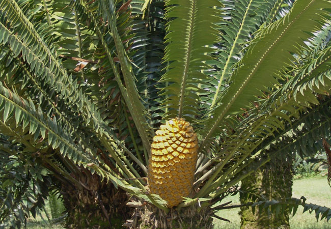
Modjadji Cycad Reserve
High in the Lobedu Mountains near Duiwelskloof and situated next to the home of the fabled rain queen, lies the Modjadji Cycad Reserve, boasting ...

Polokwane Game Reserve
Bordering the city of Polokwane in Limpopo, the Polokwane Game Reserve is possibly one of the finest on which to cut your teeth if you're new to ...

Bakone Malapa
Regarded as a living museum, the Bakone Malapa Museum near Polokwane is one of several museums and national monuments that bear testimony to Sout...

Zion City at Moria
The largest Christian gathering in South Africa happens twice a year at Zion City, Moria near Polokwane at Easter and again for the September fes...

Wolkberg Wilderness Area
Lying just off the R71 outside Haenertsburg where the Drakensberg meets the Strydpoort Mountains, the Wolkberg Wilderness Area is a selected few ...
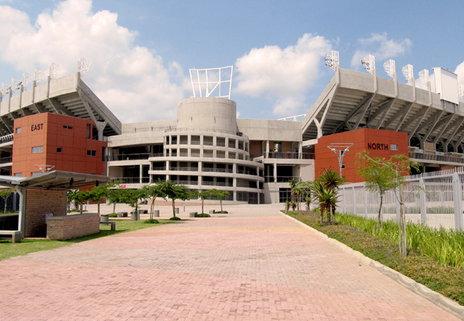
Peter Mokaba Stadium
Polokwane is the capital city of the South African province of Limpopo, and the proud home of the Peter Mokaba Stadium. This is one of the five s...

Lekgalameetse Nature Reserve
Bounding the Wolkberg Wilderness, Lekgalameetse is an attractive mountain reserve sporting sparkling clear rivers and waterfalls and natural pool...
Find accommodation in Polokwane
FIND / South Africa Accommodation / Limpopo Accommodation / Capricorn Accommodation / Polokwane Accommodation
Polokwane as a destination
Why book with SA-Venues.com
- Your card is safe with us; strictest card verification in the industry and we don't store card numbers.
- No airy fairy service fees; you save!
- We care. Service with integrity.
- Multiple payment methods:
credit card, SID instant EFT, bank transfer. - All Polokwane property owners / managers are verified (our experience protects you from online fraud).
- Secure your booking
Maps
Destination Polokwane
- By type in Polokwane
- Polokwane Accommodation
- Polokwane Hotels
- Polokwane Guest Houses
- Polokwane Bed & Breakfast
- Polokwane Self Catering
- & Holiday Apartments & Suites
- & Holiday Cottages & Chalets
- & Holiday Homes & Villas
- Polokwane Conferences
- Polokwane Weddings
- Polokwane Honeymoons
- Destinations near Polokwane
- Haenertsburg, Magoebaskloof, Mokopane, Pietersburg, Tzaneen
- Resources for tourists
- About Polokwane
- Things To Do
- Attractions
- Reviews