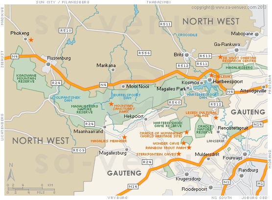
Map of Magaliesberg, Gauteng
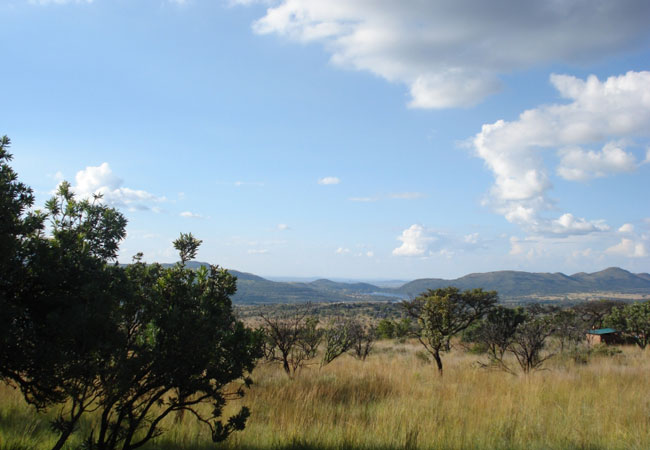
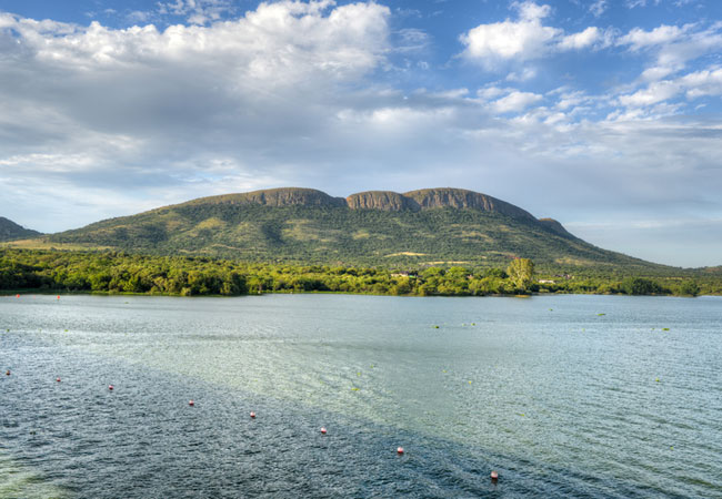
Magaliesberg Region map showing the towns and suburbs and major attractions of the beautiful Magaliesberg Region. Stretching for over 120 kilometres and separating the highveld grasslands to the south from the bushveld savannah in the north, the Magaliesberg is a stretch of mountains 100 times older than Everest, that extend from Rustenburg in the North West Province all the way to the Bronkhorstspruit Dam, just east of Pretoria in Gauteng. To find out more please visit Magaliesberg Information.
Maps of Gauteng
Provincial Maps
Street Level Maps
Gauteng Regions
Special Interests by Map
In the vicinity
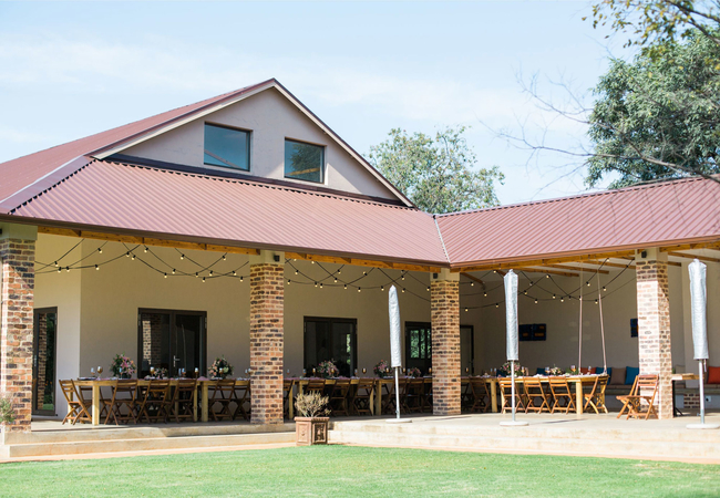
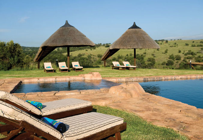
Hotels & other accommodation options
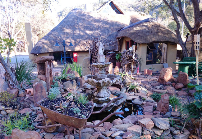
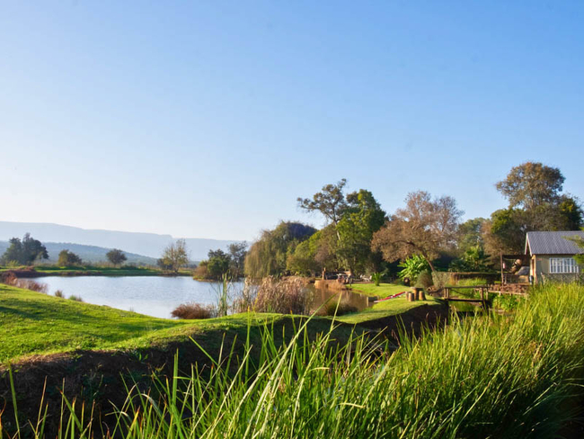
Stone Hill
Perched high above the distant village of Magaliesburg, Stone Hill offers 6 top class, fully equipped luxurious self-catering timber cottages, ac...
Warthogs Bush Lodge
Tucked away in the Magaliesburg, Warthogs Bush Lodge offers accommodation for up to 20 guests. The lodge boasts a wonderful ambiance that goes ha...
Phefumula Country Retreat
Phefumula Country Retreat offers luxurious accommodation in romantic cottages nestled against the slopes of the Magaliesberg Mountain range. The ...
Hornbill Lodge
Located in Magaliesburg, Hornbill Lodge and Legends offers both Bed and Breakfast and Self Catering accommodation. The lodge features a large lan...
Esther's Country Lodge
On arrival at Esther's, one gets an impression of modern minimalism. This is a guest lodge with a difference, decorated with pieces of glass art ...
Mahikeng Lodge
Mahikeng Lodge offers a luxury experience in the bushveld where you can spot over 13 different game species and a variety of bird life. The lodge...
Little Swift Chalets
Little Swift Chalets is situated in the Skeerpoort Valley and overlooked by the majestic Magaliesberg Mountain Range. Intimate and romantic self-...
Imbabali Retreat
Imbabali Retreat is located in Hekpoort and offers accommodation in tranquil surroundings with views of the Magaliesburg Mountains. The farm has ...

Migdash Guesthouse
Situated on the banks of the Magalies River, Migdâsh Guesthouse offers accommodation in a selection of rooms. Here you can enjoy a tranquil stay ...
Noteworthy attractions
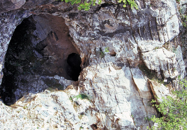
Sterkfontein Caves
The Sterkfontein Caves are a series of limestone caves 50 kilometres north west of Johannesburg that are not only the richest, but most productiv...
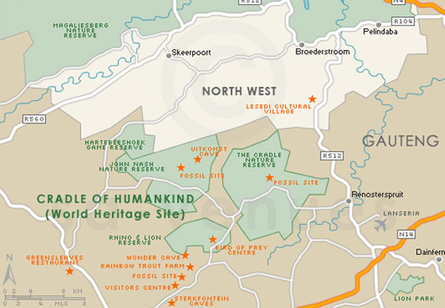
Cradle of Humankind
The Cradle of Humankind Site comprises a strip of a dozen dolomitic limestone caves containing the fossillised remains of ancient forms of animal...
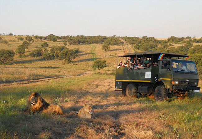
Plumari Game Reserve
Plumari Ranch Game Reserve comprises a pristine malaria free wilderness area of over 2000 hectares. The ranch boasts an amazing natural African b...
Magalies Wild Game Farm
Magalies Wild Game Farm has two major selling points: the first is that the farm lies so close to Johannesburg and Pretoria that weekends easily ...
Cradle Nature Reserve
The Cradle Nature Reserve covers an area of 3 000 hectares, which includes a delightful array of plant and animal species representing the divers...
Mountain Sanctuary Park
Mountain Sanctuary Park is aptly named, for it is every bit the restful and refreshing space in which to reconnect with nature it professes to be...
Magaliesberg Biosphere Reserve
The Magaliesberg is the second oldest mountain range in the world, almost 100 times older than Mount Everest, and half the age of the earth. It i...
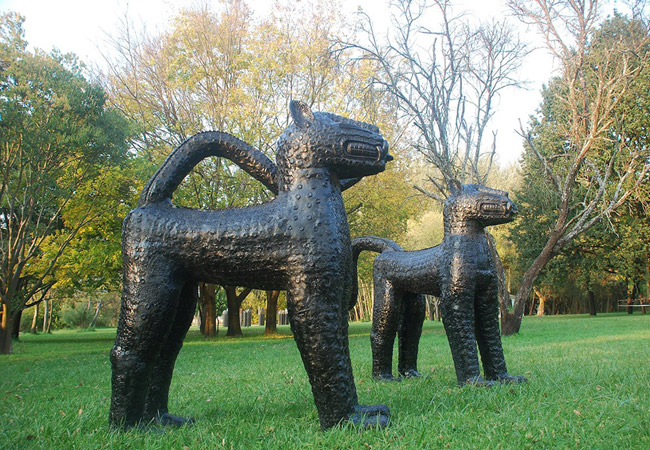
Nirox Sculpture Park
North west of Johannesburg is an area known as the Cradle of Humankind. It's a newsworthy area not least for the recent release of data based on ...
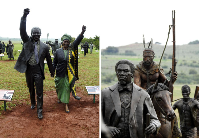
Long March to Freedom Monument
South Africa's "march to freedom" has been a long and complex one, and visitors will find themselves completely awe-struck by this country's jour...
Magaliesberg as a destination
Why book with SA-Venues.com
- Your card is safe with us; strictest card verification in the industry and we don't store card numbers.
- No airy fairy service fees; you save!
- We care. Service with integrity.
- Multiple payment methods:
credit card, SID instant EFT, bank transfer. - All Magaliesberg property owners / managers are verified (our experience protects you from online fraud).
- Secure your booking
Maps
Destination Magaliesberg
- By type in Magaliesberg
- Magaliesberg Accommodation
- Magaliesberg Hotels
- Magaliesberg Guest Houses
- Magaliesberg Bed & Breakfast
- Magaliesberg Self Catering
- & Holiday Apartments & Suites
- & Holiday Cottages & Chalets
- & Holiday Homes & Villas
- Magaliesberg Conferences
- Magaliesberg Weddings
- Magaliesberg Honeymoons
- Destinations in Magaliesberg
- Cradle of Humankind, Doornhoek, Hekpoort, Kromdraai, Maanhaarrand, Magaliesburg, Renosterspruit, Skeerpoort
- Resources for tourists
- About Magaliesberg
- Things To Do
- Attractions