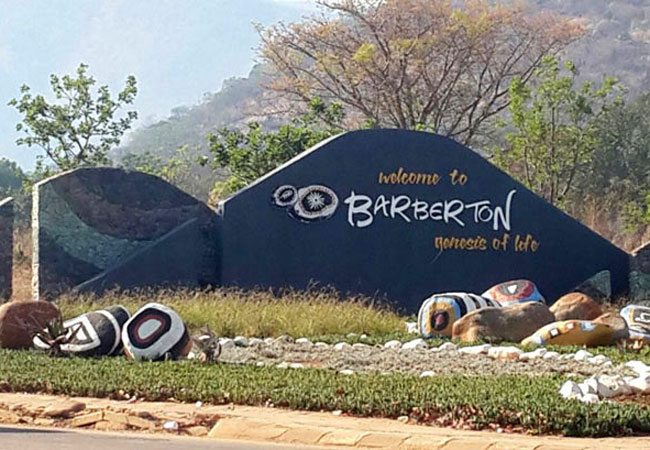
About Barberton, via Bulembu, to Badplaas
Route: Barberton, Bulembu (Swaziland), Badplaas, Nelshoogte Pass, Barberton
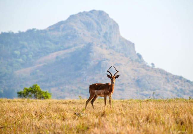
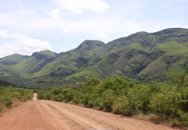
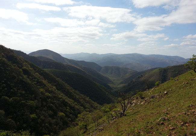
Description: The incredibly scenic mountain pass route to Bulembu, followed by a circular route via Badplaas traverses some of the most beautiful scenery in Mpumalanga
Length: roughly 260 km
Time: a day (the view stops will add up)
Overnight: Barberton and Badplaas
Our tip: drive this route, particularly the pass just before the border with Swaziland, in a 4x4 (although the South African side of the road is in good condition, but steep)
Barberton to Bulembu, via the Bulembu Pass, 43 km
The R40 between Barberton and the Josefsdal border post is the drive's highlight. The incredibly scenic mountain pass is regarded as, arguably, one of the most spectacularly scenic drives in southern Africa. People describe it as 'jaw droppingly beautiful'. It twists and turns its way through one of Mpumalanga's most beautiful valleys and over some of the oldest mountains on earth.
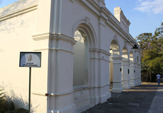
Leave the pretty, historical town of Barberton (one of the oldest gold-mining towns in the country) via Sheba Road (R38) as it curves gently to the right just after passing the Dutch Reformed Church (on your right).
At the t-junction with the R40, turn right, and follow the road out of town. The first 9 km are steep, over the Saddleback Mountains behind Barberton.
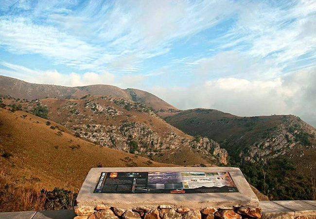
This section of the R40, between Barberton and the Swazi border, is also known as the Barberton Makhonjwa Geotrail, a self-drive trail with 11 stops at information boards explaining the various geological marvels on Barberton's Greenstone Belt, the best-preserved example of a 350 million year sequence of Archaean earth rocks (ancient volcanic and sedimentary rocks unique to Archaean earth between 3.2 and 3.57 billion years ago!) in the world. It is probably better to do this as part of a separate guided tour, but if you have time, include the boards as well.
Look out for the T4 tourist route that turns off to Shiyalangubo Dam, ending at Low's Creek roughly 10 km after you join the R40. It is not a long detour (a half hour at most) and an essential road for the views, the beauty and the stops en route. Visit Peglar's Bush (natural forest in the midst of pine plantation) for incredible bird spotting opportunities, picnic at the Shiyalongubo Dam (best picnic spot), and then press on a little further, just beyond Low's Creek, to join the R38 briefly (turn right onto the R38).
Opposite the Esperado turn-off to Revolver Creek are Nukain Mabusa's painted rocks, known as Nukain Mabusa's flower garden, beside the R38 (8 km from Kaapmuiden on the N4). This fine example of 'outsider art' inspired the new portals to Barberton and the Barberton Makhonjwa Geotrail.
If you have time, include Boondocks Mountain Labyrinth (4 km from the N4 turn off from Kaapmuiden). The labyrinth and the nature walks are worth it. Phone ahead to warn Stuart Jensen of your visit.
Head back to the R40.
The road climbs continuously. There are numerous lay-bys at which one can stop to look back at the views over Barberton. This mountainland south of Barberton is beautiful. The area is thick with pine plantations as the serpentine road winds up and down hills. You will pass below the old aerial cable-way from Barberton station to Bulembu (built to carry asbestos ore but now closed) more than a couple of times.
The Bulembu Pass starts to twist and turn in earnest about 18 km from the start of the R40, a combination of hairpin bends and incredible view points. This part of the journey will have you wishing, if you are not already driving one, that you had a 4x4, as the road is steep and though tarred, can be weather worn.
Valleys and mountains get deeper and bigger as you approach Swaziland. The best views of the whole drive are to be had from the R40 just before the Swaziland border with South Africa.
Pass the turn-off to Oshoek and Badplaas to descend to the border post.
From the Swazi border to Badplaas, 80 km
Once over the border you may want to drive the dirt, tree plantation road up to Piggs Peak. This is best in a high clearance vehicle, as the road is not always in good condition, depending on the rainfall. It takes about an hour and is very scenic.
Bulembu sits atop the Malolotja Mountains; an old asbestos mining town in Swaziland. Today the mine is long closed. Locals farm honey in the forests, you will find a bakery in town, a craft centre and an orphanage, home to 350 Aids orphans.
Leave Bulembu by the R40. After 2.2 km take a left onto the dirt road that descends into the Msauli valley to Badplaas. This winding road through the Songimvelo Nature Reserve is a peace of heaven via Msauli, Ekulindeni (something of a ghost town now that the mine is closed). The road gets rather hairy just above Ekulindeni (Msauli) where not only is the road steep, but the series of eroded hairpin bends slow you right down to below 40 km/hour.
The all weather gravel road then skirts the nature reserve's southern boundary to join up with the R541 to Badplaas. This whole section is advisable in a 4x4 vehicle.
Once over the Nkomati River the condition of the road improves as you join the R541 to Badplaas. This little town, famous for its healing springs, lies in the foothills of the Dhlumudhlumu Mountains.
Badplaas to Barberton 71 km
The R38 back to Barberton wends its way past the Vygeboomdam and then up Nelshoogte Pass. Unforgettable scenery is far from over as this last part of the journey will reveal.
Nelshoogte Pass might only be 12 km worth of tarred road, but it offers one incredible vista after another. The steep pass heads through the Nelshoogte State Forest up Nelsberg peak.
Need to Know
WhereRoute: Barberton, Bulembu (Swaziland), Badplaas, Nelshoogte Pass, Barberton
WhenBest during daylight hours
How muchFree
TelephoneNot applicable.
OvernightStay nearby in Barberton, in Mpumalanga
Disclaimer
Please note, business details can change. While we endeavour to ensure all information provided by the service provider is correct at the time of publication, we do not assume any liability caused by errors or changes, such as price, cost, time, and location. Please check with the provider that the activity/business is still offered as described, before making any travel plans.
Need an Update?
Send us feedback if this is your service/activity. Please let us know if anything on this page is outdated or contains inaccuracies.
Note, we do not have additional information or rates. Please don't contact us, rather use the service provider's contact details provided.
Find Barberton, via Bulembu, to Badplaas in these collections
In the vicinity
Hotels & other accommodation options by proximity
* Distances shown are "as the crow flies", not driving distances. Please confirm with the establishment should driving distance be a factor in your decision.
Barberton BnB
Barberton BnB is situated in the beautiful historic town of Barberton, Mpumalanga, fringed by the breath-taking Makhonjwa Mountain Range. The acc...
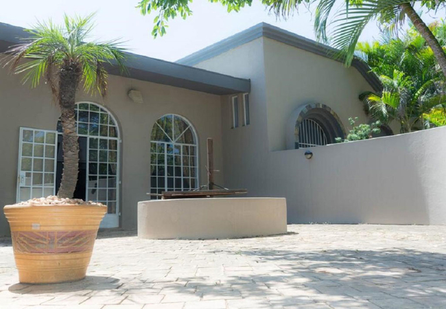
Fountain Baths Guest Cottages
Fountain Baths is a welcome retreat for travellers exploring this historic part of South Africa. All accommodation is self catering or semi-self ...
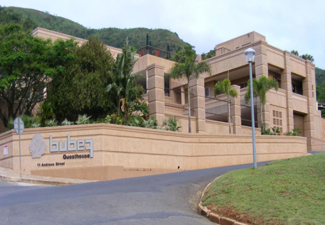
Bubez Guesthouse
Bubez Guesthouse accommodation features barbecue facilities, garden and terrace in Barberton. The property is close to the Barberton Museum, Jock...
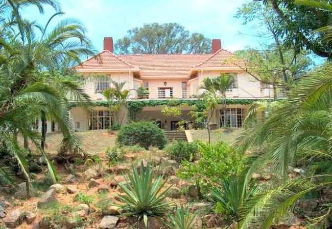
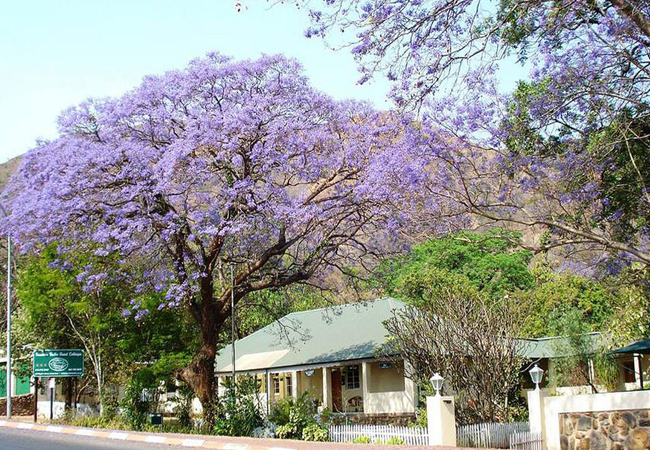
Barberton Manor Guest House
A Sir Herbert Baker design, built in 1927 now registered as a National Heritage. The two story, spacious house, with pressed ceilings, is situate...
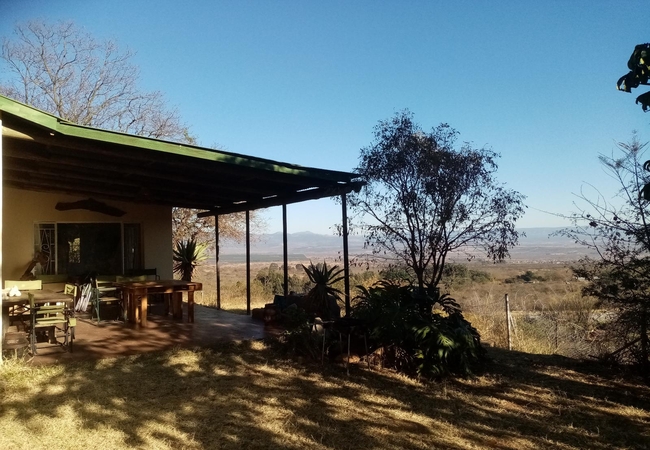
Bushwhacked
Located on the outskirts of Barberton in Mpumalanga, Bushwhacked is ideally situated just an hours drive from the Kruger National Park and is les...
Geo Trail Lodge and Spa
Geo Trail Lodge and Spa offers accommodation in Barberton and is the ideal place for those looking to overnight in style without forking out an a...
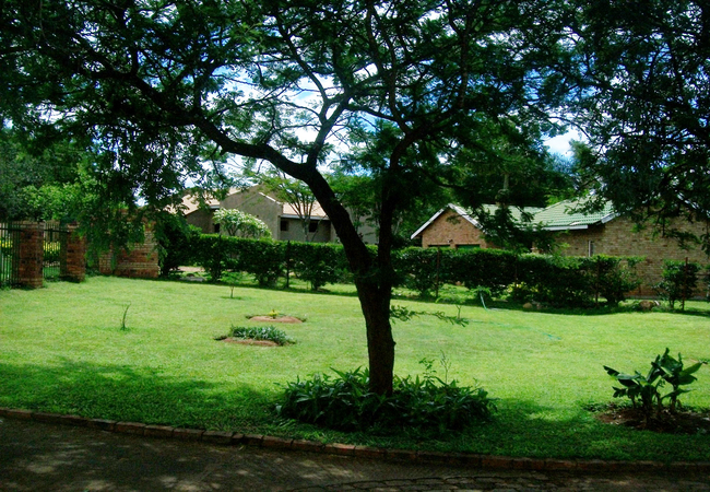
6 on Erythrina
6 on Erythrina offers comfortable accommodation in two chalets in Barberton. The chalets are in a secure complex and are close to a wide range of...

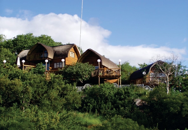
Old Coach Road Guest House
Situated on 13 acres of land 9km outside Barberton, the Old Coach Road Guest House is surrounded by indigenous lowveld vegetation and many relics...
Dawsons Cottage
Dawsons Cottage offers rustic but comfortable accommodation in Badplaas at Dawson's Game and Trout Lodge. This is a great place to enjoy a cosy a...
Dawsons Game & Trout Lodge
A unique African Experience, at the head of the Nelshoogte Pass, Dawson's offers exclusive luxury in individually styled rooms. Rich décor create...
Dawsons Homestead
Dawsons Homestead is a comfortable old farmhouse offering accommodation in Badplaas. Located 2.1km from Dawsons Game & Trout Lodge, guests can en...
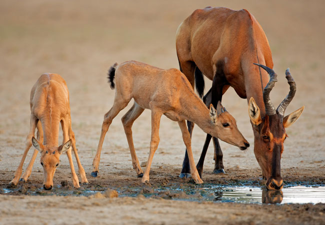
Nkomazi Game Reserve
Known as 'the place of water', Nkomazi Game Reserve is a destination of outstanding scenic beauty. It is an ecological Aladdin's Cave of natural ...
Other things to do in the area
Heritage Walk
The town of Barberton may be small, but it has a history steeped in gold and mining; industries that date back to the 19th century. This part of ...
Take a Tour of Barberton
Take a short day trip to Barberton for a cultural, natural and historical injection. This Mpumalanga town was founded in the Gold Rush, and still...
Barberton Museum
Learn about geology and mining history and the general history of the Barberton area by paying a visit to this very interesting museum in Barbert...
Barberton Makhonjwa Geotrail
Known officially as the Barberton Makhonjwa (after the mountains behind Barberton) Geotrail, this self-drive route is a 38 km exploration of anci...
Adventure Skydives
Adventure Skydives in Nelspruit was established in 1994 in the pursuit of excellence in the skydiving market. The adventure skydives team has sky...
Queen Rose MTB Trail
Where: Queens View or Makesh Hut, just outside BarbertonLevel: easy to difficultType of route: 13 km/18 km/22 km/33 km/45km mainly on plantation ...
Queen Rose Trail
Start: Nelshoogte forest reserve, in the mountains east of BarbertonFinish: Nelshoogte forest reserveDuration: 2 days, 21 kmFitness: fairly fit, ...
Ebutsini 4x4 Trail
The Ebutsini 4x4 Trail is nestled between the Songimvelo Nature Reserve in Mpumalanga and the border of Swaziland, an independent kingdom bordere...
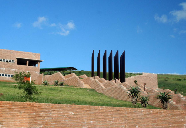
Samora Machel Monument
Finding accommodation in Mpumalanga opens up a world of discovery and adventure to travellers in South Africa. This province has so much in the w...
Noteworthy attractions
Barberton Makhonjwa Mountain Land
The Barberton Makhonjwa Mountain Land is the first UNESCO World Heritage Site in the province. Mpumalanga, which shares borders with Gauteng and ...

Skukuza Golf Club
The golf course at Skukuza in the Kruger National Park was built in 1972 as a recreational facility for the Skukuza personnel, and is now availab...
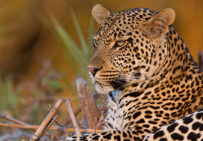
Sabi Sands Game Reserve
The Sabi Sands Game Reserve is undoubtedly the most exclusive private game reserve in South Africa. The 65,000-hectare Sabi Sands Game Reserve is...
Andover Nature Reserve
Andover Nature Reserve is a provincial nature reserve that lies just seven kilometres from the Orpen Gate of the Kruger National Park, close to M...
Songimvelo Game Reserve
Songimvelo Game Reserve lies deep in the Barberton Mountainlands and is one of the largest reserves of the Mpumalanga Parks Board that extends ov...
Kruger National Park
The largest game reserve in South Africa, the Kruger National Park is larger than Israel. Nearly 2 million hectares of land that stretch for 352 ...
Kruger National Park Tours
Guided day trips to the Kruger National Park: The largest game reserve in South Africa, the Kruger National Park is nearly 2 million hectares of ...
Nkomazi Game Reserve
Set in the incredibly picturesque scenery of the Barberton Mountainland, Nkomazi Game Reserve lies in the malaria-free parts of Mpumalanga closes...
Mthethomusha Game Reserve
The magnificent Malelane Mountains, and the 8,000 hectare Mthethomusha Game Reserve bordering the world famous Kruger National Park at its feet, ...
Accommodation convenient to Barberton, via Bulembu, to Badplaas
FIND / South Africa Accommodation / Mpumalanga Accommodation / Wild Frontier Accommodation / Barberton Accommodation
Barberton as a destination
Why book with SA-Venues.com
- Your card is safe with us; strictest card verification in the industry and we don't store card numbers.
- No airy fairy service fees; you save!
- We care. Service with integrity.
- Multiple payment methods:
credit card, SID instant EFT, bank transfer. - All Barberton property owners / managers are verified (our experience protects you from online fraud).
- Secure your booking
Things To Do
- By Province
-
Search
Search our comprehensive (and still growing) list of 4612 things to do whilst visiting our beautiful country.
-
Suggestion?
Know of a fabulous thing to do in your suburb, city or region? Share your local knowledge and experiences with visitors and tourists: Suggest a thing to do
Destination Barberton
- By type in Barberton
- Barberton Accommodation
- Barberton Hotels
- Game Lodges
- Barberton Guest Houses
- Barberton Bed & Breakfast
- Barberton Self Catering
- & Holiday Cottages & Chalets
- & Holiday Homes & Villas
- Barberton Conferences
- Barberton Honeymoons
- Destinations near Barberton
- Blyde River Canyon, Hectorspruit, Komatipoort, Kruger Park, Malelane, Marloth Park, Mjejane Game Reserve, Orpen Gate, Sabi Sands, Skukuza
- Resources for tourists
- About Barberton
- Things To Do
- Attractions
- Reviews