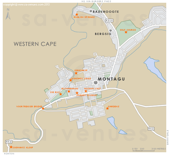
Map of Montagu, Western Cape
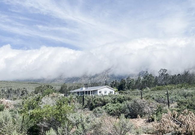
Montagu street level map showing the location of popular attractions including the Avalon Springs. Known as the mountain mecca of the Western Cape, Montagu lies surrounded by the Langeberg mountain range in the western corner of Kannaland, and is famous for her orchards, vineyards, local herbs, rock formations and healing hot mineral springs. To find out more about Montagu please see Montagu Information.
If you are interested in overnighting in the area, we can recommend some great accommodation options including hotels, guest houses and self-catering properties. If you're only planning on driving through Montagu, en-route to another destination, you may want to peruse our Montagu Restaurants before you leave to see if you should plan a stop here for lunch or maybe just a coffee. Also check out Montagu Things To Do to see if there are any activities for which you would consider stopping.
Maps of the Western Cape
Provincial Maps
Street Level Maps
Western Cape Regions
Special Interests by Map
In the vicinity
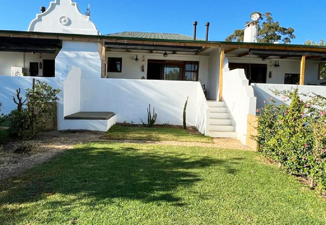
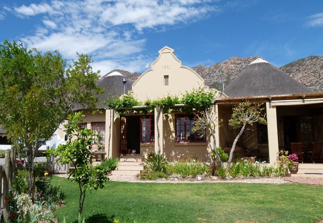
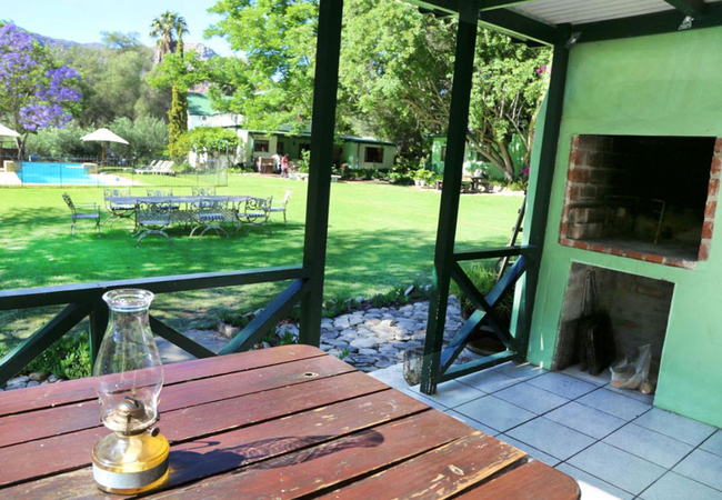
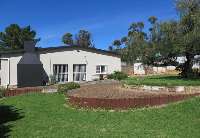
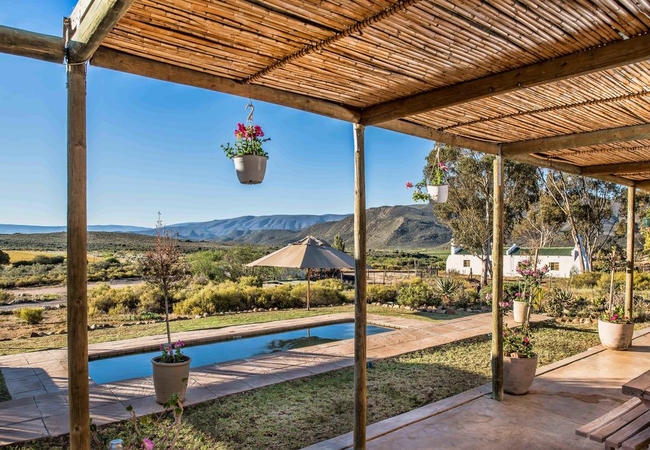
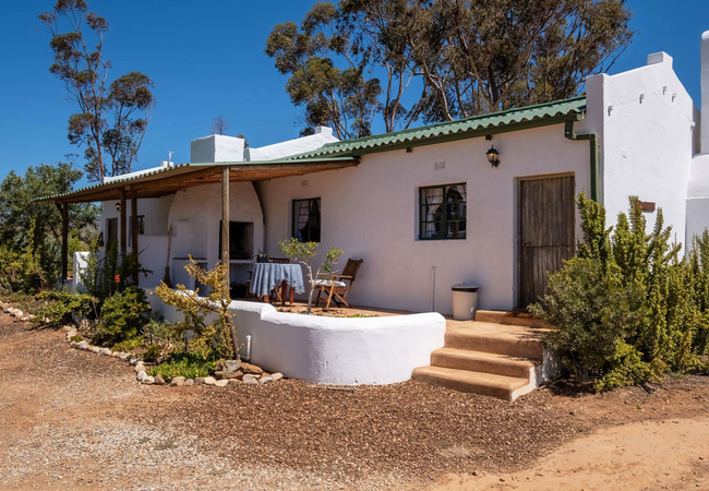
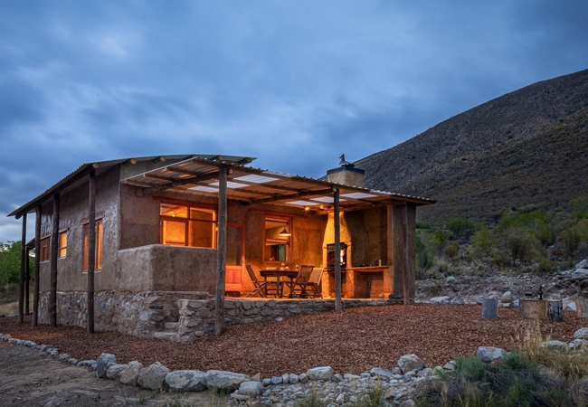
Hotels & other accommodation options
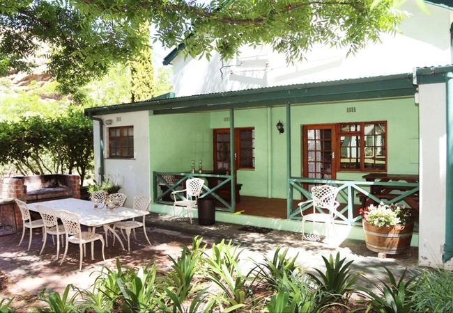
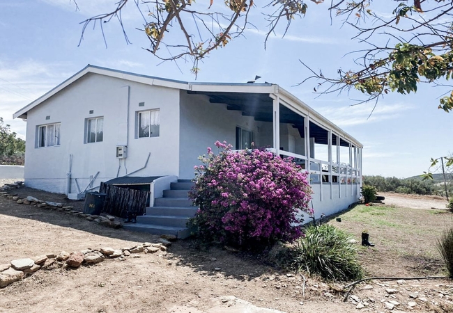
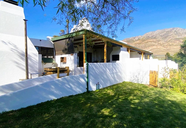
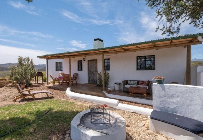
Fish Eagle @ Glen Eden
Fish Eagle @ Glen Eden offers Montagu accommodation on the Glen Eden Farm. With 360 degree mountain views, fresh mountain air, and only a 10 minu...
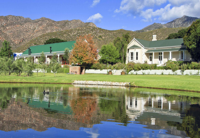
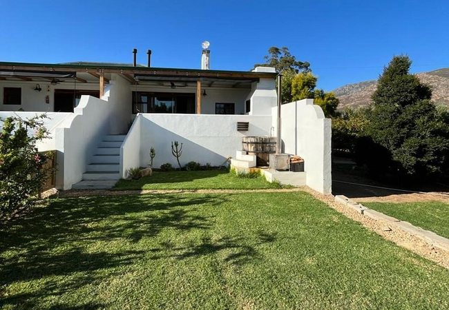
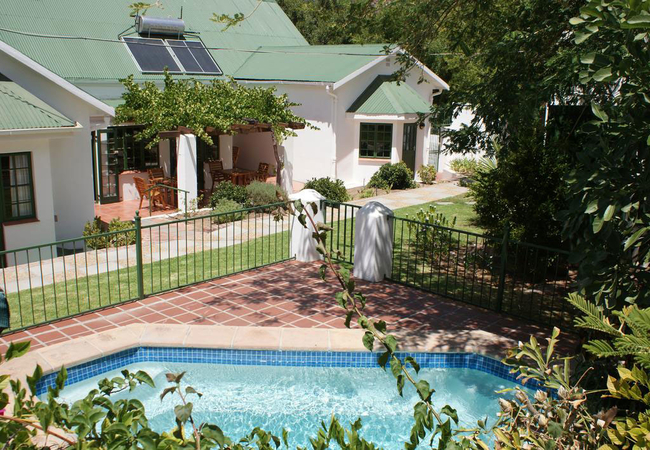
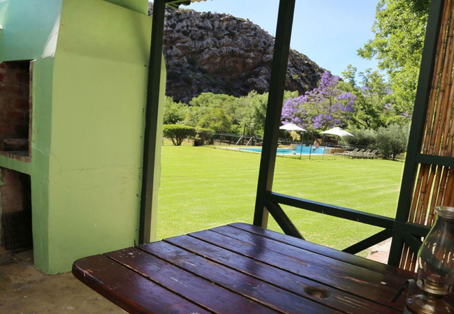
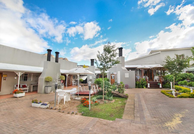
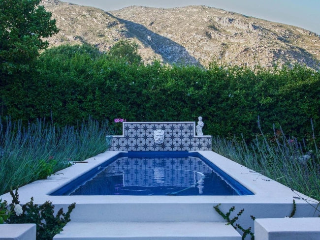
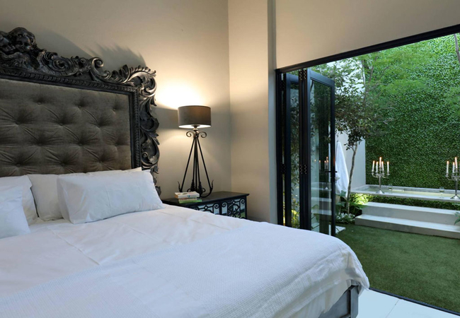
Montagu Country Hotel
Walking through the foyer you get a glimpse of the courtyard, lush green lawn and swimming pool area where guests unwind while enjoying the view ...
Leaf Lover
Leaf Lover is a romantic and private cabin for two offering accommodation in Montagu. The farm is located at the foot of the Langeberg Mountains ...
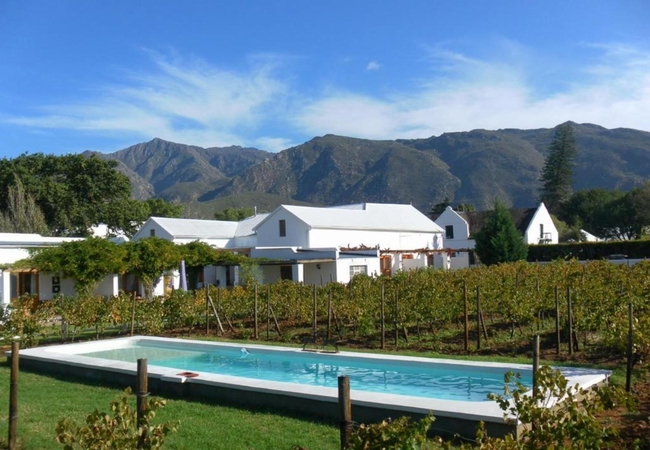
Olive Stone Farm
Olive Stone Farm offers three self catering holiday cottages in Montagu. All three cottages are entirely built from locally-sourced stone, offeri...

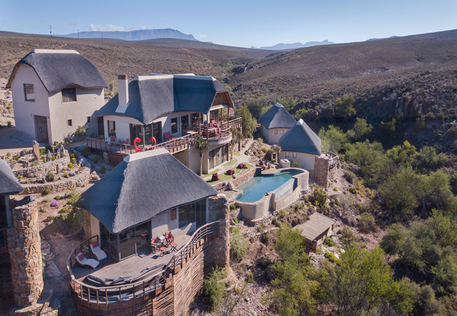
KumbuKumbu Mountain Villas
KumbuKumbu Mountain Villas are nestled high up on the mountain, with heavenly views over endless mountain ranges. Each villa is privately placed ...
Blue Crane @ Glen Eden
Blue Crane @ Glen Eden is located on Glen Eden Farm and offers comfortable Montagu accommodation just 14km outside of town. With 360 degree mount...
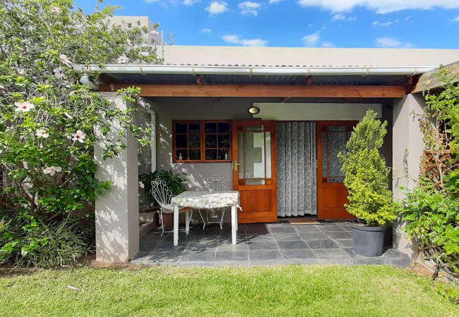
Klein Nektar Cottage
This charming privately positioned cottage with farm style look and feel has two bedrooms, one bathroom with shower only, open plan kitchen/dinin...
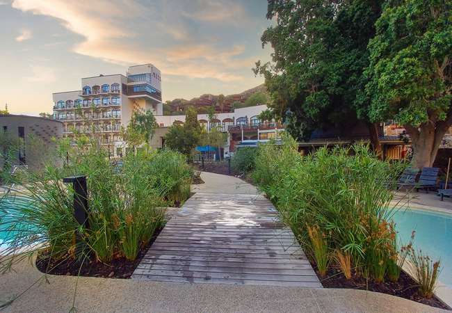
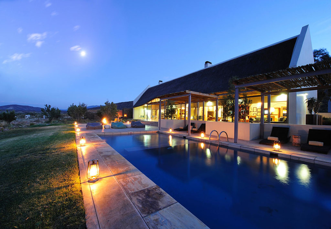
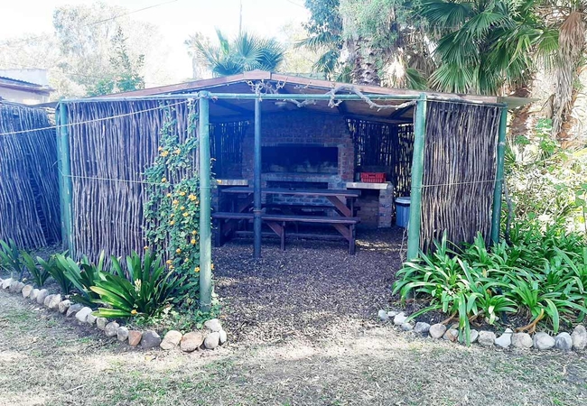
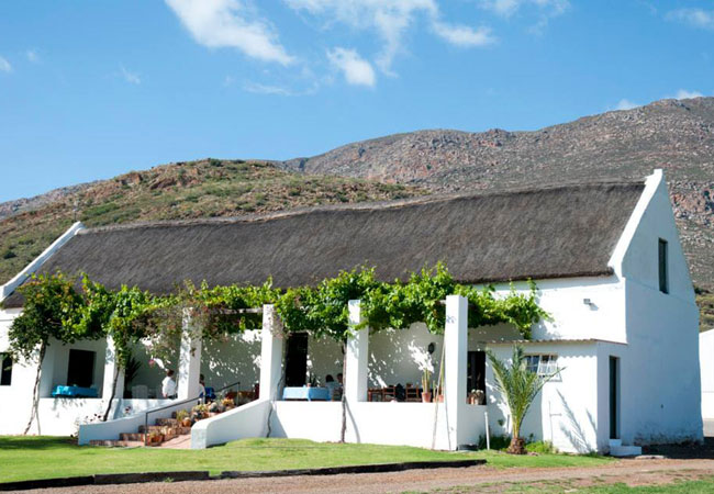
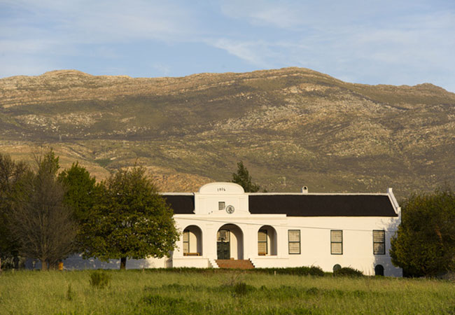
Avalon Springs
Situated just two hours from Cape Town, Avalon Springs provides accommodation and warm hospitality in the natural surroundings of Montagu. The ho...

Sugar Bird @ Glen Eden
Sugar Bird @ Glen Eden offers Montagu accommodation on Glen Eden Farm. With 360 degree mountain views, fresh mountain air, and only a 10 minutes ...
Montagu Vines Guesthouse
Montagu Vines Guesthouse is a safe stroll away from the centre of Montagu, with its amenities that cater for all tastes and interests. There are ...
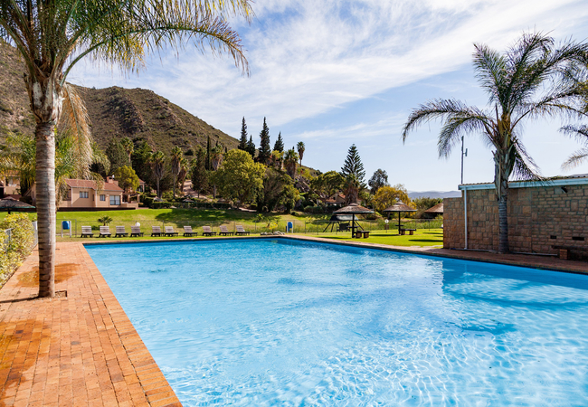
Montagu Springs Resort
Montagu Springs Resort offers self catering accommodation in a relaxing environment. We have 90 chalets available, each of which sleep up to four...
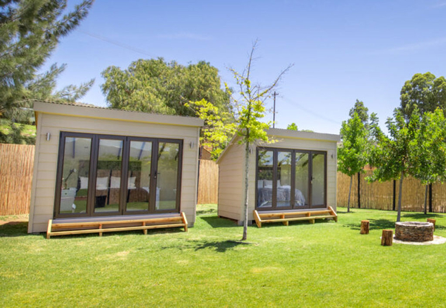
Aloe Pod @ Glen Eden
Aloe Pod @ Glen Eden offers Montagu accommodation on Glen Eden Farm. The pod is situated in a field, away from the cottages, close to the river, ...
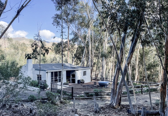
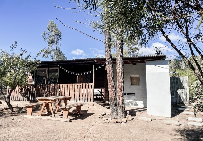
Tree Hugger
Tree Hugger is a free standing cottage at Wonder Farm Stay nestled in a beautiful eucalyptus forest. Tree Hugger cottage sleeps six guests and ha...
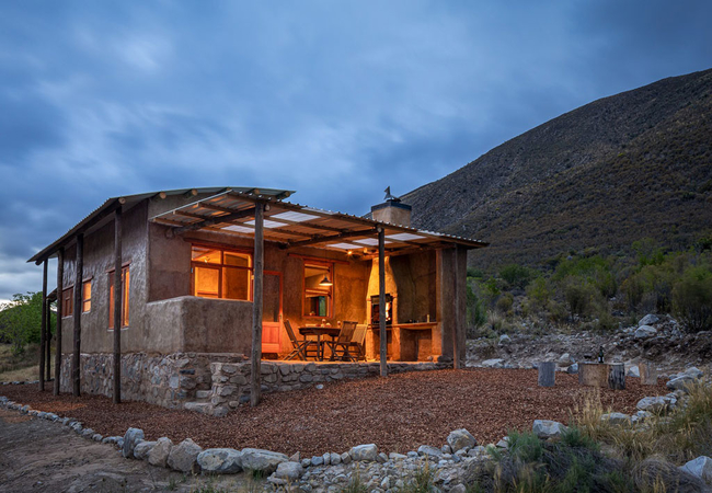
Giant Kingfisher
Giant Kingfisher offers accommodation in Montagu in the picturesque mountains some 25 kilometres outside the town. The Farm is the second last in...
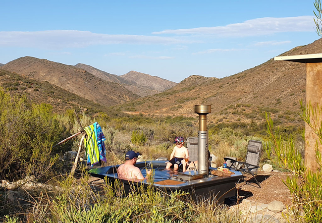
Elsjes Corner at The Farmhouse
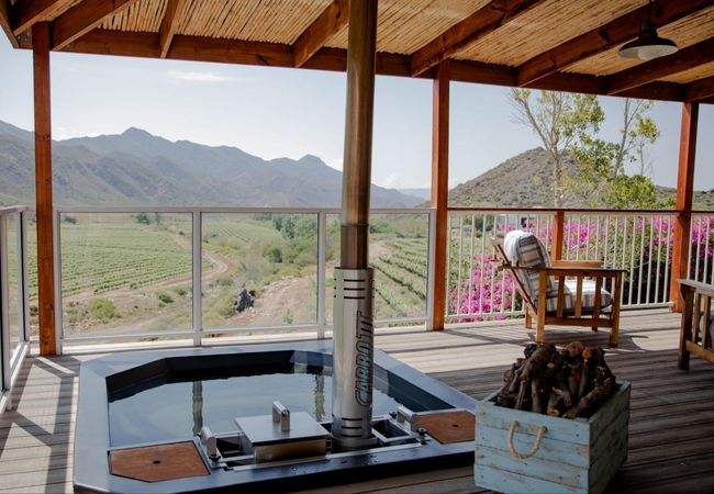
Elsjes Corner offers accommodation on a working farm with spectacular views. Outside there is a patio with a wood fired hot tub, comfortable seat...
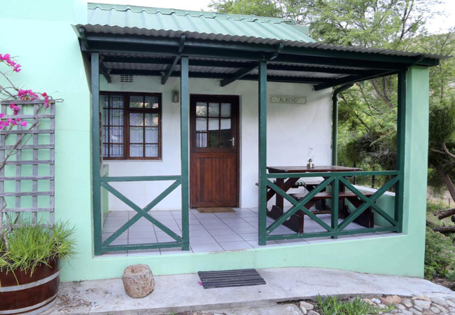
Almond @ Rainbow Glen
Almond is a chalet at Rainbow Glen, a guest farm located close to the Cogmanskloof hiking trails and rock climbing crags and has a splendid view ...
Protea Pod @ Glen Eden
Protea Pod @ Glen Eden offers Montagu accommodation on Glen Eden Farm. The pod is situated in a field, away from the cottages, close to the river...
Koo Karoo Guest Lodge
The Koo Karoo Guest Lodge offers three spacious en suite rooms, each with private entrance located in the main house. A charming self catering co...
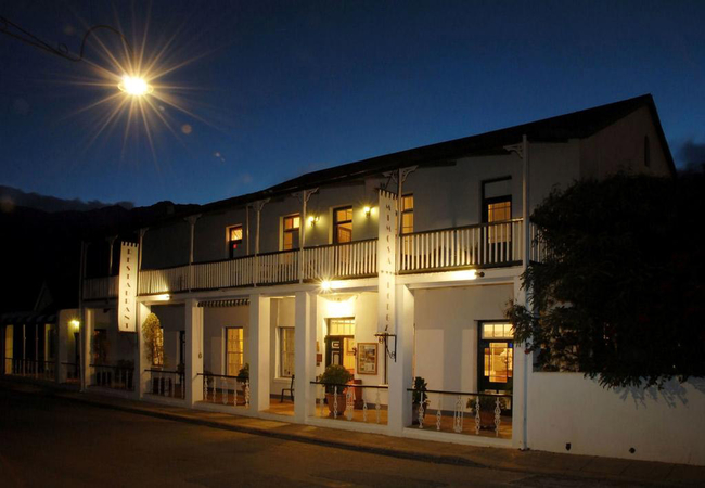
Monte Vista Boutique Hotel
Monte Vista Boutique Hotel offers accommodation for forty eight guests on the historical Church Street in Montagu. The hotel is close to fine res...
John Montagu Guest House
John Montagu Guest House offers bed & breakfast accommodation in the lovely area of Montagu. All rooms have percale linen and fluffy bath towels,...
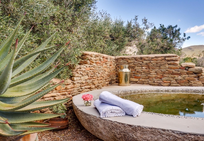
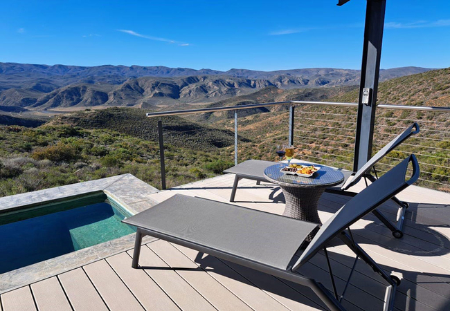
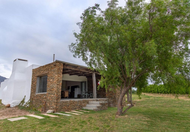
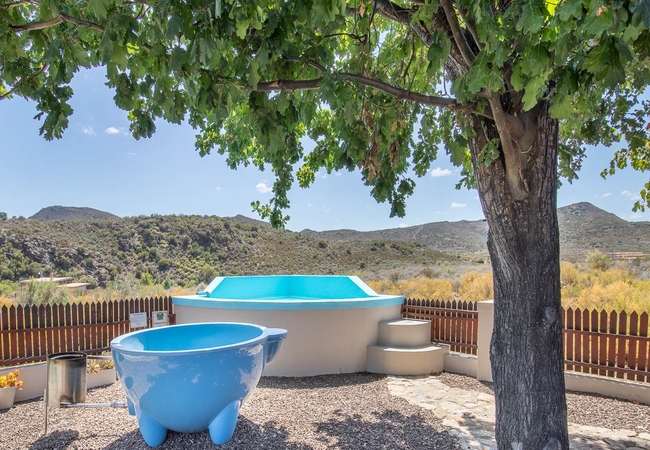
Stone Cottage at Olive Stone
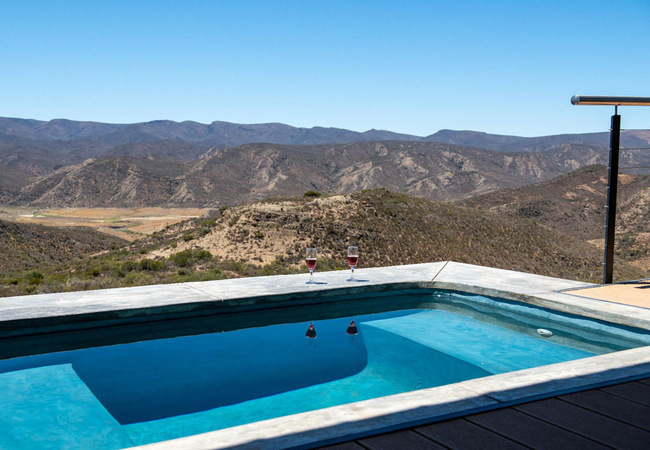
Enjoy an outside braai, sun lounger and a beautiful private natural plunge pool, just for you on hot Karoo days. There is also a Kolkol hot tub a...
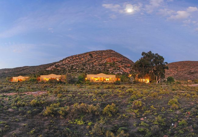
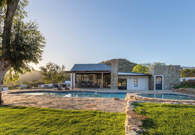
Gondwana Family Lodge
With views of the magnificent Anysberg Mountains and overlooking the Bellair Dam, Gondwana Lodge is the perfect sanctuary for family, friends and...
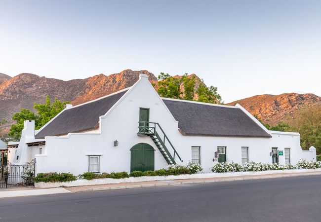
Klein Nektar Manor
Klein Nektar Manor is a Cape Dutch house located in the heart of Montagu within easy walking distance to restaurants, shops, hiking trails and ro...
Kogman & Keisie Guest Farm
Kogman & Keisie Guest Farm is nestled between the charming village of Montagu in the Klein Karoo and the mountains of Montagu Nature Reserve. Mon...
Syds Place
Syds Place is a self catering holiday cottage in Montagu sleeping two guests. The spacious open plan unit is furnished with a King-size bed and h...
Anchorage Inn
Anchorage Inn in Montagu offers luxury accommodation in Montagu in the Western Cape, only two hours' drive from Cape Town. The charm of thatch, t...
Pecan @ Rainbow Glen
Pecan is a chalet at Rainbow Glen, a guest farm located conveniently close to the Cogmanskloof hiking trails and rock climbing crags and has a sp...
Star Gazer
Star Gazer holiday home in Montagu has two bedrooms and can accommodate four guests. The patio has a beautiful view and features braai facilities...
The Farm Cottage at Olive Stone
Enjoy an outside braai, sun lounger, umbrella and a beautiful private natural plunge pool, just for you on those hot Karoo days. There is also a ...
Penny Lane @ Rainbow Glen
Penny Lane is a chalet at Rainbow Glen, a guest farm located conveniently close to the Cogmanskloof hiking trails and rock climbing crags and has...
KumbuKumbu The Summit
The Summit mountain villa is nestled high up on the mountain at KumbuKumbu Lodge offering accommodation in Montagu, embraced by a rocky ridge on ...
Sun Seeker
Sun Seeker is a semi detached holiday cottage in Montagu at Wonder Farm Stay. Sun Seeker has two bedrooms and can accommodate four guests. Outsi...
Muskadel @ Rainbow Glen
Muskadel is a cottage at Rainbow Glen, a guest farm located conveniently close to the Cogmanskloof hiking trails and rock climbing crags and has ...
Mountain View Lodge Montagu
Relax in total privacy while enjoying our spectacular mountain views. Located just below Kanonkop and just above the town centre of Montagu, we o...

Alpaca Inn
Nestled between the majestic Montagu mountains, Alpaca Inn offers Montagu self catering and an authentic colonial Cape Dutch experience. Walking ...
Hide Montagu
Hide Montagu is perched on the hillside of the private Le Domaine Eco Nature Reserve, accessible by normal car via a working farm. It's nestled s...

Pale Chanting Cottage
360 on 62 Pale Chanting Cottage is situated on a working farm with splendid mountain views and offers guests comfortable Montagu accommodation. T...
The Vineyard Country House
Set on a working grape and apricot small-holding on historic Long Street in Montagu, within walking distance of monuments, restaurants and shops,...
Ludicks Farm Cottage
Located on a farm situated halfway between the towns of Montagu and Barrydale on the Route 62, Ludicks Farm Cottage is at the foot of the Langebe...
Olive Moon @ The Farmhouse
Olive Moon @ The Farmhouse offers accommodation in Montagu on a working farm with 360 degree mountain views. The farm dam is just 100m from the c...

Peace Cottage
Located in Montagu in the Breede River Valley, Peace Cottage boasts glorious views of the mountain. Enjoy glorious summer days around the shared ...
Nektarien @ Lank-gewag
Nektarien Cottage offers a digital detox vacation on a picturesque working farm, located approximately 10km from central Montagu. The cottage is ...
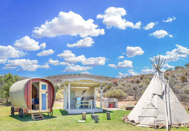
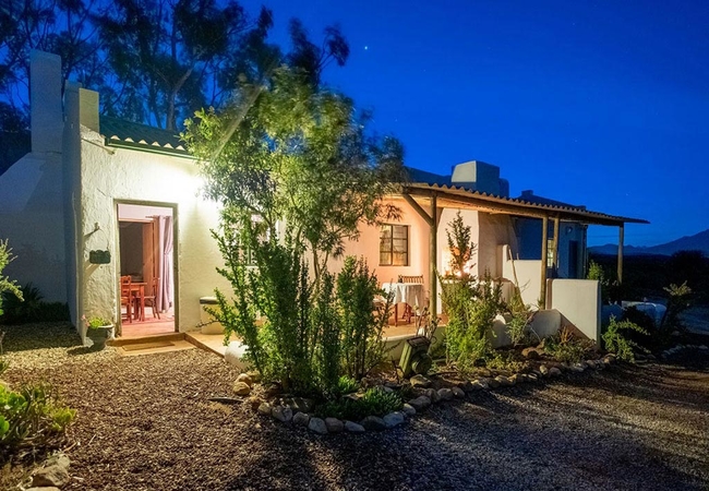
Wonder Farm Stay
Wonder Farm Stay is located at the foot of the Langeberg Mountains in the area of Montagu and offers accommodation in three cottages, ideal for f...
Abigails Garden Cottage
Abigail's Garden Cottage is centrally situated in beautiful Montagu. If you want accommodation away from the buzz and noise some places offer the...
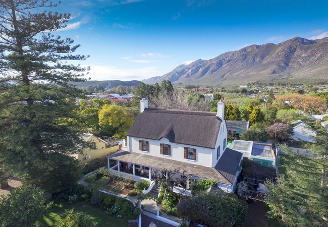
Tilney Manor
The lush oasis setting of Tilney Manor is surrounded by carefully laid out indigenous gardens. Sanbona has an alluring atmosphere of stillness, a...
Mimosa Lodge
Fine hospitality, superb cuisine and exceptional wines, are daily faire for the purveyors of this four-star establishment - a two hour drive from...
Plovers Nest
Plovers Nest offers accommodation in Montagu on a working farm with spectacular views. The cottages do not have TVs to distract you from the soun...
Montagu Four Seasons
Halfway between Cape Town and the Garden Route on the Route 62, these luxurious cottages are situated under a big old oak tree where the singing ...
Ludicks Farm House
Ludicks Farm House offers accommodation for eight guests in four bedrooms with en-suite bathrooms. The open-plan kitchen is fully equipped and th...
James Honeymoon Cottage
360 on 62 Honeymoon Cottage offers Montagu accommodation on a working farm with 360° mountain views. The historic village lies in a fertile valle...
Garden Cottage @ Rainbow Glen
The Garden Cottage is a chalet at a guest farm located conveniently close to the Cogmanskloof and has a splendid view of Kanonkop. The house has ...
Mont Eco Game Reserve
Set in the Karoo, within the reserve, Mont Eco Game Reserve Lodge is situated along the tree line of a riverbed and protected by the surrounding ...
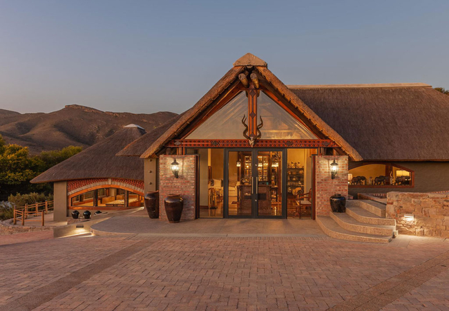
White Lion Lodge on Sanbona
The privately owned White Lion Lodge on the Sanbona Wildlife Reserve is a perfect place for individuals, sole use of a group or a family up to ei...
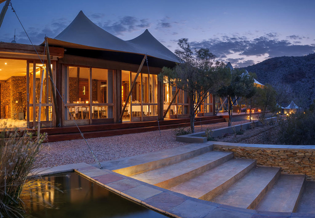
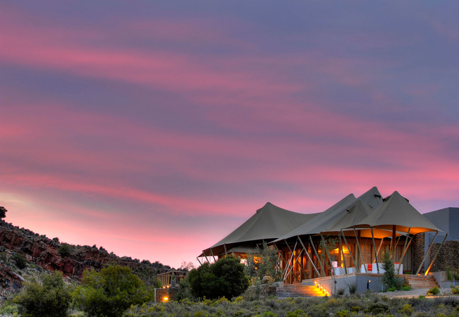
Dwyka Tented Lodge
Embraced by striking rock formations, Dwyka Tented Lodge in Sanbona epitomises an atmosphere of seclusion. The lodge stands proud within the beau...
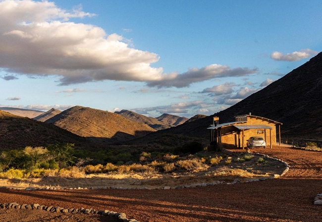
Ontevreden Farm
Ontevreden Farm offers self catering accommodation on the host's property in Montagu. This private farm overlooks the surrounding vineyards of Mo...
KumbuKumbu Quarriebosch
Quarriebosch mountain villa rests on an open, yet steep Karoo plane; sheltered by Quarriebosch trees on either side. A purple-grey rockface lead...
Magnifik Montagu
Magnifik Montagu is a luxury self-catering villa in Montagu on a 1.1 hectare Pecan, Fig, Olive and Fruit Farm right in the heart of Montagu, with...
Olive Cottage at Olive Stone
Olive Cottage at Olive Stone is a self catering holiday cottage in Montagu entirely built from locally-sourced stone. Enjoy an outside braai, sun...
Samuel Bosman Manor
Samuel Bosman Manor is a holiday home in Montagu on the Vrugtegeur Farm in the Koo Valley. The Manor has four bedrooms. The kitchen is fully equi...
360 on 62 Farm Cottages
Set on a working farm just outside the charming village of Montagu, 360 on 62 offers farm cottage accommodation with 360° mountain views. The his...
Bokmakierie Cottage
360 on 62 Bokmakierie Cottage offers Montagu accommodation on a working farm in the Little Karoo on the R62. This historic village lies in a fert...
Brown-Hooded Kingfisher
Brown-Hooded Kingfisher offers accommodation in Montagu in the picturesque mountains some 25 kilometres outside the town. The farm is the second ...
Lilly Pod @ Glen Eden
Lilly Pod @ Glen Eden offers Montagu accommodation on Glen Eden Farm. The pod is situated in a field, away from the cottages, close to the river,...
Squirrels Corner
Squirrels Corner offers a comfortable stay for guests, with a warm friendly welcome and great service. Each one of the rooms boasts a wall mounte...
Honeybee @ Glen Eden
Honeybee Cottage offers Montagu accommodation on Glen Eden Farm. Glen Eden Farm is a small holding of 50 hectares, situated on the famous Route 6...
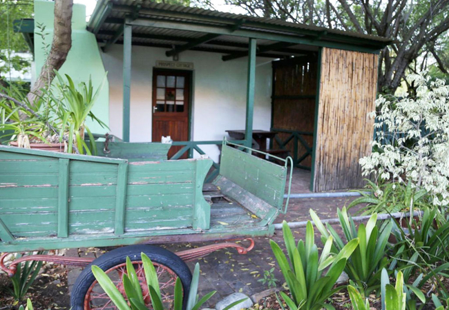
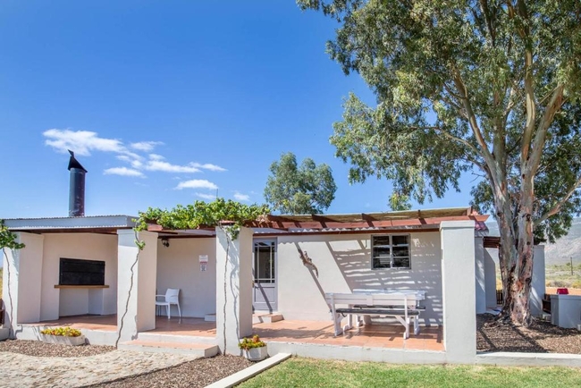
Prospect Cottage
Prospect Cottage is open plan and furnished with a double bed. The kitchenette is equipped with a bar fridge, microwave, two plate mini stove and...
Fish Eagle Cottage
360 on 62 Fish Eagle Cottage is situated on a working farm with splendid mountain views and offers guests comfortable Montagu accommodation. The ...
Little Eden Pixie
Little Eden Pixie offers Montagu accommodation on Glen Eden Farm. The pod is situated in a field, away from the cottages, close to the river, wit...
Glen Eden Farm
Located 14km from the historic town of Montagu on Route 62, Glen Eden Farm offers self-catering accommodation in three luxury cottages, a charmin...
The Barn on 62
The Barn On 62 is the ideal accommodation for holidaymakers, business travellers and overnight guests to stay in Montagu. The Barn on 62 is locat...
Nonnetjie Cottage
360 on 62 Nonnetjie Cottage offers accommodation in Montagu on a working farm in the Little Karoo on the R62. This historic village lies in a fer...
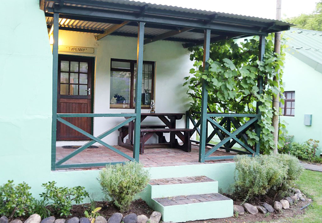
Tupenny @ Rainbow Glen
Tupenny is a chalet at Rainbow Glen, a guest farm located conveniently close to the Cogmanskloof hiking trails and rock climbing crags and has a ...
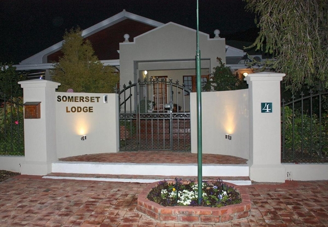
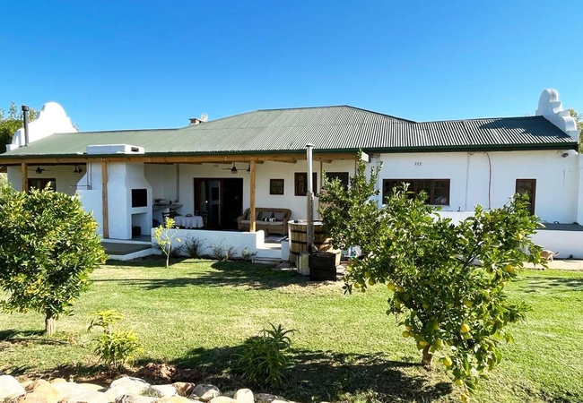
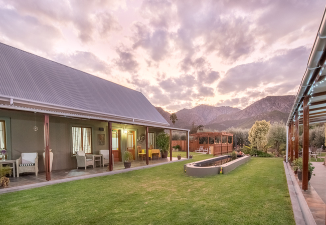
Somerset Lodge Montagu
Somerset Lodge, is set in a English country garden against a backdrop of magnificent mountains. We are situated a mere two-minute walk from the M...
House on the Hill @ Glen Eden
House on the Hill @ Glen Eden offers Montagu accommodation on Glen Eden Farm. With 360 degree mountain views, fresh mountain air, and only a 10 m...
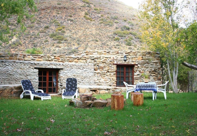
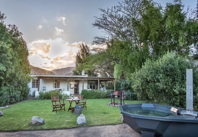
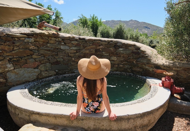
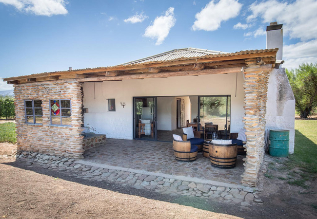
Malachite Kingfisher
Malachite Kingfisher (with private, wood fired hot tub) is a renovated 100 year old plus stone cottage offering accommodation in Montagu with a w...
Sylvias House
Sylvias is a self catering holiday cottage in Montagu sleeping two guests. The spacious open plan unit is furnished with a Queen-size bed. The ki...
Pied Kingfisher
Pied Kingfisher (with private, wood fired hot tub) offers accommodation in the picturesque mountains some 25 kilometres outside of Montagu. The F...
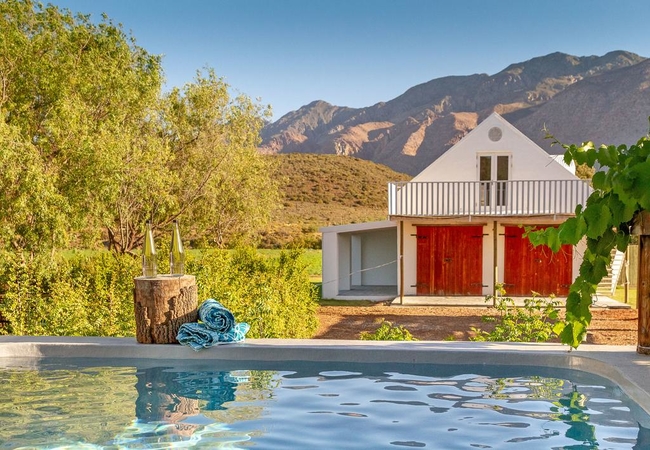
Sanbona Wildlife Reserve
Nestled in the rolling koppies of the Little Karoo, a sprawling expanse of undulating rock formations, hardy scrub vegetation and blue African sk...
Kingfisher Cottages
Kingfisher Cottages offers accommodation for up to 16 guests in four seprate cottages. Each cottage has either one or two bedrooms and is able to...

Stay At Running Stream
Stay @ Running Stream offers accommodation in Ashton that is a perfect getaway for nature lovers who want a quiet and off-the-grid stay. The gard...
Pruim @ Lank-gewag
Pruim Cottage offers a digital detox vacation on a picturesque working farm, located approximately 10km from central Montagu. The cottage is off-...
Mirihof Olive and Guest Farm
Wide open spaces, well appointed luxury suites, delicious farm style breakfasts and unsurpassed hospitality make this establishment unique. Wake ...
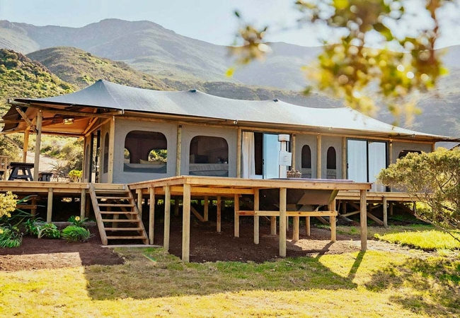
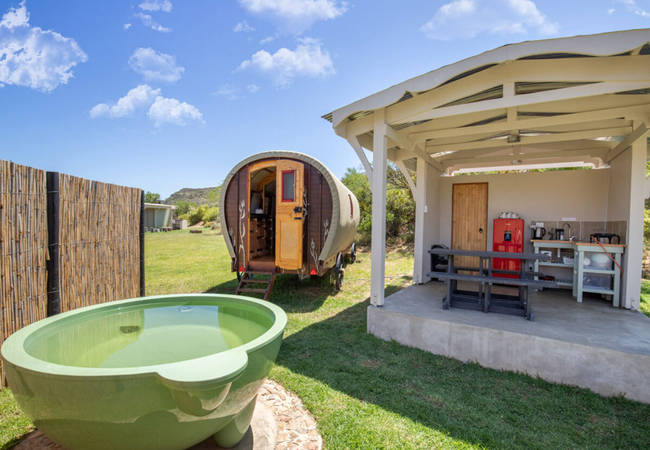
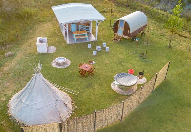
Ontevreden Glamping Tent
Welcome to Ontevreden Farm Glamping, where you can enjoy the best of both worlds - the beauty of the outdoors and the comforts of modern living. ...
Montagu Coach House
Montagu Coach House is a charming guesthouse in Montagu situated in the historic Oudam area, opposite a quiet park with magnificent mountain view...
JC Rossouw
JS Rossouw is a holiday home offering self- accommodation in Montagu on the Vrugtegeur Farm in the Koo Valley. We are extraordinarily excited to ...
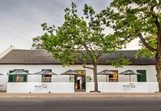
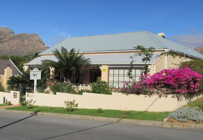
MonTQ Guesthouse
MonTQ Guesthouse is an historical thatch monument offering accommodation in Montagu on the famous R62. Being in the centre of town it forms part ...
7 Church Street
Situated in the heart of Montagu, 7 Church Street Guest House is a tastefully restored Victorian guest house set in beautiful park like gardens w...
Another World
Escape to your own private world of absolute luxury with a visit to Another World. This brand new luxurious one bedroom holiday cottage offers ac...

Aasvoelkrans Guest Farm
The Aasvoëlkrans Bed & Breakfast provides guests with a very special experience. The spacious individual cottages are tastefully furnished and co...
Airlies Historical Villa
Airlies is located in an historical house built at the beginning of the previous century offering Guest House and Bed & Breakfast Accommodation i...
Things to do in the area - see all in Breede River Valley
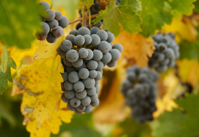
Wine Valley Safari
The Robertson Wine Valley produces some of the most delicious and respected wines in South Africa. And, as an added benefit, it is absolutely bea...
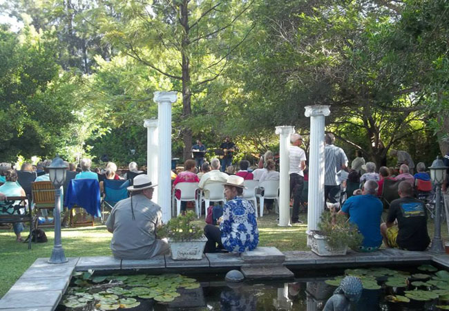
Dine in Style at Mimosa Lodge
Mimosa Lodges award-winning restaurant has put Montagu on the culinary map. Its award-winning Swiss Chef takes pride in using only the freshest ...
Lunch or breakfast at Die Stal
If you are a fan of hearty, traditional, country fare then you should maak n "draai" at Suzanne Venters Die Stal in Montagu. Situated on Kruis ...
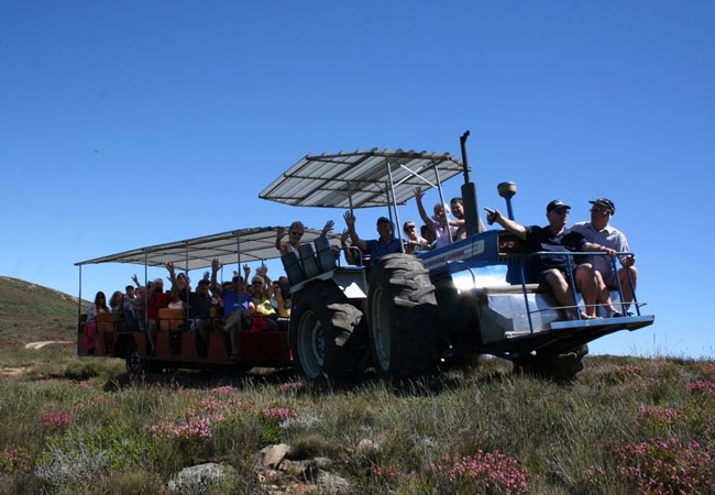
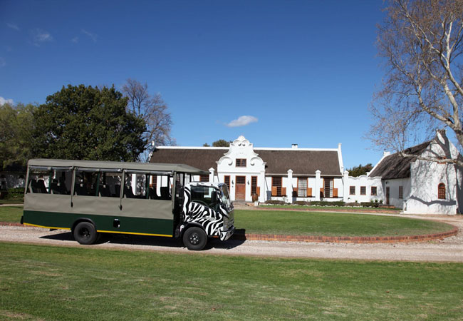
Montagu Tractor Trip
In 1985 the Protea Farm started offering the, now famous, Montagu Tractor Trip. The trips take place on Wednesday and Saturday (large groups can ...
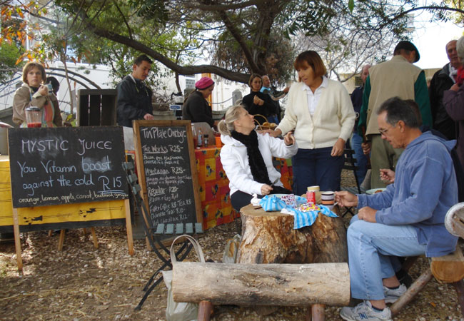
Montagu Village Market
The Montagu Village Market is the perfect way to spend a Saturday morning for locals and visitors that have their accommodation in Montagu or its...
Photography Courses in Montagu
Come and enjoy a weekend course in Art or Photography at Eden Farm in Montagu. This unique hands on excursion style tuition, allows participants ...
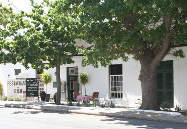
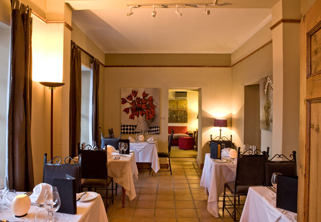
Templetons Restaurant
Taking pride of place in the third oldest house in Montagu, Templetons Restaurant was voted one of the top 20 restaurants in South Africa. Named...
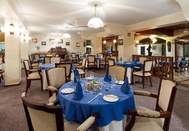
Cogmans Restaurant
Cogmans is a fine dining restaurant located within the Avalon Springs Hotel & Spa Resort. With the hot springs featuring as a major tourist attr...
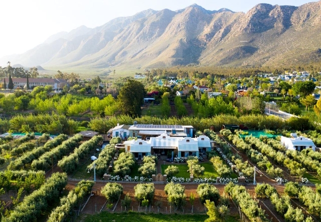
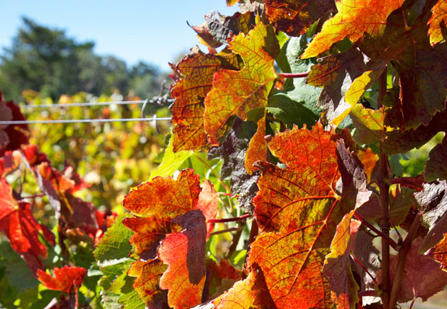
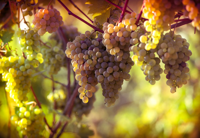
Montagu Winery
With an impressive 700 hectares under vine, the exquisite Montagu Coöperative Cellar produces about 13 000 tons of top-notch wines every year. Th...
Noteworthy attractions - see all in Breede River Valley
Marloth Nature Reserve
Lying just three kilometres from the pretty little town of Swellendam, the Marloth Nature Reserve conserves the central Langeberg Mountains that ...

Vrolijkheid Nature Reserve
Set in a part of the country known as the arid Robertson Karoo, the Vrolijkheid Nature Reserve lies in the Breede River Valley, roughly 15 kilome...
Robertson Wine Route
Only 1.5 hours drive from Cape Town and in the heart of Route 62 - the longest wine route in the country - Robertson Wine Valley lies surrounded...
Tulbagh Wine Route
Only 80 minutes drive from Cape Town, the Tulbagh Valley lies surrounded on three sides by mountains in the west, the Obiqua Mountains, to the...
Worcester Wine Route
The Worcester winelands incorporate over 250 years of winemaking knowledge to produce, amongst other cultivars, Cabernet Sauvignon, Chenin Blanc ...
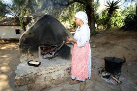
Kleinplasie Worcester Open Air Museum
1km outside Worcester, is Kleinplasie Living Open-air Museum. Here we depict the lifestyle of the early Cape pioneer farmers. Activities like tob...

Worcester Golf Club
The Worcester Golf Club is situated at the start of the Western Capes Klein Karoo, approximately 50 minutes from Cape Town en route to Oudtshoor...
De Oude Drostdy
Definitely high on the list of must visits when in Tulbagh, De Oude Drostdy is a typical Cape Dutch style home built in 1804 just outside the t...
Karoo Desert National Botanical Garden
In Roux Road on the outskirts of Worcester, some 120 kilometres from Cape Town, lies a unique gem of a garden - the only truly succulent garden i...
Find accommodation in Montagu
FIND / South Africa Accommodation / Western Cape Accommodation / Cape Town Accommodation / Breede River Valley Accommodation / Montagu Accommodation
Montagu as a destination
Why book with SA-Venues.com
- Your card is safe with us; strictest card verification in the industry and we don't store card numbers.
- No airy fairy service fees; you save!
- We care. Service with integrity.
- Multiple payment methods:
credit card, SID instant EFT, bank transfer. - All Montagu property owners / managers are verified (our experience protects you from online fraud).
- Secure your booking
Maps
Destination Montagu
- By type in Montagu
- Montagu Accomodation
- Montagu Hotels
- Montagu Guest Houses
- Montagu Bed & Breakfast
- Montagu Self Catering
- & Holiday Apartments & Suites
- & Holiday Cottages & Chalets
- & Holiday Homes & Villas
- Montagu Conferences
- Montagu Weddings
- Montagu Honeymoons
- Destinations near Montagu
- Ashton, Bainskloof, Bonnievale, Breeriver, Ceres, De Doorns, Du Toitskloof, McGregor, Prince Alfred Hamlet, Rawsonville, Robertson, Tulbagh, Wolseley, Worcester
- Resources for tourists
- About Montagu
- Things To Do
- Attractions
- Reviews