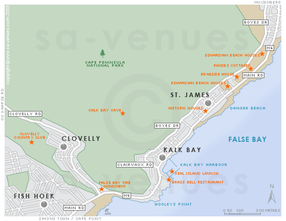
Map of Kalk Bay, Cape Town
Kalk Bay detail and street level map showing some attractions including the Kalk Bay Harbour, Brass Bell Restaurant and Seal Island Launch. To find out more about Kalk Bay, view photographs and see all this quaint harbour town has to offer, please visit Kalk Bay Information.
If you are interested in overnighting in the area, we can recommend some great accommodation options including hotels, guest houses and self-catering properties. If you're only planning on driving through Kalk Bay, en-route to another destination, you may want to peruse our Kalk Bay Restaurants before you leave to see if you should plan a stop here for lunch or maybe just a coffee. Also check out Kalk Bay Things To Do to see if there are any activities for which you would consider stopping.
Maps of the Western Cape
Provincial Maps
Street Level Maps
Western Cape Regions
Special Interests by Map
In the vicinity
Hotels & other accommodation options
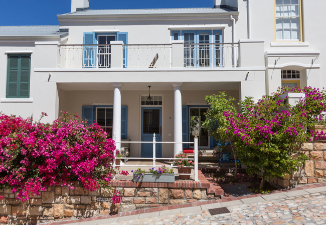
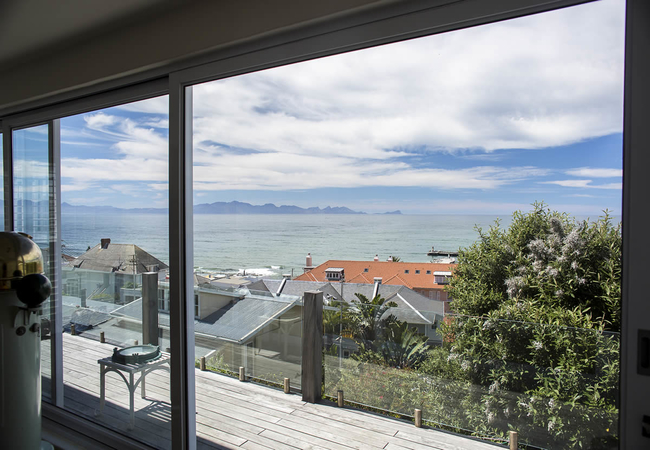
Whalers Studio and Cottage
Whalers Cottage and Studio offers Cape Town self catering accommodation dating back to the early 1900's situated in the historical fishing villag...
Baytree Beach House
Baytree Beach House offers accommodation in Kalk Bay in a house (sleeps 10) and a separate apartment. This marvelous location gives you easy acce...
Dragon Tree Guest House
In the heart of Kalk Bay under the cooling shade of the iconic dragon tree, the Dragon Tree Guest House in Kalk Bay offers luxury self-catering a...
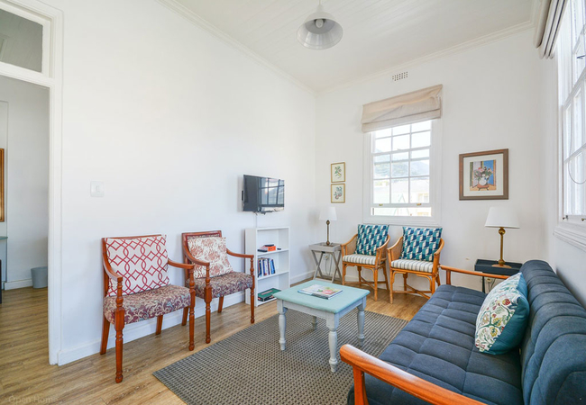
Majestic Three Bedroom Apartment
These townhouses in Kalk Bay have three en-suite bedrooms, spacious living rooms, a fully equipped kitchen and a small back garden. Original hote...
The Majestic Apartment
The Majestic Apartments are located inside the revitalised old Majestic Hotel. Tenants of the one and two bedroom self catering apartments have e...
Rosmead Apartment
Rosmead Apartment is a sunny, open and airy space that provides accommodation for five guests. Originally part of the Dutch Reformed Church, the ...

Fintimara Bay House
Fintimara Bay House is a haven offering accommodation that will enchant you with its character and charm. In front lies the wide expanse of False...

Kalk Bay Cottage
Located in the quaint seaside village of Kalk Bay, this recently renovated, historically significant cottage is perfectly situated for those who ...
Pineapple Cottage
Pineapple Cottage offers Cape Town self catering accommodation dating back to the early 1900's situated in the historical fishing village of Kalk...
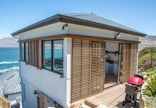
The Crow's Nest
The Crows Nest is a luxurious and spacious two bedroom apartment in Kalk Bay, in walking distance of the main road. The Crows Nest sleeps four gu...
Majestic Two Bed Apartments
These luxurious apartments feature a spacious living room, a fully equipped kitchen and two en-suite bedrooms which are furnished with double bed...
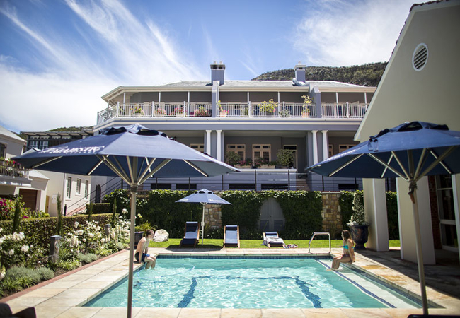
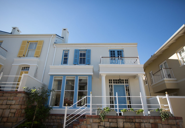
Chartfield Guest House
Chartfield Guesthouse is nestled in this quaint seaside village where the pace and charm is reminiscent of a bygone era while every modern conven...
Baytree Apartment
Baytree Apartments offer guests comfortable accommodation in a holiday apartment in Kalk Bay. This lovely location has easy access to a range of ...
Sunny Windsor Apartment
Sunny Windsor Apartment is a simple, rustic, relaxing apartment within walking distance of the beach and tidal pools of Kalk Bay. Tucked away beh...
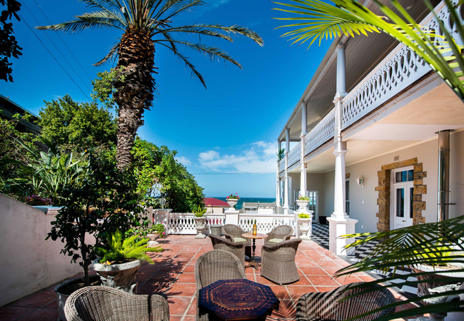
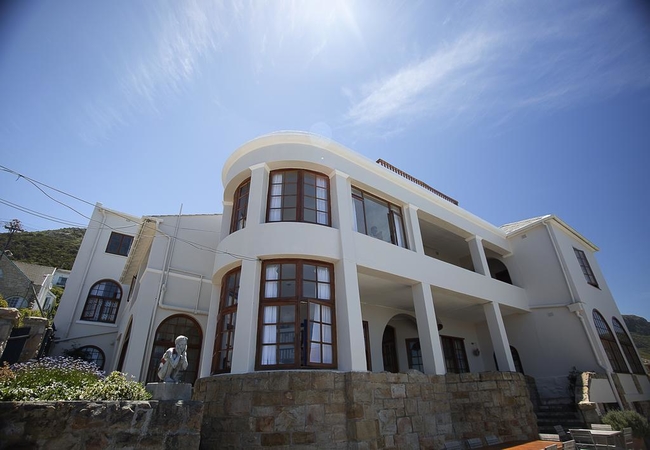
The Inn at Castle Hill
The Inn at Castle Hill is a characterful Edwardian villa overlooking the quaint fishing village of Kalk Bay. The Inn at Castle Hill is ideally lo...

Contemporary Cottage
The Contemporary Cottage is located in a beautiful holiday home in Kalk Bay built in 1920 on the mountainside near the Harbour. The style and fit...
Majestic Studio
Situated in Kalk Bay, within the secure Majestic Village, Majestic Studio is able to accommodate up to two guests. Here guests are within walking...
Things to do in the area - see all in False Bay
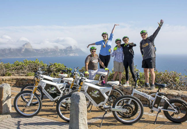
Cape Peninsula E-Bike Experience
Exploring a destination on a bicycle combines fun, fitness and a comfortable pace. Exploring Cape Town on an electric bike means even more fun an...
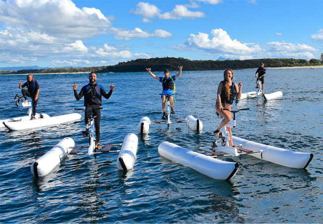
Cape Town Water Bikes
The beauty of False Bay really is something to behold. The chilly blue of the Atlantic Ocean is lined with the quaint little towns of Fishhoek, K...
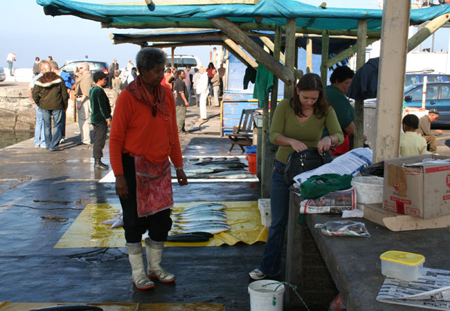
Buy & Braai a Cape Fish
Chokka, Snoek, Red Roman and Yellowtail are all local Cape ocean fish that are the pride of fisherman and the prize on the grill. Kalk Bay Harbou...
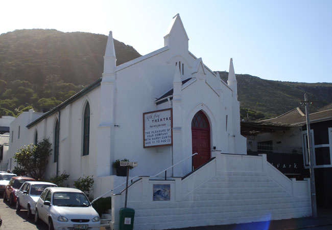
Kalk Bay Theatre
The Kalk Bay Theatre is a 78-seater theatre / restaurant located in the old Kalk Bay DR church, built in 1876 and is a heritage protected buildin...
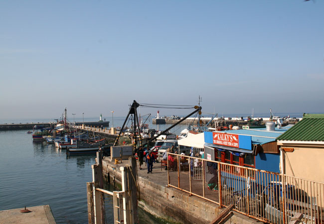
A Stroll in Kalk Bay Harbour
A family favourite for a lovely sunny afternoon is a nice stroll along Kalk Bay Harbour. Especially for young kids, it is a place where there is ...
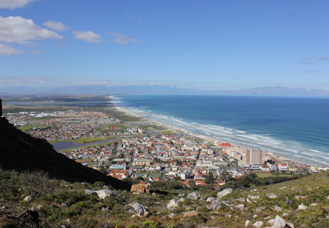
Kalk Bay to the Amphitheatre Hike
Cape Town is known for its stunning vistas and magnificent landscape. A rather different side to the Mother City is showcased on the walk from Ka...
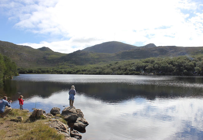
Kalk Bay to Boomslang Cave Hike
Start: Echo Valley signFinish: Echo Valley signDuration: 4 km, roughly 2 hours (but allow for stops and cave exploration)Fitness: easyOur tip: if...
Self Drive the Cape Peninsula
Self Drive the Cape Peninsula two oceans in one day and one of the most beautiful drives, and easiest way to truly orientate yourself to the mo...
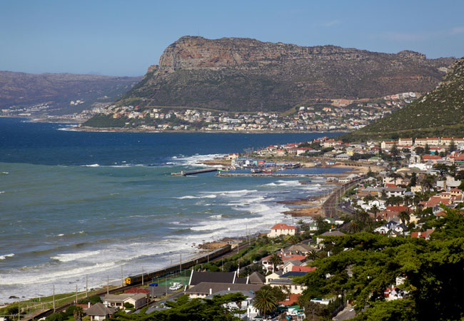
Danger Beach
Just outside the hustle and bustle of Cape Town are little towns that are bursting at the seams with charm and character. St James and Kalk Bay a...
Noteworthy attractions - see all in False Bay
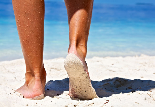
Cape Town Beaches
The Mother City has some of the most beautiful beaches in the world and something to offer everyone. It is no surprise that South Africa was one ...

Long Beach Mall
An outing to one of the most beautiful areas in the Cape would not be complete without a visit to the Longbeach Mall. Take a trip out this way an...
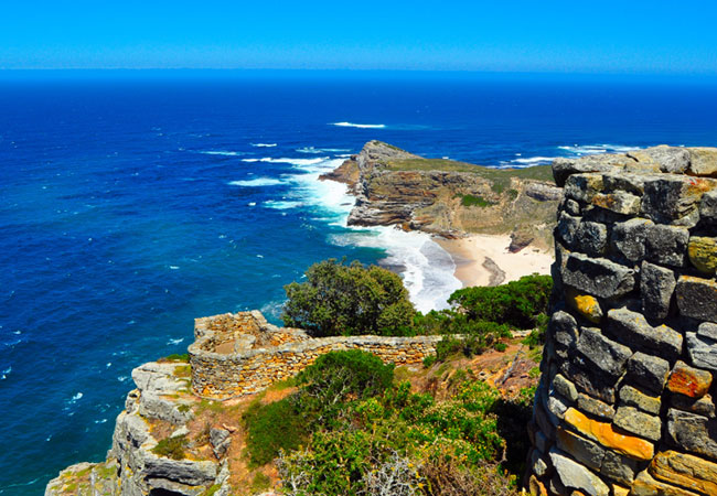
Cape Point
Bartholomeu Dias, the Portuguese seafarer, was the first to sail around the Cape. This was in 1488. On his return voyage, which must have been pa...
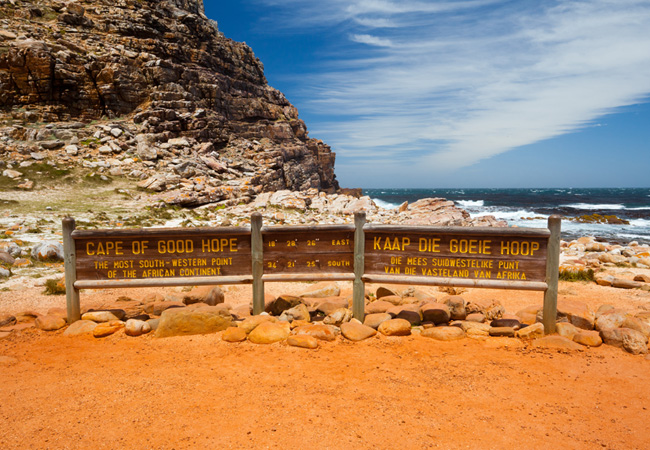
Cape of Good Hope Nature Reserve
Part of the Table Mountain National Park that extends from Signal Hill in the north all the way to Cape Point in the south, the Cape of Good Hope...
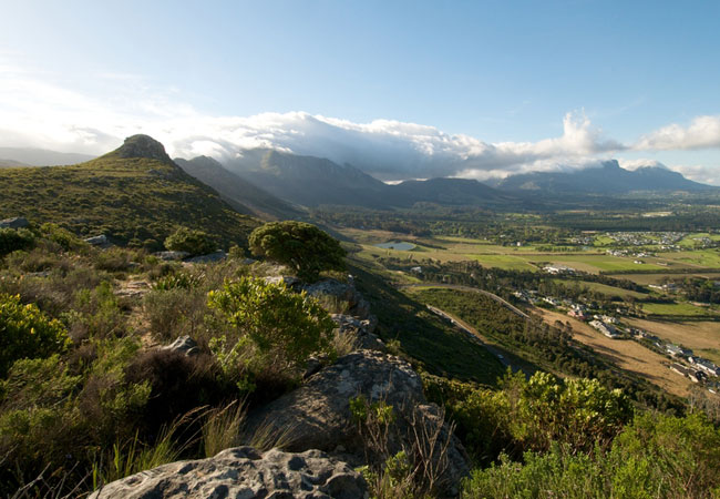
Silvermine Nature Reserve
The park straddles the mountain, from the winding Ou Kaapse Weg (Old Cape Road) on the Tokai, Constantia and Westlake side of the mountain, over ...

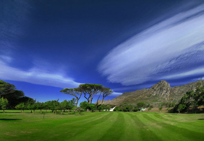
Clovelly Golf Club
Clovelly was designed to be secluded from the everyday noises of passing cars and local railway tracks to truly entrench your senses into your ga...
Westlake Golf Club
Against the amethyst slopes of the Silvermine mountains lies one of Cape Town's Premier Courses - Westlake. This easy to walk, 18 hole Par 72 gol...
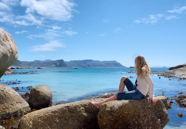
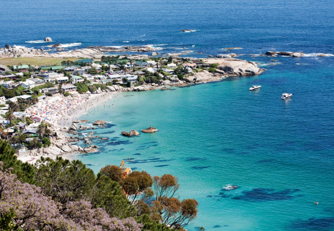
False Bay Coast Beaches
Where? The western coast of False Bay, from Cape Point to start of Helderberg. Includes: Muizenberg, Fish Hoek, Boulders. Go there for swimming, ...
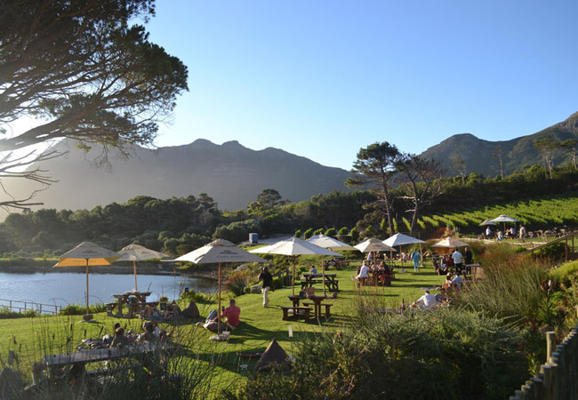
Cape Point Wine Route
It was only in 1998 that the new Cape Point Wine District was declared and the Cape Point Vineyards are still relatively new on the tourist itine...
Find accommodation in Kalk Bay
FIND / South Africa Accommodation / Western Cape Accommodation / Cape Town Accommodation / False Bay Accommodation / Kalk Bay Accommodation
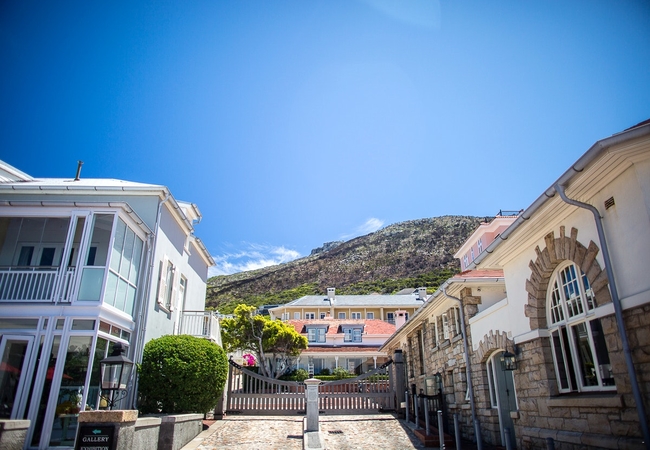
Kalk Bay as a destination
Why book with SA-Venues.com
- Your card is safe with us; strictest card verification in the industry and we don't store card numbers.
- No airy fairy service fees; you save!
- We care. Service with integrity.
- Multiple payment methods:
credit card, SID instant EFT, bank transfer. - All Kalk Bay property owners / managers are verified (our experience protects you from online fraud).
- Secure your booking
Maps
Destination Kalk Bay
- By type in Kalk Bay
- Kalk Bay Accommodation
- Kalk Bay Guest Houses
- Kalk Bay Bed & Breakfast
- Kalk Bay Self Catering
- & Holiday Apartments & Suites
- & Holiday Cottages & Chalets
- & Holiday Homes & Villas
- Kalk Bay Conferences
- Destinations near Kalk Bay
- Clovelly, Fish Hoek, Glencairn, Lakeside, Marina da Gama, Muizenberg, Simons Town, Smitswinkel Bay, St James, Westlake
- Resources for tourists
- About Kalk Bay
- Things To Do
- Attractions
- Reviews