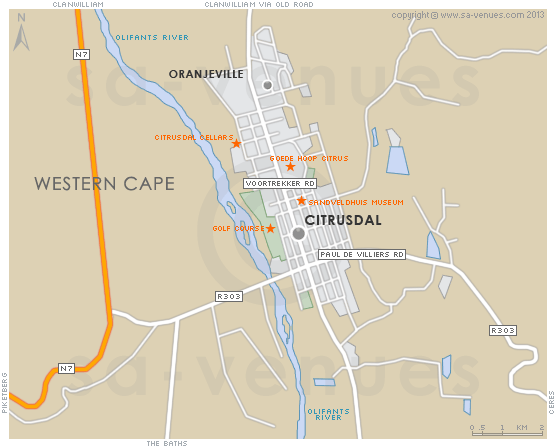
Map of Citrusdal, Western Cape
Citrusdal detail and street level map showing popular landmarks and attractions. The popular weekend getawat town of Citrusdal is surrounded by gorgeous scenery and lies nestled between the Koue Bokkeveld and Swartberg Mountains ... To find out more about Citrusdal please see Citrusdal Information.
If you are interested in overnighting in the area, we can recommend some great accommodation options including hotels, guest houses and self-catering properties. If you're only planning on driving through Citrusdal, en-route to another destination, you may want to peruse our Citrusdal Restaurants before you leave to see if you should plan a stop here for lunch or maybe just a coffee. Also check out Citrusdal Things To Do to see if there are any activities for which you would consider stopping.
Maps of the Western Cape
Provincial Maps
Street Level Maps
Western Cape Regions
Special Interests by Map
In the vicinity
Hotels & other accommodation options
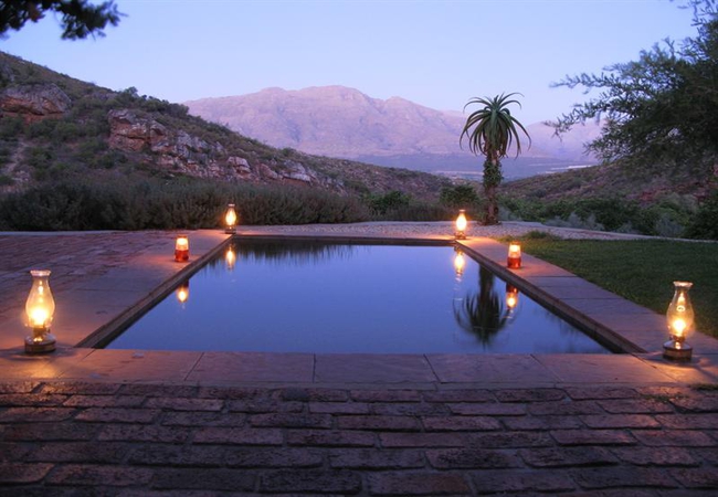
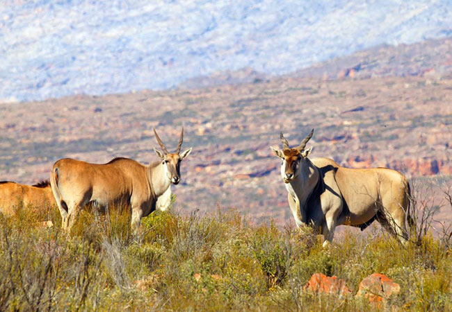
Kagga Kamma Nature Reserve
Kagga Kamma Nature Reserve is located in an untouched wilderness area near Ceres, renowned for its scenic beauty and dramatic rock formations typ...
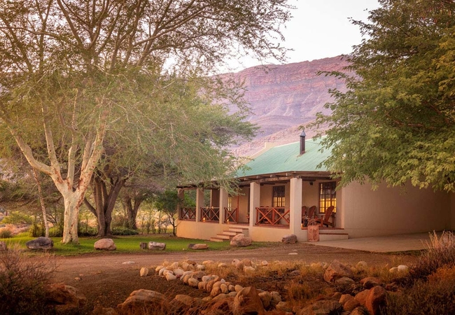
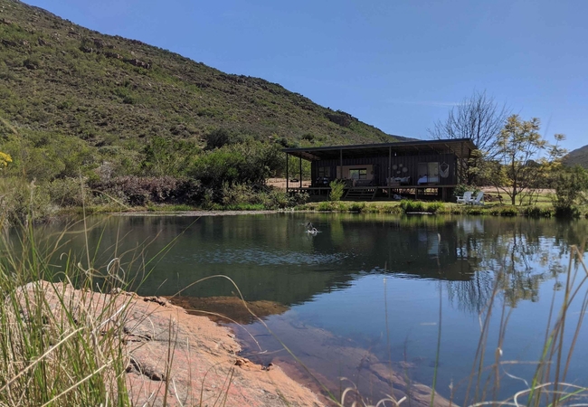
Mount Ceder Lodge
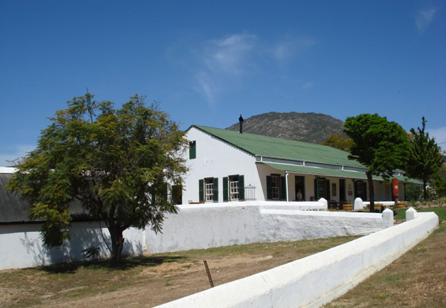
Mount Ceder is situated in a valley surrounded by mountains on the farm Grootrivier, next to the main route through the Cedarberg, approximately ...
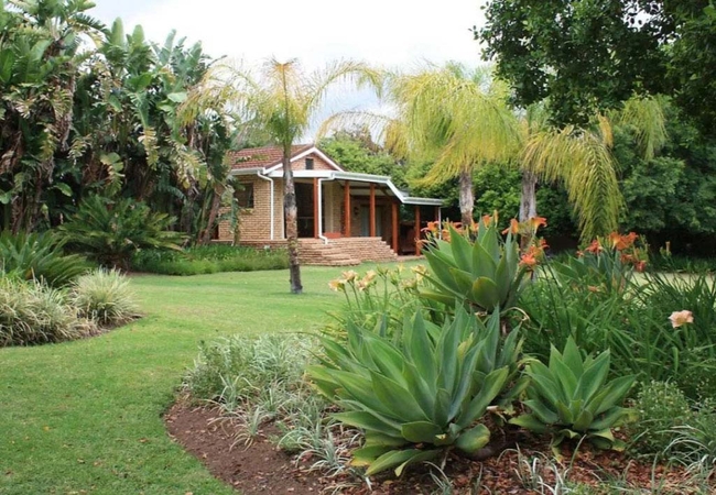
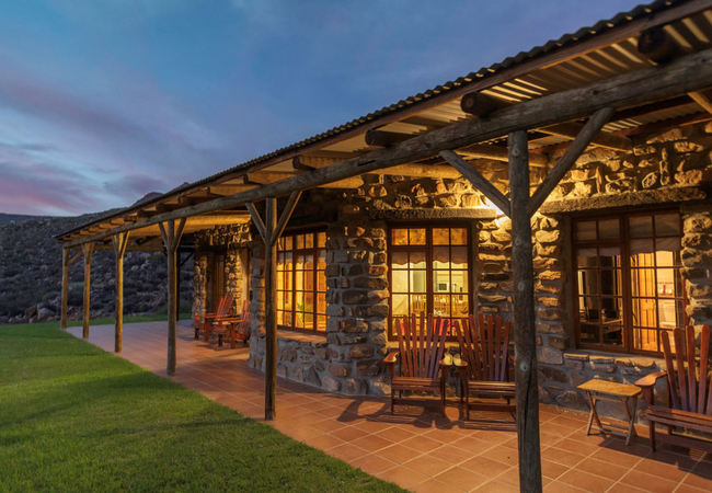
Sewefontein Homestead
Sewefontein Homestead offers visitors the opportunity to stay on a working farm just a short drive from Citrusdal. Sewefontein Guest Farm is the ...
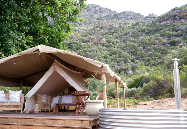
Cederkloof Luxury Forest Camp
Cederkloof Luxury Forest Camp offers comfortable tented accommodation in the Cederkloof Botanical Retreat. The retreat forms part of a working fa...
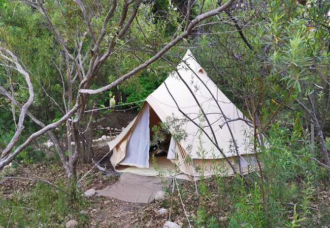
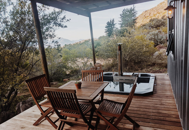
Leopard Valley Glamping
Leopard Valley Glamping Tents offers glamping accommodation in a peaceful valley between Citrusdal and Clanwilliam. The glamping tents are each ...
Kromrivier Cederberg Park
Cederberg Park is located on Kromrivier which is a working farm with a child-friendly farmyard in the heart of the Cederberg. Today, Kromrivier R...
Klipbokkop House
Klipbokkop House at Mount Ceder offers Cederberg accommodation with a magnificent 360 degree view of the surrounding landscape. Mount Ceder lies ...
Aan d' Oewer B&B
Aan d' Oewer B&B is set in a beautiful lush garden with the Piekenierskloof mountains as the backdrop. Guests have a choice of rooms each with a ...
Cederkloof Botanical Retreat
These private mountain cottages are situated on a 270 ha fynbos and citrus farm in the Citrusdal Valley in the Oliphants River Mountains which ne...
Sewefontein Cottage
Sewefontein Cottage offers visitors the opportunity to stay on a working farm just a short drive from Citrusdal. Sewefontein Guest Farm is the id...
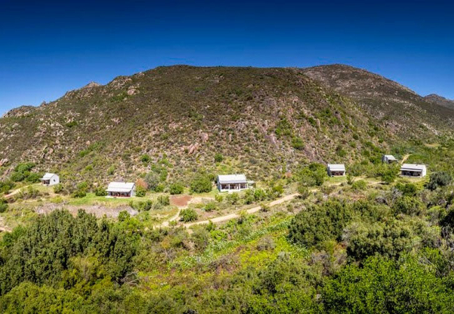
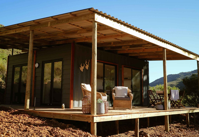
Leopard Valley Eco Retreat
Leopard Valley is an Eco Retreat nestled in a peaceful valley between Citrusdal and Clanilliam.There are various cabins crafted from used shippin...
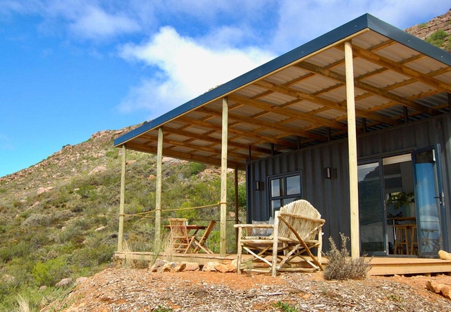
Verreaux's Eagle
Verreaux's Eagle is a cosy self-catering eco-cabin offering Citrusdal accommodation perched on the side of the mountain, with sweeping views down...
Malachite Sunbird Cabin
Malachite Sunbird Cabin offers Cederberg self catering in a one bedroom cabin located in the Cape Leopard Valley in Citrusdal. We are passionate ...
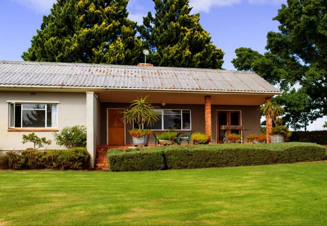
Kareeboom House
Kareeboom House offers Cederberg Accommodation at Mount Ceder and is located at the foot of the surrounding mountains. Nestled in a valley of the...
Blinkberg House
Blinkberg House offers Cederberg accommodation nestled on the slopes of Tuinskloof ridge at Mount Ceder. Mount Ceder which lies within easy reach...
Petersfield Mountain Cottages
Petersfield is a working citrus and Rooibos tea farm overlooking the town of Citrusdal in the Cederberg area. Situated 170 km form Cape Town on t...
Cape Sugarbird Cabin
Cape Sugarbird is a spacious self catering eco-cabin offering Citrusdal accommodation. The cabin is perched on the edge of a waterlily pond with ...

Cape Canary Cabin
Cape Canary is a cosy self-catering eco-cabin perched on the side of the mountain, with sweeping views down the valley. This cabin features a pri...
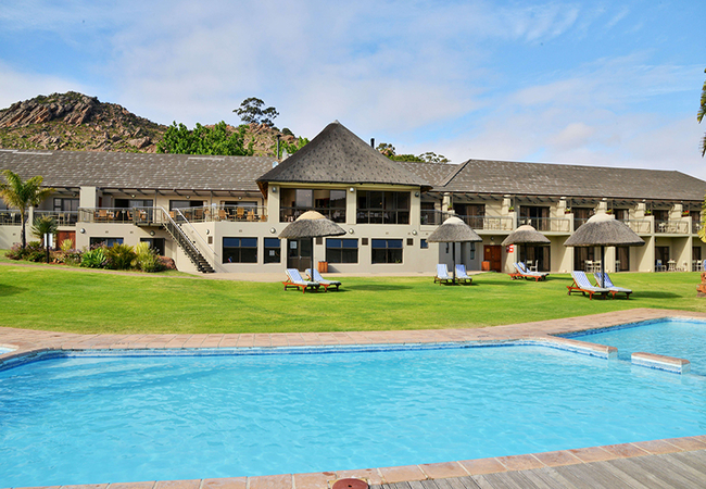
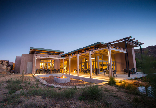
Piekenierskloof Mountain Resort
Situated in Citrusdal, Piekenierskloof Mountain Resort offers comfortable accommodation for up to 140 guests. You can play mini-golf at this reso...
Things to do in the area - see all in Cederberg
Citrusdal Museum
The Citrusdal Museum is housed in a former old stone church. Here you will discover more about the first colonists and San inhabitants in the are...

De Tol Farm Stall
De Tol Farm Stall is located about 6km from Citrusdal on the Piekenierskloof Pass. The beautiful farmhouse boasts a terrific farm stall and a sm...
The Old Village Restaurant & Pub
The first building after the pass opened was the post office and trading store, which has been turned into an elegant restaurant with restaurante...
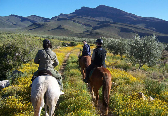
Horse Riding at Mount Ceder
Day horse-rides - Go explore a beautiful valley, see bushman paintings, visit an old farmhouse ruin and have a swim at the waterfall or river whe...
Olive Grove Cycle Route
Go Mountain Biking at Mount Ceder on the Olive grove cycle route - Mount Ceder has recently marked a cycle route for the whole family. This route...

The Grapevine Coffee Shop
Stop off at the gorgeous 'The Grapevine coffee shop' for something to eat and drink while in Citrusdal. With its green and white interior, white...
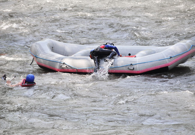
Doring River White Water Rafting
Doring River offers white water rafting adventures from mid-June to September, on the river that winds through the Cederberg. Arrive the night be...
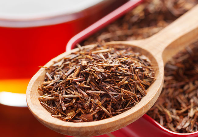
Rooibos Factory
The Rooibos factory is based in the small town of Clanwilliam, and originally started as a cottage industry. It has grown over the years, ...
Noteworthy attractions - see all in Cederberg
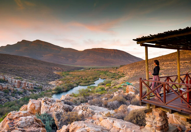
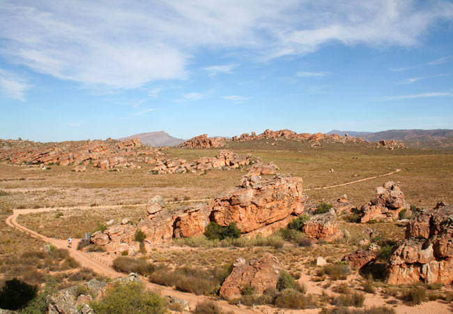
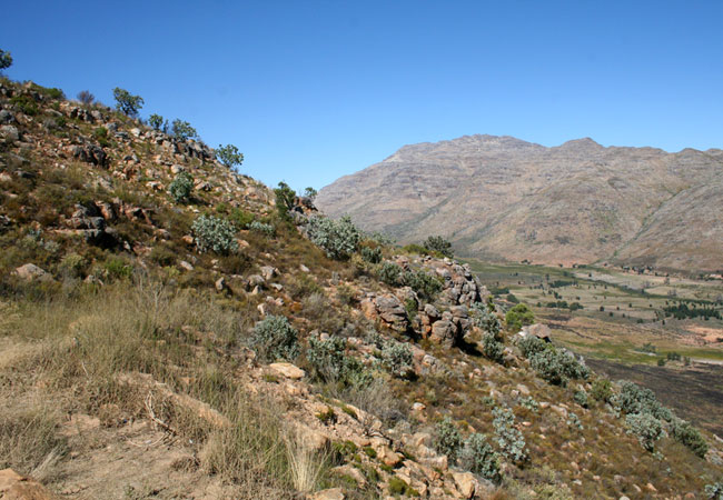
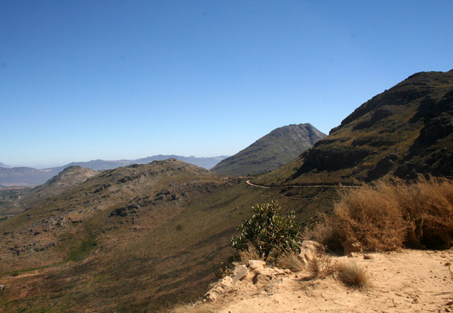
Cederberg Wilderness Area
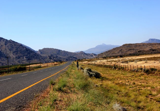
The Cederberg Wilderness Area lies some 200 km north of Cape Town. This vast area stretches from the Middelberg Pass at Citrusdal to north of the...
Beaverlac Nature Reserve
This little talked about gem lies just 25 kilometres outside of Porterville, roughly 2 hours from Cape Town, in the Olifants River Mountains in t...
Bushmanskloof Wilderness
Bushmanskloof Wilderness, lying in the northern Cederberg wilderness roughly 270 kilometres from Cape Town, is a South African Natural Heritage S...
Matjiesrivier Nature Reserve
The beautiful Matjiesrivier Nature Reserve lies on the eastern edge of the Cederberg Mountains, managed as part of the greater Cederberg conserva...
Pakhuis Conservancy
Set on the northern edge of the Cederberg Wilderness area, roughly 300 kilometres from Cape Town and close to the town of Clanwilliam, the Pakhui...
Middle Keurbooms Conservancy
On the beautiful Prince Alfred Pass lies the Middle Keurbooms Conservancy, or MKC for short. More than 30 000 hectares have been designated by la...
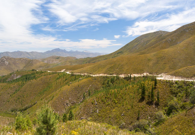
Katbakkies Pass
Katbakkies Pass has what is commonly known as a descriptive name. Others in the area include Houdenbek and Skitterykloof - although Skitterykloof...
Nieuwoudt Pass
The Nieuwoudt Pass is a dirt road that occurs roughly halfway between Citrusdal and Clanwilliam, off the N7. It is actually an alternative route ...
Pakhuis Pass
The drive from Clanwilliam to Wuppertal in the Cederberg, the incredible wild and mountainous region that attracts hikers and lies roughly three ...
Find accommodation in Citrusdal
FIND / South Africa Accommodation / Western Cape Accommodation / Cape Town Accommodation / Olifants River Valley Accommodation / Cederberg Accommodation / Citrusdal Accommodation
Citrusdal as a destination
Why book with SA-Venues.com
- Your card is safe with us; strictest card verification in the industry and we don't store card numbers.
- No airy fairy service fees; you save!
- We care. Service with integrity.
- Multiple payment methods:
credit card, SID instant EFT, bank transfer. - All Citrusdal property owners / managers are verified (our experience protects you from online fraud).
- Secure your booking
Maps
Destination Citrusdal
- By type in Citrusdal
- Citrusdal Accommodation
- Citrusdal Hotels
- Citrusdal Guest Houses
- Citrusdal Bed & Breakfast
- Citrusdal Self Catering
- & Holiday Apartments & Suites
- & Holiday Cottages & Chalets
- & Holiday Homes & Villas
- Citrusdal Conferences
- Citrusdal Weddings
- Citrusdal Honeymoons
- Destinations near Citrusdal
- Biedouw Valley, Clanwilliam, Porterville, Wuppertal
- Resources for tourists
- About Citrusdal
- Things To Do
- Attractions
- Reviews