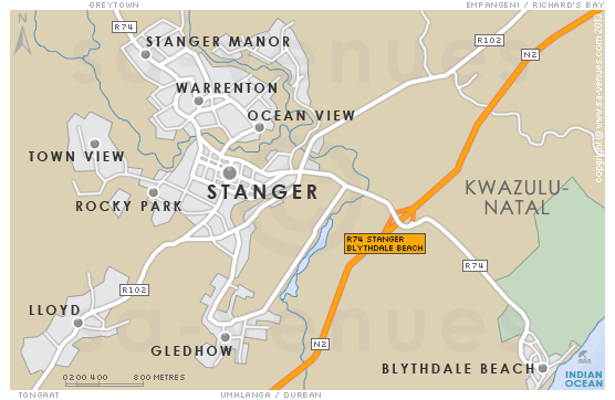
Map of Stanger, KwaZulu Natal
Stanger detail and street level map showing suburbs and landmarks of Stanger. KwaDukuza-Stanger lies inland from Blythedale in the midst of sugarcane fields, its streets lined with Jacarandas, home to King Shakas memorial monument and part, not only of the Zulu Heritage Route, but the proposed Sugar Route as well. For additional information see Stanger Information.
If you are interested in overnighting in the area, we can recommend some great accommodation options including hotels, guest houses and self-catering properties. If you're only planning on driving through Stanger, en-route to another destination, you may want to peruse our Stanger Restaurants before you leave to see if you should plan a stop here for lunch or maybe just a coffee. Also check out Stanger Things To Do to see if there are any activities for which you would consider stopping.
Maps of KwaZulu Natal
Provincial Maps
Street Level Maps
KwaZulu Natal Regions
Special Interests by Map
In the vicinity
Hotels & other accommodation options
The Eighteenth Three Bed Superior
Situated in The Prince's Grant Golf Estate, The Eighteenth Three Bed Superior apartment offers self-catering accommodation in a relaxing atmosphe...
The Eighteenth Three Bed Deluxe
Situated in The Prince's Grant Golf Estate, The Eighteenth Three Bed Deluxe apartments offer self-catering accommodation in a relaxing atmosphere...
The Golf House @ No 2
The Golf House @ No 2 is a 4-bedroom holiday home situated on the back end of the estate in a quiet cul de sac road, with views of the coastal fo...
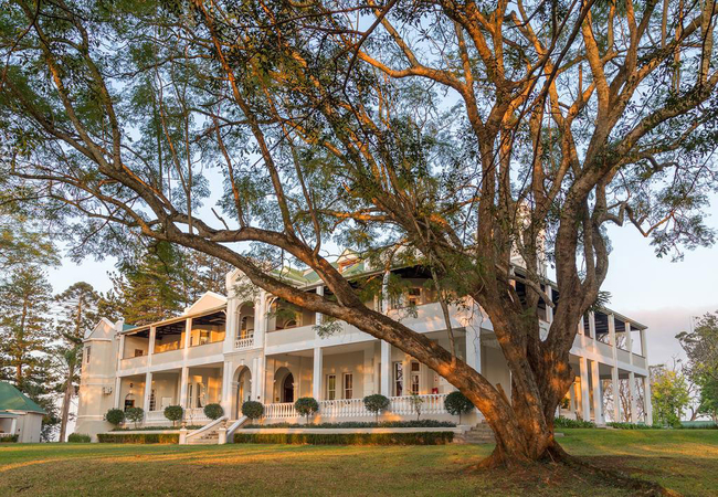
Kearsney Manor
Situated on an original sugar estate near Stanger, Kearsney Manor is an old English mansion built in the late 1800's by Sir Liege Hulett. This ma...
The Eighteenth Two Bed Luxury
Situated in The Prince's Grant Golf Estate, The Eighteenth apartments offer self-catering accommodation in a relaxing atmosphere. Guests have the...
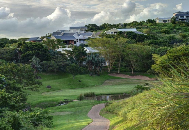
The Lodge at Prince's Grant
Set amongst the grand old sugar estates on the North Coast some 45 minutes drive from Durban, Prince's Grant, a recently proclaimed "Site of Cons...
Things to do in the area - see all in Dolphin Coast
Hiking in Harold Johnson Nature Reserve
The Harold Johnson Nature Reserve is situated north of Ballito on the banks of the Tugela River and north of Zinkwazi. The Harold Johnson Nature ...
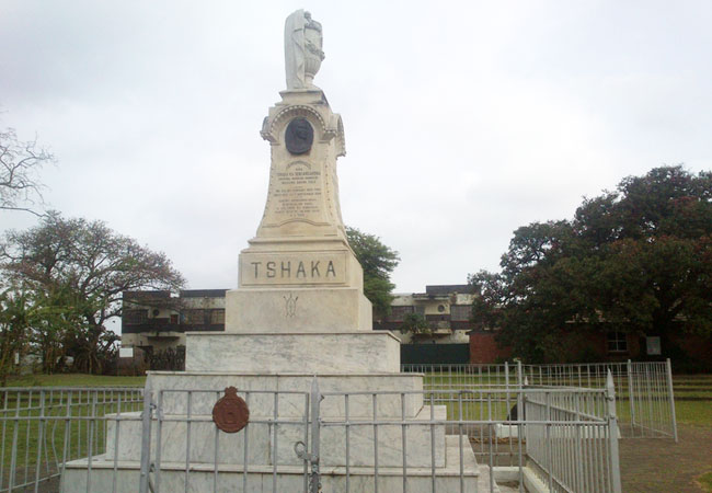
Visit the King Shaka Memorial
A 20-minute slide show on the history of King Shaka can be viewed and there is also a small curio shop and an Interpretative Centre. Shaka was bo...
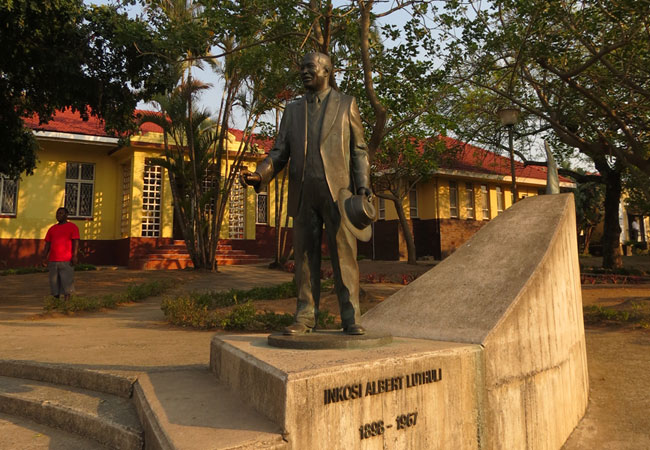
Luthuli Museum
The Luthuli Museum is one of the many tributes to those who fought for the freedom and peace of a nation, risking their lives and reputations. Th...
Noteworthy attractions - see all in Dolphin Coast
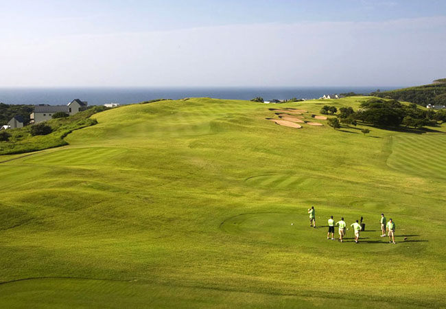
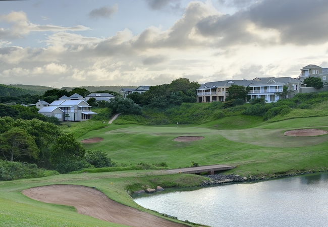
Princes Grant Golf Club
With panoramic views of the Indian Ocean, this development has been designed to capture the gracious colonial life-style of early Natal. Set out ...

Umhlali Country Club
Neighbouring on Ballito Bay, only 15 minutes North of Umhlanga Rocks, Umhlali, just 20 minutes drive north of Durban is a scenic undulating cours...
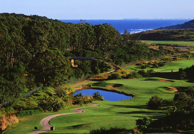
Zimbali Country Club
Zimbali is well known for its stunning 18-hole golf course. It offers a challenging round of golf of world-class standards and stunning views. Th...
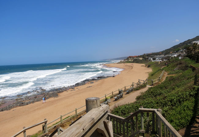
Dolphin Coast Beaches
Dolphin Coast offers visitors a combination of modern facilities at it's sun drenched seaside resorts in a lush, subtropical environment. The Dol...
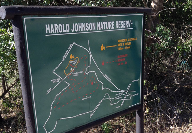
Harold Johnson Nature Reserve
The Harold Johnson Nature Reserve is situated north of Ballito on the banks of the Tugela River and north of Zinkwazi. Fort Pearson and the Ultim...
Mount Moreland Conservancy
Part of the focus of the Mount Moreland Conservancy is to preserve and improve the condition of the Mdloti River and the state of its surrounding...
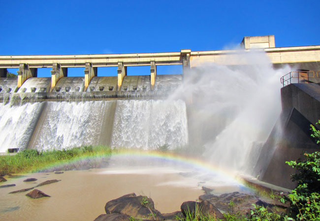
Hazelmere Dam
Hazelmere Dam may have been constructed for practical purposes, but it has since become a favoured retreat for holidaymakers and those needing to...
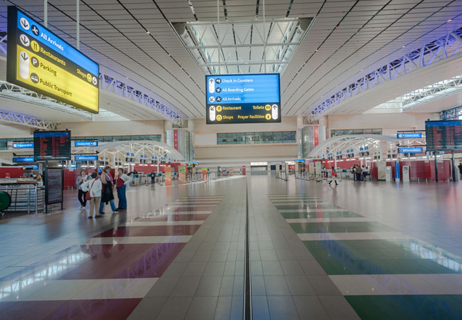
King Shaka International Airport
King Shaka International Airport is modern and well-equipped, boasting world-class facilities and amenities to cater to South African and foreign...
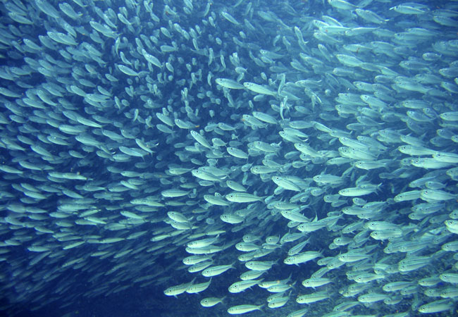
Sardine Run
The Sardine Run is an annual migration of sardines along South Africa's east coast, between May and July. These tiny fish migrate from the cold w...
Find accommodation in Stanger
FIND / South Africa Accommodation / KwaZulu Natal Accommodation / Dolphin Coast Accommodation / Stanger Accommodation
Stanger as a destination
Why book with SA-Venues.com
- Your card is safe with us; strictest card verification in the industry and we don't store card numbers.
- No airy fairy service fees; you save!
- We care. Service with integrity.
- Multiple payment methods:
credit card, SID instant EFT, bank transfer. - All Stanger property owners / managers are verified (our experience protects you from online fraud).
- Secure your booking
Maps
Destination Stanger
- By type in Stanger
- Stanger Accommodation
- Stanger Hotels
- Stanger Guest Houses
- Stanger Bed & Breakfast
- Stanger Self Catering
- & Holiday Apartments & Suites
- & Holiday Homes & Villas
- Stanger Conferences
- Stanger Honeymoons
- Destinations near Stanger
- Ballito, Blythedale Beach, Darnall, Kearsney, La Mercy, Princes Grant, Salt Rock, Shakas Rock, Sheffield Beach, Tinley Manor, Tongaat, Tugela, Umdloti, Umhlali, Westbrook, Zimbali, Zinkwazi
- Resources for tourists
- About Stanger
- Things To Do
- Attractions
- Reviews