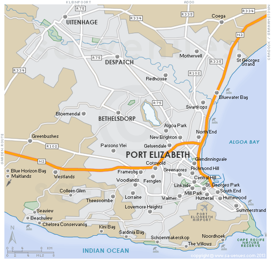
Map of Port Elizabeth Metro, Eastern Cape
Greater Port Elizabeth detail map showing the locations of towns and major suburbs, national roads and the Algoa Bay coastline. Algoa Bay's 40 km of breathtaking coastline boasts a perfect combination of warm water, protected beaches and is complemented by Port Elizabeth's wonderful climate, which has been rated as having the fourth best weather of any coastal city in the world. To find out more visit Port Elizabeth Information.
Maps of the Eastern Cape
Provincial Maps
Street Level Maps
Eastern Cape Regions
Special Interests by Map
In the vicinity
Hotels & other accommodation options

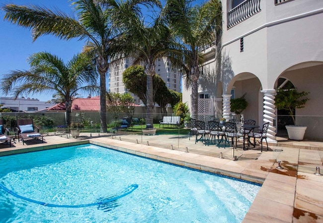
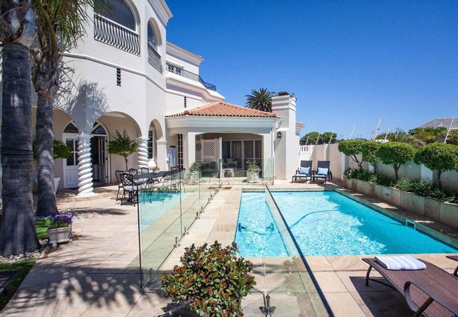
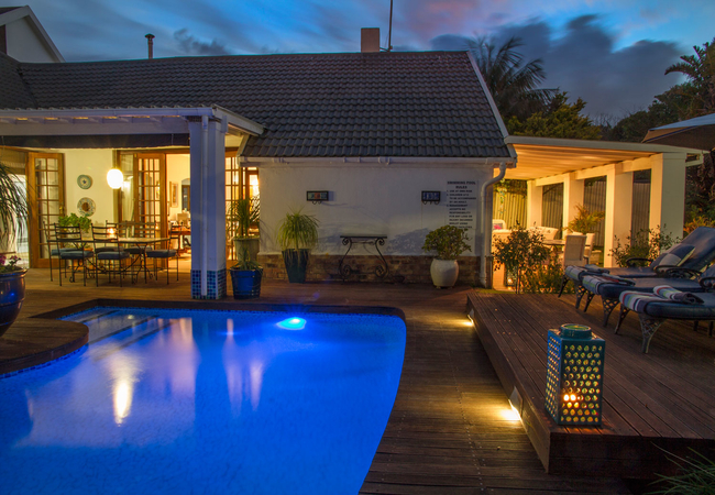
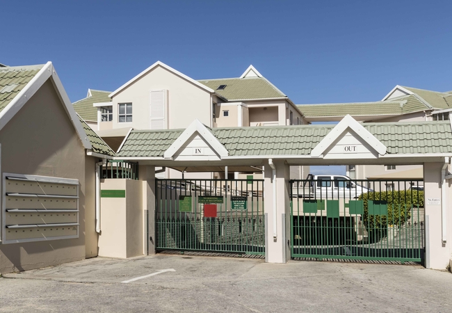
Cape Recife Lighthouse Villa
Cape Recife Lighthouse Villa has two bedrooms furnished with double beds. The kitchen is fully equipped and there is a dining room. The living ro...
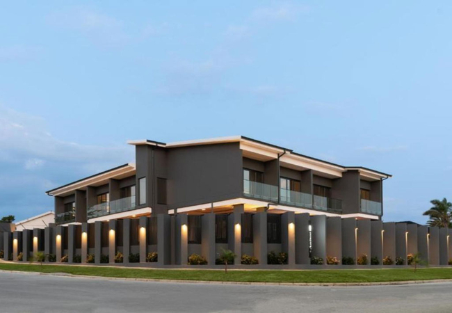
4 Boutique Garden Villa
4 Boutique Garden Villa is a spacious, open plan Holiday Home which is stylishly decorated. The bedroom is furnished with a King-size bed, walk i...
Thunzi Stargazing Dome
Thunzi Stargazing Dome is located at Thunzi Bush Lodge, a tranquil sanctuary in the Malaria free Eastern Cape Province nestled at the base of a 4...
4 Boutique Beach House
4 Boutique Beach House suites each have their own entrance and outdoor seating area and have full access to the in-house facilities and swimming ...
Anfani Boutique Hotel
Only a kilometre from Kings Beach, Anfani Boutique Hotel provides bed and breakfast accommodation in Port Elizabeth, the "Friendly City". The hot...
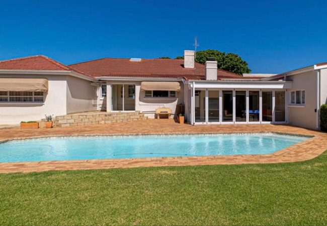
Admiralty Beach House
The Admiralty Beach House offers the tourist and discerning business person, bed & breakfast or self catering accommodation. Relaxed comfort in a...
Mill Park Oasis
The Mill Park Oasis is a luxury self-catering villa located in Mill Park, Gqeberha. This exclusive vacation home is ideally situated 6.5km from C...
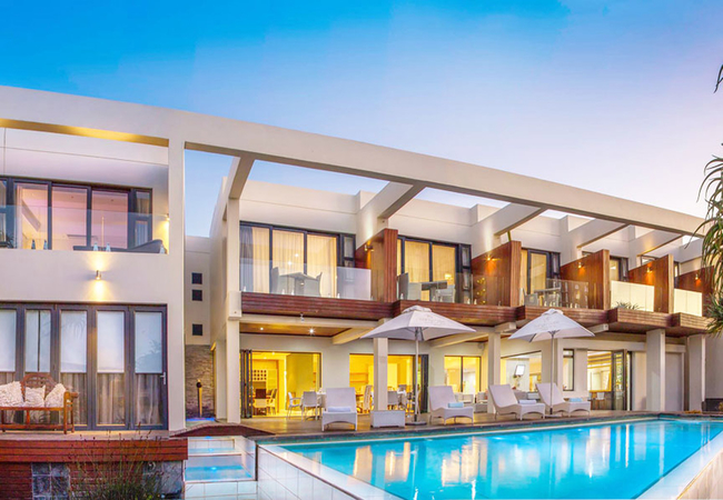
Isango Gate Boutique Hotel and Spa
Isango Gate Boutique Hotel and Spa is situated in the premier quiet suburb of Summerstrand in Port Elizabeth and on the doorstep of one of its pr...
Summerseas 35
Located in Summerstrand, Summerseas 35 offers accommodation in a modern apartment with sea views and direct access to Pollock beach. The secure c...
Noteworthy attractions
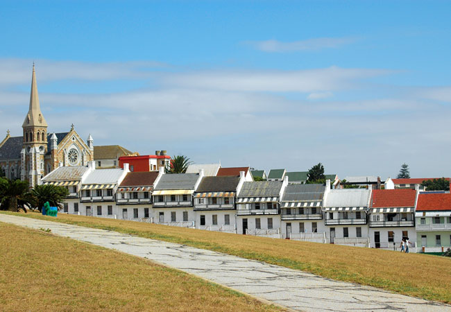
Donkin Heritage Trail
The Donkin Heritage Trail is named after the Acting Governor of the Cape Colony at the time, Sir Rufane Donkin. South Africans are well acquainte...
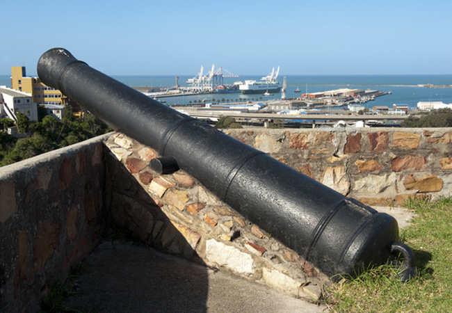
Fort Frederick
Like many national monuments, Fort Frederick first appears as little more than a few brick walls, albeit old walls that seem to hold little signi...
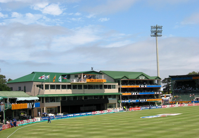
St Georges Park Cricket Ground
The oldest park in Port Elizabeth and the site of the second oldest cricket club in the country, St Georges Park lies in the heart of Port Eliza...
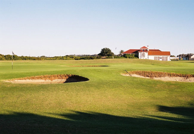
Humewood Golf Club
One of South Africas top-rated golf clubs, Humewood is a true Links course which has hosted numerous PGA events, including the South African Ope...
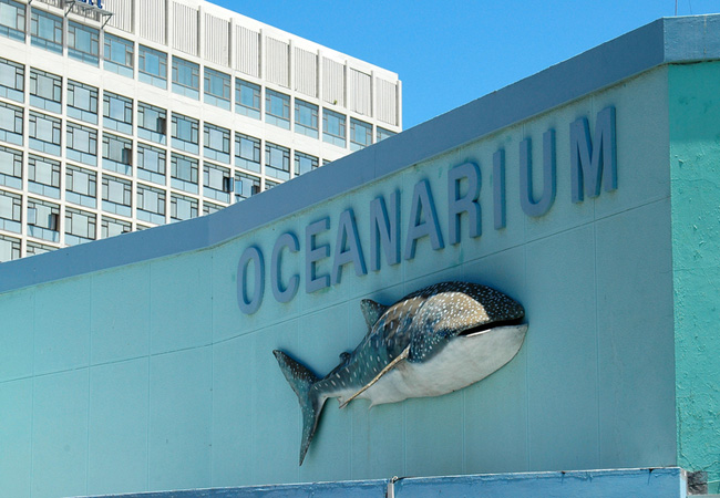
Bayworld Museum Complex
The Main Museum of Bayworld blends cultural and natural history. Embark on an exciting journey through time and through the fascinating world aro...
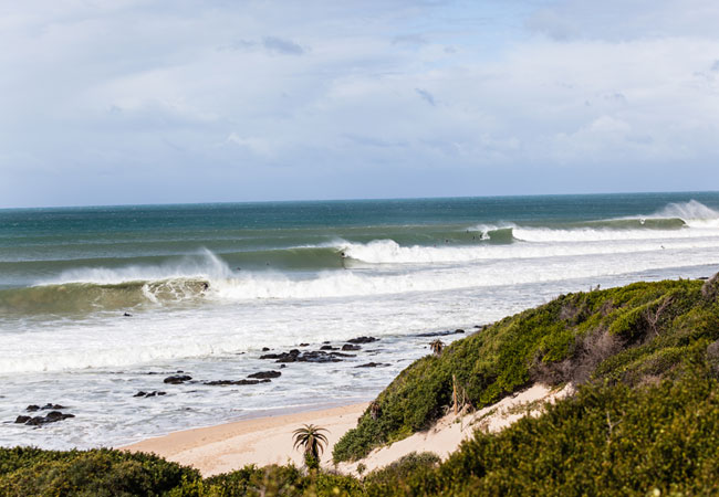
Eastern Cape Beaches
The Eastern Cape in South Africa boasts some of the worlds best beaches and 800 km of unspoilt picturesque coastlines where blue oceans tumble o...
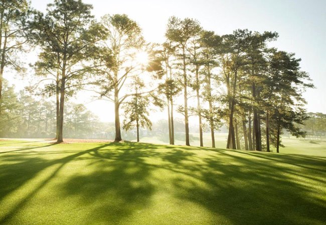
Port Elizabeth Golf Club
Port Elizabeth Golf Club, which is commonly known as "The Hill", was founded in 1890 and is one of South Africa's oldest golf clubs. Today the pl...

Walmer Country Club - PERMANENTLY CLOSED
Walmer Country Club with its warm and friendly atmosphere, is 54 years old. It has grown from strength to strength and has over 550 members. Walm...
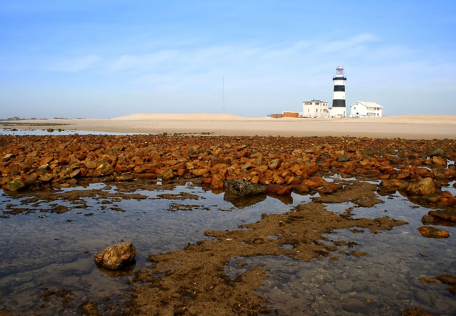
Cape Recife Nature Reserve
Cape Recife Nature Reserve is one of the best bird-watching locations in Port Elizabeth. The Cape Recife Nature Reserve offers beautiful beach, n...
Port Elizabeth Metro as a destination
Why book with SA-Venues.com
- Your card is safe with us; strictest card verification in the industry and we don't store card numbers.
- No airy fairy service fees; you save!
- We care. Service with integrity.
- Multiple payment methods:
credit card, SID instant EFT, bank transfer. - All Port Elizabeth Metro property owners / managers are verified (our experience protects you from online fraud).
- Secure your booking
Maps
Destination Port Elizabeth Metro
- By type in Port Elizabeth Metro
- Port Elizabeth Metro Accommodation
- Port Elizabeth Metro Hotels
- Port Elizabeth Metro Guest Houses
- Port Elizabeth Metro Bed & Breakfast
- Port Elizabeth Metro Self Catering
- & Holiday Apartments & Suites
- & Holiday Cottages & Chalets
- & Holiday Homes & Villas
- Port Elizabeth Metro Conferences
- Port Elizabeth Metro Weddings
- Port Elizabeth Metro Honeymoons
- Destinations in Port Elizabeth Metro
- Beachview, Blue Horizon Bay, Bluewater Bay, Central Hill, Charlo, Chelsea Conservancy, Colleen Glen, Cotswold, Fern Glen, Glendinningvale, Greenacres, Greenbushes, Humerail, Humewood, Kini Bay, Kragga Kamma, Lorraine, Lovemore Park, Maitlands, Mill Park, Mount Croix, Newton Park, North End, Parsons Hill, Parsons Vlei, Perridgevale, Richmond Hill, Sardinia Bay, Schoenmakerskop, Seaview, South End, St Georges Park, Summerstrand, Sunridge Park, Theescombe, Uitenhage, Walmer, Walmer Heights, Westlands, Woodlands
- Resources for tourists
- About Port Elizabeth Metro
- Things To Do
- Attractions