


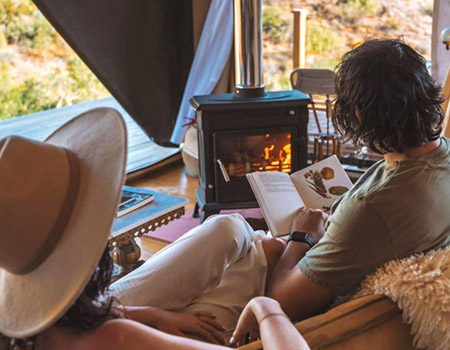
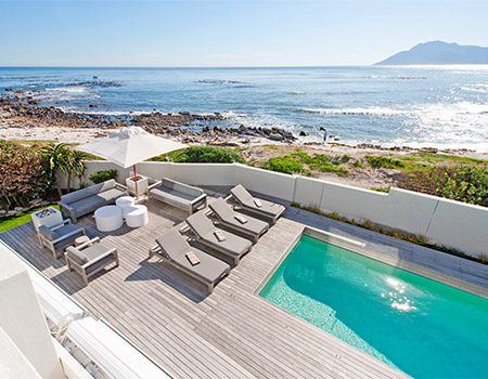
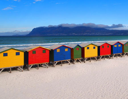
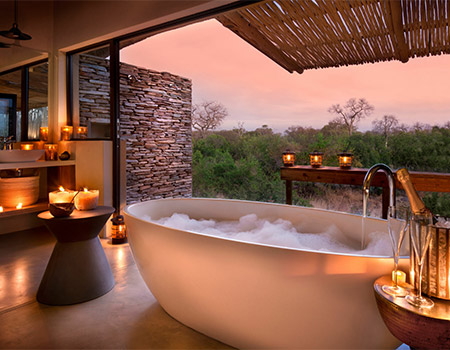
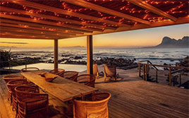
Leave Ordinary Behind ~ 50 Unique Stays

Auf Deutsch / German-speaking travellers can research and plan their perfect South African holiday on our sister site https://www.Suedafrika-Reise.net
On special
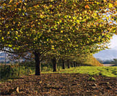
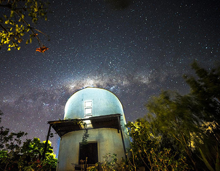
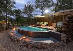
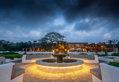
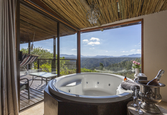
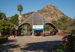
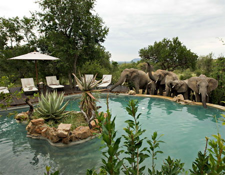
Amakhala
Stay 2+1
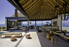
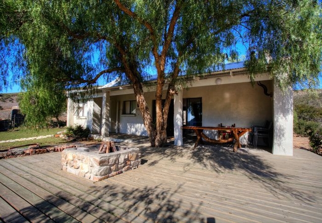
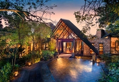
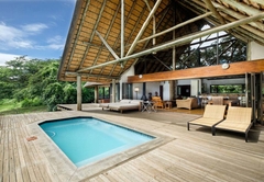
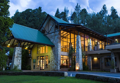
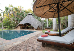
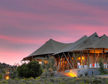
Amakhala Safari Lodge
Safari Lodge is secretly hidden up a kloof in the indigenous Valley Bushveld in the Amakhala Game Reserve. This extraordinary conservancy allows ...
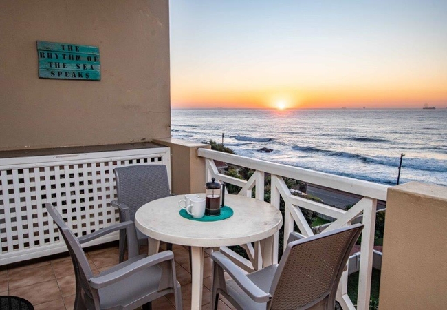
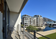
Umdloti
10% off
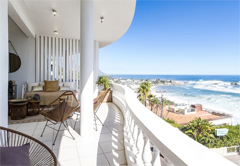
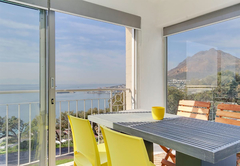
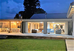
Waterfront 24
Waterfront 24 is a neat and comfortable apartment with uninterrupted sea views from the balcony overlooking the swimming pool. The Waterfront Com...
Storms River
15% off
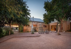
Uitenhage
15% off
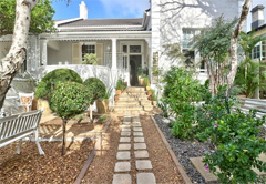
Pepper Tree @ Kleinrivier
Pepper Tree is a beautiful farm cottage with all the comforts of home but the tranquillity of the Karoo landscape. With the bicycle track and nat...
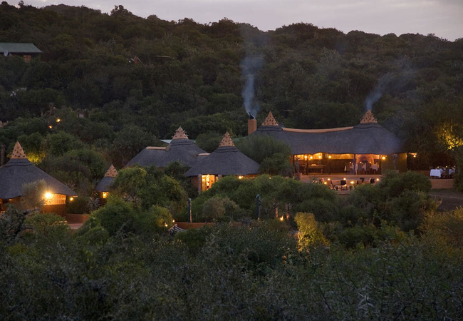
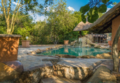
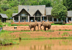
Hoedspruit Wildlife Estate
20% off
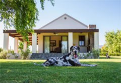
Ntoma House
Ntoma House offers accommodation in the Hoedspruit Wildlife Estate. It is ideally situated within easy reach of the Kruger National Park. Being j...
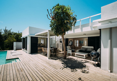
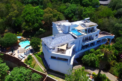
De Waterkant
30% off
312 Rockwell
Accommodating two guests only, this modern and luxurious apartment is centrally located in De Waterkant close to V&A Waterfront, CBD and CTICC. T...
De Waterkant
15% off
24 Loader Street
24 Loader Street is a 3 bedroom holiday home that accommodates 6 guests. The property is modern and stylish from within and boasts one of the hig...
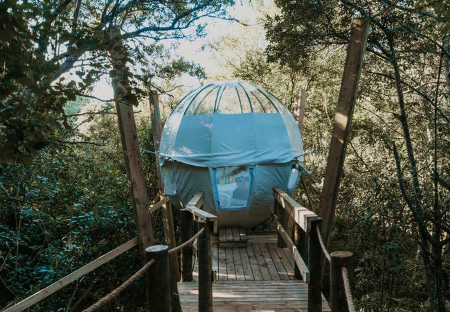
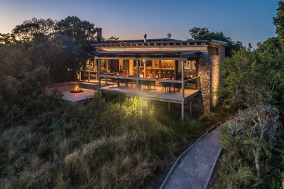
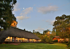
Harkerville
Stay 2+1
Tsala Treetop Lodge
Tsala Treetop Lodge offers luxury accommodation tucked into the forest canopy. There are ten luxury hide-away suites and six luxury villas. Exten...
Marloth Park
35% off
Grace of Africa
Grace of Africa guest house in Marloth Park offers guest luxury suites located in the village, a wildlife conservancy holiday town. The town is i...
Marloth Park
15% off
Impala Lily
Impala Lily is a holiday house located in Marloth Park, offering accommodation for four guests. The house is situated 15 minutes from Kruger Nati...
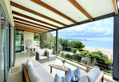
Simons Town
10% off
Bay Views Simons Town
Bay Views Simons Town provides accommodation for four guests in the stunning seaside village of Simon's Town. This is a great place for a peacefu...
Hluhluwe
12% off
Rhino River Homestead
Rhino River Homestead offers Hluhluwe accommodation on a privately-owned game reserve with some of the best game viewing Zululand has to offer. W...
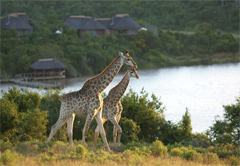
Kenton On Sea
15% off
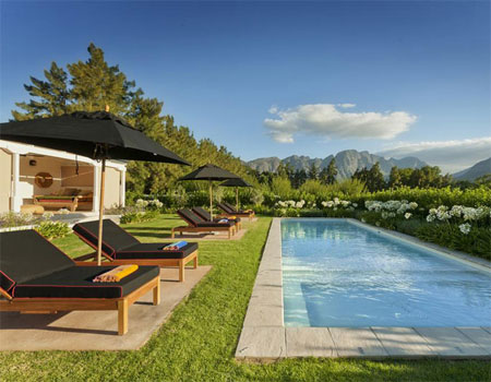
Kariega Ukhozi Lodge
Ukhozi Lodge in the Kariega Game Reserve captures the romance and intimacy of Africa. Nestled in the bush you will discover 10 superbly appointe...
Oudtshoorn
15% off
De Zeekoe Guest Farm
An expansive modern working ostrich farm of 2000 hectares, on the banks of the Olifants River. De Zeekoe Guest Farm offers luxury en-suite bedroo...
Plettenberg Bay
Stay 4+1
Plettenberg Bay
Stay 2+1
Barrington's
Barrington's is home to one of the first Craft Breweries situated within Plettenberg Bay, as well as a magnificent garden, brasserie, bar and sma...
Plettenberg Bay
Stay 4+1
Rothersands 16
Rothersands 16 is a popular holiday villa sleeping six guests in three bedrooms. Two of the bedrooms have queen size beds and face the swimming p...
Hoedspruit
Stay 3+1
Mali Mali Safari Lodge
Mali Mali Safari Lodge offers accommodation in the Ndlovumzi Nature Reserve about 35km outside the small town of Hoedspruit. Stretching over a 10...
Foreshore
15% off
214 Harbour Bridge
214 Harbour Bridge is a luxurious holiday apartment, situated on the 2nd floor with a sweeping view over the Roggebaai Canal, Signal Hill and the...
Nottingham Road
10% off
Fairfax Farmhouse
Fairfax Farmhouse is a modern holiday home located on a secure farm, just 4.2 km away from Nottingham Road central. Nottingham Road is the hub of...
Recent Guest Reviews
Very friendly staff.
 Raul F.
Stayed at Echo Mountain Inn
Thabazimbi, Waterberg
We know Paternoster well and I would say this is hands down the best location. No shortage of beautiful views, from every window. We were 8 and never felt crammed, enough room ... and of course beach and ocean ...
Anne H.
Stayed at Bekkie
Paternoster, Cape West Coast
We truly enjoyed our stay at Camissa Farm, from the landscape to the interior design of the cabin everything was perfect and magical. Camissa is so serene and Sam's hospitality and warm welcome made us feel at ...
Theodora N.
Stayed at Avocado Cabin
Stellenbosch, Cape Winelands
Fantastic place for a breakaway.. We enjoyed our stay.
Antoinette B.
Stayed at Avalon Springs
Montagu, Breede River Valley
wow this was awesome and will defiantly be coming here again! unbeatable!! staff absolutely tops!!
paula r.
Stayed at Rustic Manor Bed & Breakfast
Tokai, Constantia Valley
Lovely and relaxed venue after a long and stressful drive.
Edward J.
Stayed at Tzamenkomst River Lodge
Colesberg, Upper Karoo
We had a lovely stay at 767 on the Ridge. What a beautiful place with everything you need and has the most spectacular view! Wonderful shower & comfy King size bed. The vouchers at the brewery was a treat! We ...
Tanya O.
Stayed at 767 On The Ridge
Clarens, Thabo Mofutsanyana
Very good , nice place very safe friendly staff
Billy v.
Stayed at TangleWood Nature Estate
Potchefstroom, Southern Region
Service was perfect 👌 place clean and staff are very good
Rhulani B.
Stayed at Ekuthuleni Guest House Soweto
Soweto, Johannesburg
I don't think my review can fully capture how impressed and special we felt staying at the Hytte Riverview in Rooi Els. What an amazing stay we had! The design of the house had us in reverence, with us ...
Carina V.
Stayed at Hytte Riverview
Rooi Els, Cape Overberg
THE VIEW WAS FANTASTIC NEAT CLEAN PLACE IDEAL FOR RELAXING BOOK READING WEEKEND
Andrew S.
Stayed at Cliffhanger Cottages
Knysna, Garden Route
Had a great stay at Sabaan. The staff is very helpful and the units have an old fashioned farm look to it. Great views of the mountains and my kids loved the play area and the pool. The dirt road leading up to ...
Ennie K.
Stayed at Sabaan Guest Farm
Hazyview, Panorama Route
Most popular accommodation
Guest House
Galagos Lodge
This superior establishment offers warm hospitality in a tranquil environment with the emphasis on service excellence. This elegant lodge makes t...
Bed & Breakfast / Self Catering
Kuilfontein Stables and Paddocks
The delightful old stable block has been converted into comfortable accommodation, decorated in French Provencal style. Charm, history and conven...
Self Catering
Restio River House
Restio River House is a self catering holiday home in Pringle Bay. The house sleeps up to ten guests in five bedrooms. The living space is ultra ...
Self Catering
Hospital Bay Beach House
Situated in Jacobs Bay on the Cape West Coast, Hospital Bay Beach House is less than 50m from the water's edge and just a few steps from the beac...
Game Lodge
The Gorge Private Game Lodge & Spa
The Gorge Private Game Lodge & Spa is nestled in the pristine area of KwaZulu Natal's South Coast, a mere 35km inland from Port Shepstone. Referr...
Self Catering
iKhayalamafu
High in the Monk's Cowl Reserve of the beautiful central Drakensberg Mountains and closer to paradise than anywhere else in the Champagne Valley....
Self Catering
Blyde Canyon A Forever Resort
Blyde Canyon A Forever Resort is the only resort offering direct access to the world famous Three Rondavels, the Blyde Canyon Gorge and the World...
Hotel
Drakensberg Gardens Golf & Spa Resort
Nestled in the heart of the Southern Drakensberg, on a scenic 860 acre World Heritage site, rests the magnificent Drakensberg Gardens Golf & Spa ...
Self Catering
Forest Valley Cottages
Beaming with casual luxury.. Forest Valley embraces the dramatic beauty of the coastline town of Knysna with mountain and forest views. The offer...
Bed & Breakfast / Self Catering
Letsatsi Lodge
Situated just outside Vanrhynsdorp, Letsatsi Lodge is an ideal stop over on the N7 route between Cape Town, Namibia, Springbok and Upington. The ...
Bed & Breakfast / Self Catering
Kosmos Manor
Named after the quant neighborhood that it stems from, Kosmos Manor on the banks of the Hartebeespoort Dam consists of 6 beautifully appointed ro...
Self Catering
Tshipise a Forever Resort
At the foot of the Tshipise koppie, in a landscape dotted with ancient Baobabs and Mopani trees, you can relax in 3-star style in a fully-equippe...
Bed & Breakfast / Self Catering
Little Switzerland Resort
Situated in the beautiful Drakensberg, Little Switzerland Resort is a little bit of heaven. Accommodation is provided either in hotel rooms or in...

Hotel
Cradle Health Spa
Soothe your soul - 12 beautifully appointed accommodation rooms will soothe you into slumber with all the small little nuances that bring you bac...
Hotel
De Stijl Gariep Hotel
De Stijl Gariep Hotel offers chic, contemporary, extremely comfortable rooms and welcoming overnight accommodation. The rooms all offer the ultim...
Guest House / Bed & Breakfast
Tzamenkomst River Lodge
Tzamenkomst River Lodge is a highly desirable premium hospitality destination that offers restful accommodation in spectacular surroundings. The ...
Hotel / Bed & Breakfast / Self Catering
Blyde River Wilderness Lodge
Surrounded by the tranquil Blyde River and the majestic Drakensberg mountains, this thatched lodge is set in a private reserve, in an area famous...
Game Lodge
African Hills Safari Lodge
Situated on the Plumari Private Reserve in the Magaliesberg, just over an hour from Johannesburg or Pretoria, African Hills Safari Lodge offers g...
Guest House
El Shadai Guest House and Spa
El Shadai Guesthouse offers luxury accommodation in the Magalies Mountains overlooking the Hartbeespoort Dam with magnificent views of the dam an...
Bed & Breakfast / Self Catering
Berghouse and Cottages
Berghouse and Cottages offers Drakensberg accommodation, high up in the Northern Drakensberg Mountains of South Africa. With unique panoramic vie...
As Featured on Social Media


About SA-Venues.com®
South Africa Accommodation
Travel South Africa with SA-Venues.com
Find a place to stay
It's easy with SA-Venues.com. Our online travel guide gets you from A to B anywhere in South Africa. No fuss, no booking fees, simply deal directly with the venue.
Everything about travel in one place
SA-Venues.com offers the choice of a huge variety of hotels and accommodation in South Africa. Find safaris and tours, and travel packages, for all budgets, all in one place. Whether you want luxury five star Cape Town hotels or an apartment in Pretoria, you'll find it here.
Our accommodation options include everything from small hotels in South Africa through game lodges, inns, guest houses, B&Bs to self catering accommodation, caravan parks, guest farms, houseboats, camping sites and bush escapes. You'll find we've included the secluded and less obvious options too, like environmentally friendly getaways, spas, and pet-friendly and child-friendly locations.
Everything you need to know about where you're going - 'must see' attractions, day tours, beaches, South Africa's 8 World Heritage sites, game and nature reserves, national parks, famous landmarks, national botanical gardens, wine estates, 18-hole golf courses ...
Getting around
Whether you're travelling from Cape Town to Jeffreys Bay, up the Garden Route, from Durban to the Drakensberg Mountains, or from Johannesburg and Sandton to the Kruger National Park there are endless travel options. SAA (South African Airlines) and a series of low budget airlines fly to all the major centres. Once there connect with numerous tour providers, or self drive and go it alone. Simply use SA-Venues.com to plan your South African travel itinerary.
South Africa Travel
'A World in One Country'
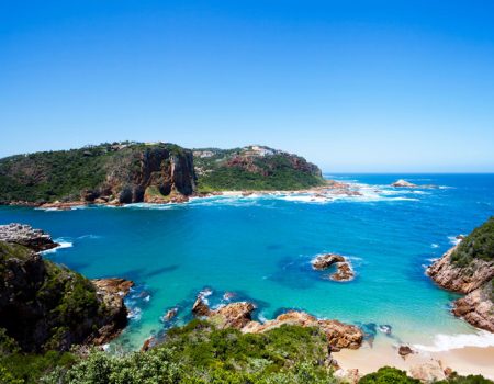
To call South Africa 'beautiful' comes only close to describing the unequalled diversity enfolded in its vastness. From the sandswept, icy waters of the Cape West Coast to the sunbaked savannah of the Limpopo there are terrains too numerous to absorb in one visit - South Africa is the smörgåsbord of the African continent.
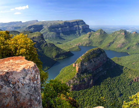
Cape Town's iconic Table Mountain and Cape Point, Namakwaland's annual spring flower symphony, the epic peaks of the Drakensberg, the Kruger National Park's wildlife-filled plains, the shopping bonanza and heartbeat of Jo'burg's nightlife, the implausible scenic beauty of the Blyde River Canyon and God's Window in Mpumalanga, and the five ecosystems of the iSimangaliso Wetland Park on South Africa's Elephant Coast - there is magic in every corner of our country.
Whether you are here to experience everything, or simply to explore the beaches, the mountains or the wine routes, there is seldom a traveller who has not found something on our shores at which to marvel. Whatever your choice, SA-Venues.com makes it easier to travel in South Africa.
Wildlife encounters
Attraction
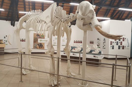
Letaba Elephant Hall
An elephant museum that covers the evolution of elephants, their biology, behaviour, and ecology ...

Game Lodges
Inyati Private Game Reserve
The lodge is situated on the banks of the Sand River allowing for fantastic game viewing from the lodge ...
Bird Watching
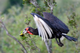
Southern Ground Hornbill
The largest hornbill in the world with a striking black plumage and the deep-red skin on its face and neck ...
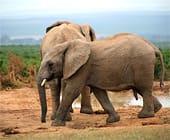
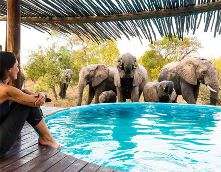
Game Reserves
Amakhala Game Reserve
Steeped in history and beauty, this 7000 hectare game reserve creates an ideal environment for an unforgettable safari ...

Game Viewing

Adventure Activity
Diving in Sodwana Bay
The beautiful Sodwana Bay, home to Triton Diving, is situated within the Greater St Lucia Wetland Park in KwaZulu-Natal. This park is one of Sout...
Game Lodges
Madikwe Safari Lodge
Set in a malaria-free reserve, 20 suites overlook the game-filled plains of the Madikwe Game Reserve ...
Adventure Activity
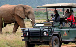
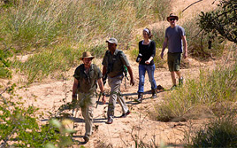
Kruger Walking Safari
A wilderness walking safari in a "Big Five" game viewing area, led by armed, professional, experienced guides ...
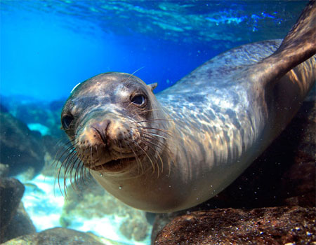
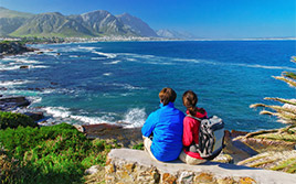
Whale watching
Outdoor activities
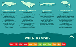
Whale Watching in South Africa
The annual migration of the whales (Jun to Nov) allows us to boast exceptional land- and boat-based whale-watching ...
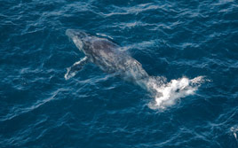
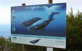
Wildlife
Southern Right Whale
Found in the waters of the Southern Hemisphere. From July to December they approach the coast to calve and feed ...
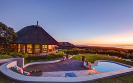
Lodge
Grootbos Nature Reserve
Guests experience a world full of outrageous flora, miles of private beaches, and safe encounters with giants of the sea ...
Annual Event
Hermanus Whale Festival
Guests experience a world full of outrageous flora, miles of private beaches, and safe encounters with giants of the sea ...
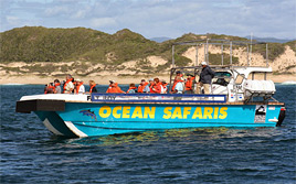
Things To Do
Close Encounter Cruises
Cruises are conducted on our permitted whale watching vessel, which is licenced to approach whales up to 50 metres ...
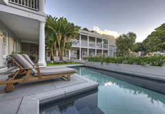
B&B / Guest House
Pringle Bay Beach House
A contemporary beach house retreat offering private and luxurious oceanfront accommodation with panoramic views ...
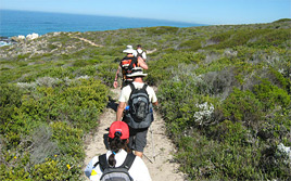
Hiking
Whale Trail
A 5-day slackpacker trail. Awe-inspiring mountain and coastal walking for moderately fit hikers. Booking essential ...
Tourist Route
The Whale Route
The Whale Route begins in Cape Town and follows the particularly pretty R44, also known as Clarence Drive, through the Kogelberg ...